Tour d'AÏ

The Tours d'Aï and Mayen are twin peaks visible from afar. The Tour d'AÏ is slightly higher than its neighbour, and also visited more frequently. It's a progressive climb which offers an aerial tour at the very end. Amazing views of Lac Léman, le Chablais, les Dents du Midi and the Mont Blanc massif from the summit.

Technical sheet

105177
Creation:
Last update:
Last review:
  • Walking
    Activity: Walking
  • ↔
    Distance: 9.73 km
  • ◔
    Average duration: 5h 15 
  • ▲
    Difficulty: Difficult

  • ⚐
    Return to departure point: Yes
  • ↗
    Vertical gain: + 863 m
  • ↘
    Vertical drop: - 863 m

  • ▲
    Highest point: 2,228 m
  • ▼
    Lowest point: 1,476 m

Description of the walk

Park in the rock climbing area's car park, at the upper end of Leysin resort, at the junction between Route des Chamois and Chemin de Prafandaz. Arriving from Aigle by "la route du Col des Mosses" (Mosses pass road).

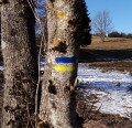
Yellow indication signs provide direction information and travel times here and there.

(S) Go past a livestock fence and take the small paved road leaving the car park heading north-east, surrounded by meadows. Motorised vehicales are forbidden on the road except for those of the alpine livestock farmers. After your first hairpin turn to the left, you'll get to a branch trail: follow the hairpin turn to the right. The slope gets steeper and the trail continues through forest cover. After a hairpin turn to the left, you'll reach a mountain chalet (admire the wooden shingles roof-covering).

(1) Keep heading north-east passing under Berneuse cable car cables.

(2) Shortly after the cable car line, leave the trail to go left up a steep grassy pasture ("Aï" sign, ski resort sign). Pass through a very narrow path and head north-west reaching Aï Lake and Aï chalets, with an impressive overhanging cliff above.

(3) Go through the chalets on a small sloped path heading north (ignore the large path to the right which heads back to the Mayen Chalets). After the chalets, the path becomes a trail and heads north-east bypassing the cliff to the right. Ignore the trail that goes left towards the base of the cliff (rock-climbing area called "Le Sphinx"). You'll reach the base of a rocky passageway.

(4) Steer left going up the passageway. It's a narrow trail but no need for rock climbing prowess. You'll reach a downhill grassy plateau. First walk along the edge of the plateau (west) then turn right (north-west) and go up a few bends to the foot of a ladder at the bottom of a rocky ledge.

(5) Climb up the ladder. Keep going on the aerial trail (some areas equipped with barriers or chains) which regularly heads back up to the top due north-north-west. Outweigh the power of the summit and take a sharp turn to the left reaching the top.

(6) The way back follows the same route you came on.

Waypoints

  1. S/E : km 0 - alt. 1,476 m - Leysin - Climbing site
  2. 1 : km 0.61 - alt. 1,554 m - Junction - Hairpin to the right
  3. 2 : km 1.86 - alt. 1,706 m - Chalet de Temelay
  4. 3 : km 2.57 - alt. 1,736 m - Chalets Aï / Mayen junction
  5. 4 : km 3.5 - alt. 1,891 m - Chalets d'Aï
  6. 5 : km 3.77 - alt. 1,937 m - Small rocky corridor
  7. 6 : km 4.23 - alt. 2,122 m - Scale - View of the - Lac Léman
  8. 7 : km 4.86 - alt. 2,208 m - Tour d'Aï
  9. S/E : km 9.73 - alt. 1,476 m - Leysin - Climbing site

Practical information

It takes around 2 and a half to 3 hours walk to get to the top (not counting rests)
Water at the Aï lakes and chalets (3), where you can also get drinks and a simple meal.
Hiking gear and boots a must.
The last part of the climb, after the ladder (5) has passages aériens (aerial sections). Although these sections are well equipped (barriers, chains) you should stay vigilant.
A map is necessary (at least the one found with the current description).

In the nearby area

Aï Lake, overhung by the cliff called "Le Sphinx" which is a renowned rock-climbing area.

Unobstructed panoramic view from the summit: Lac Léman, Vallée du Rhône, Chablais massif, Dents du Midi, Mont Blanc massif...

Reviews and comments

4.9 / 5
Based on 10 reviews

Reliability of the description
4.9 / 5
Clarity of route map
4.9 / 5
Route interest
4.8 / 5
Nanard61
Nanard61
• Last modified:

Overall rating : 4.7 / 5

Date of walk : Sep 06, 2020
Reliability of the description : ★★★★★ Very good
Clarity of route map : ★★★★☆ Good
Route interest : ★★★★★ Very good
Busy trail : No

The walk starts out a little long on tarmac, then follows paths through pastures to Lac d'Aï, where the truly alpine route begins. The difficult sections are well equipped and safe (ladders, cables, chains, barriers), but you'll need to be sure-footed. Not recommended for people who are afraid of heights or who are not comfortable on steep slopes. The times indicated on the yellow signposts on the ground are well within the capabilities of trained walkers.

Automatically translated

paolo&co
paolo&co

Overall rating : 5 / 5

Date of walk : May 20, 2020
Reliability of the description : ★★★★★ Very good
Clarity of route map : ★★★★★ Very good
Route interest : ★★★★★ Very good
Busy trail : No

First real hike in Switzerland and I understand better what "Difficult" means.

It's a fairly dry climb, you need to be in good physical condition and yes, hiking boots are compulsory.

Breathtaking 360° views, the lake, Mont Blanc...

I started at 8:30 and there was no-one there, but by 11:00 there were more than 20 people on the climb...

Automatically translated

Netra
Netra ★

Hello dimarcom, and thank you for your comments!

No snow at the top of the course?

Automatically translated

dimarcom
dimarcom

Overall rating : 4.3 / 5

Date of walk : May 21, 2020
Reliability of the description : ★★★★☆ Good
Clarity of route map : ★★★★★ Very good
Route interest : ★★★★☆ Good
Busy trail : Yes

Loooooooong tarmac road at the start, then ski slopes, but after that it's super pretty!

Automatically translated

laurdo
laurdo

Overall rating : 5 / 5

Date of walk : Sep 22, 2018
Reliability of the description : ★★★★★ Very good
Clarity of route map : ★★★★★ Very good
Route interest : ★★★★★ Very good

A very pretty walk
Quite physical
Quite aerial
Shame it's an out-and-back and not a loop

Automatically translated

bmal
bmal
• Last modified:

Overall rating : 4.7 / 5

Date of walk : Jul 28, 2018
Reliability of the description : ★★★★★ Very good
Clarity of route map : ★★★★★ Very good
Route interest : ★★★★☆ Good

A really beautiful itinerary, with only 2 drawbacks: a little too much tarmac road/big track for downhill mountain biking, and then the passage through Berneuse which is over-crowded due to the cable car ascent.
You'll also need either a GPS or a good map to take certain routes (such as the ascent to Berneuse, for example) as the directions are not always clearly marked.
A total of 1130m of ascent, but the climb up the arete above Berneuse, and then the view from the summit is a real treat!

Automatically translated

fifounette
fifounette

Overall rating : 5 / 5

Date of walk : Jun 17, 2018
Reliability of the description : ★★★★★ Very good
Clarity of route map : ★★★★★ Very good
Route interest : ★★★★★ Very good

A wonderful hike! Those sensitive to vertigo should refrain! Unfortunately, the summit was shrouded in fog today... so we weren't able to admire the view, which must be magnificent!

Automatically translated

Netra
Netra ★

Hello jl74500,

Thank you for your feedback and comments.

Up to WP No. 3, the routes to Aï and Mayen are shared. I've just added this information to the description.

Automatically translated

jl74500
jl74500

Overall rating : 5 / 5

Date of walk : Aug 20, 2017
Reliability of the description : ★★★★★ Very good
Clarity of route map : ★★★★★ Very good
Route interest : ★★★★★ Very good

Fortunately, we had the map and the route to start with, as there was no signpost to the Tour d'Aï.
There was just one sign pointing to Mayen.
It's a pity there isn't a path along the side of the road, and then it looks like mountain bikers have priority over hikers, although of course they have to pay a fixed rate...
Otherwise, it's a lovely view from the summit, or at least the little we could see, as the sky quickly became overcast and we descended in the fog.

Automatically translated

Netra
Netra ★

Hello Pacobill, and thank you for your feedback and comments!

I've climbed the Tour d'Aï several times and I've never taken this return route. I'll probably include this suggestion in the practical information.

Automatically translated

Pacobill
Pacobill

Overall rating : 5 / 5

Date of walk : Jun 09, 2017
Reliability of the description : ★★★★★ Very good
Clarity of route map : ★★★★★ Very good
Route interest : ★★★★★ Very good

Magnificent walk with magnificent scenery and varied viewpoints. The first part of the hike is on tarmac, which is a bit daunting (except for the scenery, which remains magnificent throughout the hike), with little change in altitude. The going gets tougher from point 4 onwards, however, and you need to be sure-footed, as the void is omnipresent and you sometimes have to use your hands. On the other hand, the equipment is very well made and you never feel in danger. I would nevertheless recommend it to people who are used to heights.
There's also a small alternative route that I took on the way back, which I think is well worth the diversions because of the scenery. What's more, it allows you to do a loop instead of a "simple" out-and-back! On the way down, when you reach "bas de la Tour" at point 3, head towards Lac d'Aï and take the direction of Berneuse (= arrival of the cable car, which is easy to spot) - although it does cost you around 100m of extra ascent! From here, there are superb views of the Tours d'Aï and Mayen and Lake Geneva. Descend on the south side towards the Col de Luissel and then Temeley (the inn you passed on the outward journey) - this completes the loop and takes you back to the road you took on the outward journey. All that remains is to return to the car park. That's my suggestion, so enjoy the walk !

Automatically translated

problot
problot

Overall rating : 5 / 5

Date of walk : Aug 14, 2016
Reliability of the description : ★★★★★ Very good
Clarity of route map : ★★★★★ Very good
Route interest : ★★★★★ Very good

Very nice route, superb views. Stage 4 is quite tricky on the descent for those who are not used to it, and in my opinion should be more clearly indicated in the description.

All the best

Philippe

Automatically translated

Netra
Netra ★

Hello,

Thank you for your feedback, and I'm glad to hear that you enjoyed this walk!

The presence of aerial passages is mentioned in the description, in the corresponding passage, but it's true that it's not emphasised enough in the practical information. I'm going to add a sentence to that effect.

Automatically translated

FLOMBARD
FLOMBARD

Overall rating : 5 / 5

Date of walk : Sep 19, 2015
Reliability of the description : ★★★★★ Very good
Clarity of route map : ★★★★★ Very good
Route interest : ★★★★★ Very good

We really enjoyed this hike, but we had to take it easy because, although it wasn't too difficult, there were some aerial passages (which were very well secured, by the way) that were still impressive for people like us who don't like heights very much.
Thanks to the person who suggested it, as it's a very beautiful place that we didn't know about.

Automatically translated

Other walks in the area

For more walks, use our search engine .

The GPS track and description are the property of the author. Do not copy them without permission.