From the Oule refuge to the Chalet du Bout via the Col Morétan and the Aup Bernard

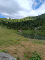
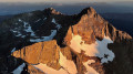
This long route will take you up and down two mountain passes (Morétan and Vay), through the Morétan Lakes valley, and across the wild, unmarked foothills leading to the Col du Vay. You’ll then begin a long, dizzying descent along a balcony path between the Chalet du Vay and l’Aup Bernard, finally arriving – after one last rather steep climb – at a very pretty spot in the middle of which stands the Chalet du Bout, the perfect place to spend the night.

Please note: this hike involves crossing two snowfields as well as a steep, exposed descent.

This walk is part of a multi-day hike: Belldonne - Autour de la Haute vallée du Breda en 3 jours

Details

103999445
Creation:
Last update:
Last review:
  • Walking
    Activity: Walking
  • ↔
    Distance: 8.43 mi
  • ◔
    Duration according to the author: 8 hrs 
  • ▲
    Difficulty: Very difficult

  • ⚐
    Back to start: No
  • ↗
    Ascent: + 4,075 ft
  • ↘
    Descent: - 5,548 ft

  • ▲
    Highest point: 8,232 ft
  • ▼
    Lowest point: 3,550 ft

Description of the walk

Setting off from the Refuge de l’Oule.

(S) Follow the path that climbs and heads off to the right: it’s impossible to get lost – there’s only one.

(1) Once you reach the plateau, try to find your way through the scree slopes by following the numerous cairns and keeping the Col Morétan and the hut in sight. The path is more to the left, along the ridge, than to the right, where there are several snowfields that pose no danger.

(2) Tackle the scree slope with caution; the stones are very loose. Look up carefully to plan your route and spot the path.

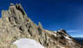
(3) Take care on the final metres leading up to Col Morétan – it’s a steep climb. Put your walking poles away and use your hands to finish the ascent; it’s safer that way. And be mindful of the weight of your rucksack, which could pull you backwards!

(4) Cross the first snowfield carefully, keeping to the left: there may be rockfalls on the right.

(5) At the end of the snowfield, climb diagonally left up the scree slope to the clearly visible cairn, and carefully begin your descent along the narrow path leading to the second snowfield. This section is very slippery, even in dry weather!

(6) Cross the second snowfield, which presents no particular difficulties. Then cross the scree slopes to Lac Supérieur, trying to follow the cairns.

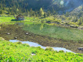
(7) Follow the path down to Lac Inférieur.

(8) Find a small path that branches off to the left in a hairpin bend and begin your ascent towards the Col de Vay.

(9) Take in the wild beauty of the area, keep as quiet as possible and keep an eye out for the local wildlife (marmots and chamois). Personally, I only spotted one chamois crossing the path about twenty metres away. Remember to look up to find your way, as the path is virtually non-existent here. Reach the Col du Vay.

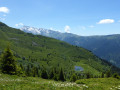
(10) Admire the views on both sides, and begin your descent towards the Chalet du Vay. The path is clearly visible on this stretch.

(11) At the chalet, take the very narrow path that branches off to the right. From here, be careful! The path is narrow, the slope is steep and some sections require a bit of agility.

(12) Once you’ve crossed the Ruisseau de la Combe Jacques, you can relax – the descent to l’Aup Bernard is straightforward.

(13) Make the most of the fountain and continue north-west towards Le Cohard. Walk past the mast and rejoin the Ruisseau de la Combe.

(14) Stay on the right bank of the stream and head down through the meadow to a forest track.

(15) Follow this track, turning left.

(16) Cross the footbridge over the Gleyzin and follow the sign for “Chalet du Bout”.

(E) When you reach the chalet, top up your water at the spring, thenhead up to see the “Sapins Henri IV”, a few dozen metres above the chalet and the pride of the area.

(17) Head back down to the chalet for a well-deserved rest in this lovely refuge, maintained by the“Tous à poêle” association. (E).

Waypoints

  1. S : mi 0 - alt. 6,063 ft - Refuge Antoine Cros, dit de l'Oule
  2. 1 : mi 0.52 - alt. 7,011 ft - Plateau (Oule hut)
  3. 2 : mi 1.14 - alt. 7,674 ft - Pierrier
  4. 3 : mi 1.43 - alt. 8,159 ft - Grand Morétan
  5. 4 : mi 1.55 - alt. 8,028 ft - First snowfield
  6. 5 : mi 1.78 - alt. 7,615 ft - Descent to the second snowfield
  7. 6 : mi 2.05 - alt. 6,932 ft - Second snowfield
  8. 7 : mi 2.39 - alt. 6,736 ft - Lac du Morétan supérieur (2060 m)
  9. 8 : mi 2.54 - alt. 6,752 ft - Junction towards Col de Vay
  10. 9 : mi 3 - alt. 7,221 ft - Plaine Sauvage
  11. 10 : mi 3.24 - alt. 7,520 ft - Col du Vay
  12. 11 : mi 3.74 - alt. 6,686 ft - Chalet du Vay
  13. 12 : mi 4.89 - alt. 5,607 ft - Start of the Aup Bernard mountain pasture
  14. 13 : mi 5.29 - alt. 5,177 ft - L'Aup Bernard
  15. 14 : mi 6.85 - alt. 3,868 ft - Le Cohard
  16. 15 : mi 7.03 - alt. 3,596 ft - Forest track
  17. 16 : mi 7.37 - alt. 3,599 ft - Footbridge
  18. 17 : mi 8.16 - alt. 4,541 ft - Chalet du Bout
  19. 18 : mi 8.34 - alt. 4,659 ft - Henri IV fir trees
  20. E : mi 8.43 - alt. 4,580 ft - Chalet du Bout

Notes

Water sources
There are no safe water sources before Aup Bernard, but on the descent from Col Moretan, between the first and second snowfields, you can top up your water supply from the stream running alongside the path. At this altitude, there is very little chance of it being contaminated: above it there are only sheer cliffs, no human traffic and no pastureland. Next, there is a water source in the hamlet of Le Cohard before reaching the valley floor. Finally, a lovely spring is available at the Chalet du Bout at the end of the stage.

Provisions
Absolutely nothing is available between the start and the finish. There are no shops in the hamlet of Le Cohard or in the nearby village of Gleyzin. The Chalet du Bout is an unstaffed mountain refuge.

Accommodation
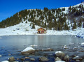
Aup Bernard: an unstaffed refuge with a spring, sleeping four. It was in very good condition both before (and after) my visit. I didn’t need to use the stove; it was mild enough outside and warm inside. Personally, I pitched my tent next to the chalet for the night. It seems to me that the signs say ‘camping prohibited’, but the websites mentioning the chalet refer to ‘bivouacking prohibited’. In the absence of any written information, I’m not quite sure how to interpret this… (it was my first bivouac trek). In any case, thanks to the “Tous à Poêle” association (https://tousapoele.org/) which looks after the site!

Other walks in the area

For more walks, use our search engine .

The GPS track and description are the property of this route's author. Please do not copy them without permission.