


Refine your search for walks in Pleucadeuc
Pleucadeuc walks


 Route from Saint-Marc to Pleucadeuc
 Tourist office
 14.00 mi
 +827 ft
 -817 ft
 7h 10
7h 10
 Difficult
 Departure from Pleucadeuc (Morbihan)
This route offers natural sites steeped in history, set against a rugged and verdant landscape. You will cross the Claie Valley, home to a 63 km-long river, before discovering St Mark’s Chapel, situated on a ridge overlooking a stunning panorama of the Oust Valley. You will arrive at St Bartholomew’s Chapel and its cemetery, where you’ll notice a small, rounded menhir and old yew trees that seem to be a reminder of an ancient Celtic custom.
 The Oust Valley towards Malestroit: between towpath and greenway
 Visorando Member28.70 mi
+243 ft
-220 ft
3 hrs
Visorando Member28.70 mi
+243 ft
-220 ft
3 hrs
 Easy
Departure from Saint-Congard (Morbihan)
Easy
Departure from Saint-Congard (Morbihan)
The Oust Valley is designated a “Grand Site National”, and cycling through it is a great way to explore it.
The Malestroit region offers several ways to explore it, whether by following the Nantes-Brest Canal along the towpath, or by crossing the countryside along the Voie Verte, a cycle path built on the former Questembert-Mauron railway line.
Malestroit, canal and countryside
9.28 mi
+364 ft
-338 ft
4h 35
 Moderate
Departure from Malestroit (Morbihan)
Moderate
Departure from Malestroit (Morbihan)
An easy hike that can be enjoyed with the whole family.
Departure from Malestroit, a pretty little town with half-timbered houses.
The first half of the route is flat, following the towpath along the Nantes-Brest stream.
The second part takes you through the countryside: fields, woods, chapels, calvaries and picturesque hamlets, following theGR®347.
Rochefort-en-Terre and the slate quarries of Pluherlin
 9.32 mi
+577 ft
-551 ft
4h 45
Moderate
Departure from Malansac (Morbihan)
9.32 mi
+577 ft
-551 ft
4h 45
Moderate
Departure from Malansac (Morbihan)
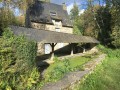
Set amidst moors and woods, Rochefort-en-Terre, perched on a rocky outcrop, is one of the most beautiful villages in France. With its cobbled streets and stylish shop signs, the town is a little gem nestled in the heart of Morbihan. Starting from this village, enjoy a lovely walk along the ridges and through the old slate quarries of Pluherlin.The route is very varied, taking in moorland, woodland and ridges.Passing through the villages of Rochefort-en-Terre and Pluherlin.
Rochefort en Terre via the Grées de Pluherlin and the Étang du Moulin Neuf
4.96 mi
+394 ft
-374 ft
2h 35
Easy
Departure from Rochefort-en-Terre (Morbihan)
Rochefort-en-Terre is built on a rocky outcrop partly surrounded by the Ruisseau de Saint-Gentien. It is hard to believe that this slender stream is the source of the gorge that opens up to the north of the town, yet it is indeed this stream that feeds the beautiful Étang du Moulin Neuf. The shores of this lake, along with the rocky ridges overlooking the Arz valley, provide a beautiful setting for this medieval gem. And strolling around, discovering the hidden corners of this famous place, offers a very different experience from that of the many visitors who are content to simply walk up and down the main street.
The Ardoisières Route between Rochefort-en-Terre and Malansac
 13.64 mi
+623 ft
-617 ft
6h 50
Difficult
Departure from Rochefort-en-Terre (Morbihan)
13.64 mi
+623 ft
-617 ft
6h 50
Difficult
Departure from Rochefort-en-Terre (Morbihan)
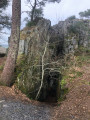
This hike is circular, taking forest paths and roads on the return journey, via the Circuit des Ardoisières, the Circuit des Pins, and passing through the village of Malansac.
The moors of Pinieux
6.70 mi
+308 ft
-305 ft
3h 20
Moderate
Departure from Sérent (Morbihan)
The moors of Pinieux offered the resistance fighters of the Maquis de la Nouette a fragile shelter during dark times. This wooded area occupies a hilltop between the Claie and Oust valleys and offers some views of eastern Morbihan. And a gem nestles in the hollow of one of the valleys: the Kerfontaine bog.
Please note: crossing the bog requires off-track walking.
From Questembert to Larré, returning via the Arz valley
24.60 mi
+1,070 ft
-1,076 ft
3 hrs
Moderate
Departure from Questembert (Morbihan)
The Arz valley lies at the bottom of one of the geological folds of the South-Armorican Fold System. Dominated by the Landes de Lanvaux to the north and the plateau overlooking the Gulf of Morbihan to the south, it features a beautiful hollow relief that will delight rollercoaster enthusiasts. The gradients are far from negligible, and whilst the terrain isn’t particularly high, the route’s profile alternates between gentle slopes where you can coast along and challenging, leg-breaking climbs. And all this amidst beautiful, wooded countryside dotted with lively towns and villages.
Route des Popinettes
8.19 mi
+623 ft
-633 ft
4h 20
Moderate
Departure from Questembert (Morbihan)
The landscape around Questembert is characterised by wooded, steep-sided valleys through which pretty streams flow. For a long time, these streams powered a multitude of mills, which you can discover along the route, between two breaks in the rich countryside criss-crossed by beautiful tree-lined paths. As for the popinettes, perhaps we passed them without knowing what they were!
Saint-Clair Chapel and Trévelo Valley in Limerzel
 7.06 mi
+361 ft
-361 ft
3h 35
Moderate
Departure from Limerzel (Morbihan)
7.06 mi
+361 ft
-361 ft
3h 35
Moderate
Departure from Limerzel (Morbihan)
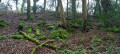
Located on the edge of the southernmost fold of the Landes de Lanvaux, the village of Limerzel overlooks a wide valley where the Trévelo and Pinieux streams converge. The former has carved out a sort of gorge at the bottom of which it meanders, downstream from the Saint-Clair Chapel. The proposed route allows you to discover a very unspoilt corner of the countryside and many elements of rural heritage.
Route de Pinieux, in Limerzel
 7.84 mi
+692 ft
-702 ft
4h 10
Moderate
Departure from Limerzel (Morbihan)
7.84 mi
+692 ft
-702 ft
4h 10
Moderate
Departure from Limerzel (Morbihan)
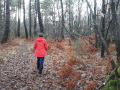
The village of Limerzel is built on the slope of the granite plateau that marks the south-eastern edge of the Landes de Lanvaux. The commune’s territory is criss-crossed by several watercourses that have carved out a rather rugged landscape.
The suggested route winds its way around the wooded area surrounding Pinieux Castle and the valley bordering it to the north.
La Vraie-Croix
7.37 mi
+344 ft
-354 ft
3h 40
Moderate
Departure from La Vraie-Croix (Morbihan)
La Vraie-Croix comes from the Breton "Lan Groez" (cross of the moor).
A lovely walk that allows you to discover the countryside around the very pretty village of La Vraie-Croix.
Route of Little Red Riding Hood in Monteneuf
9.66 mi
+390 ft
-381 ft
4h 45
Moderate
Departure from Monteneuf (Morbihan)
Set off to explore the Étang du Chaperon Rouge. On the side of the dyke is the ‘Bonnet Rouge’ shelter, a seat carved out of the stone by a revolutionary. To the north of the Étang de Quéhéon, you may be lucky enough to see gentians, sundews (a protected flower) and at least three varieties of heather. Finally, at La Loge Morinais, you’ll discover the most charming of the covered walkways and a wide variety of flora and fauna.
Monteneuf megalithic circular loop
 7.18 mi
+331 ft
-322 ft
3h 35
Moderate
Departure from Monteneuf (Morbihan)
7.18 mi
+331 ft
-322 ft
3h 35
Moderate
Departure from Monteneuf (Morbihan)
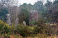
Set off to explore the dry and wet moors, home to a wide variety of flora and fauna. You will then come across several Neolithic burial monuments (La Loge Morinais, the Bordouès Covered Walkway). A little further on is the Pierres Droites megalithic site, one of the most important archaeological sites in central Brittany. It has 420 menhirs, around forty of which have been re-erected in their original location.
Heathland, ponds and megaliths in Monteneuf
 6.99 mi
+180 ft
-180 ft
3h 20
Moderate
Departure from Monteneuf (Morbihan)
6.99 mi
+180 ft
-180 ft
3h 20
Moderate
Departure from Monteneuf (Morbihan)
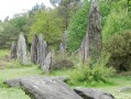
As you walk through the Landes de Monteneuf, come and discover a remarkable megalithic site: a collection of standing stones, covered passages and isolated menhirs. Although less spectacular than the site at Carnac, it is nonetheless very interesting due to the presence of a site currently undergoing restoration, where regional archaeologists have recreated both the dwellings of the period and the methods used to erect the stones.
Route des Vertus in Berric
6.72 mi
+328 ft
-322 ft
3h 20
Moderate
Departure from Berric (Morbihan)
This is a lovely country walk starting from Berric. From the first hills overlooking (slightly) the Gulf of Morbihan and the Vilaine estuary at the bottom of the valleys that criss-cross this wooded landscape, the proposed route winds its way along delightful tree-lined paths enhanced by the colours of autumn. But they must be pleasant in all seasons!