Route of Little Red Riding Hood in Monteneuf

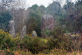
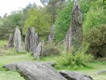
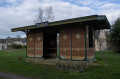
Set off to explore the Étang du Chaperon Rouge. On the side of the dyke is the ‘Bonnet Rouge’ shelter, a seat carved out of the stone by a revolutionary. To the north of the Étang de Quéhéon, you may be lucky enough to see gentians, sundews (a protected flower) and at least three varieties of heather. Finally, at La Loge Morinais, you’ll discover the most charming of the covered walkways and a wide variety of flora and fauna.

Details

21892248
Creation:
Last update:
Last review:
  • Walking
    Activity: Walking
  • ↔
    Distance: 9.66 mi
  • ◔
    Average duration: 4h 45 
  • ▲
    Difficulty: Moderate

  • ⚐
    Back to start: Yes
  • ↗
    Ascent: + 390 ft
  • ↘
    Descent: - 381 ft

  • ▲
    Highest point: 486 ft
  • ▼
    Lowest point: 128 ft
  • ⚐ Country: France
  • ⚐ City: Monteneuf (56380)
  • ⚑
    Start/End: N 47.872263° / W 2.209289°
  • ❏
    IGN map(s): Ref. 1019SB, 1020SB, 1119SB, 1120SB
  • Hour-by-hour weather

Description of the walk

Park in the car park in front of the Maison du Randonneur, near the church.

Yellow signposting along the entire route.

(S/E) Turn left onto the street running alongside the church. At the end, turn right onto Rue Saint-Michel (D776) towards the pond.

(1) Cross the road to take the path that goes round the pond on the right and follow it to the Étang du Chaperon Rouge.

(2) At the junction, continue straight ahead along the path. Once past the pond, take the path on the right.

(3) At the farm track, turn left and carry on straight ahead to the next pond, then walk as close as possible to its left-hand side.

(4) Continue along the path on the left to rejoin a farm track and follow it to the left until you reach the car park.

(5) Turn right and continue along the track. At the junction, veer right, following the signposts.

(6) Halfway along, take the path on the right towards La Loge Morinais. Pass through the covered walkway and continue along the path until the next junction with a forest track.

(7) Turn left, then, at the next junction, keep to the left.

(8) At a place called La Ville Abel, carry on straight ahead along the road. At the junction, turn left onto the road, then rejoin the track on the right.

(9) Turn left and follow the track straight on through the fields until you reach a wooded area.

(10) Continue along the track to the left. Cross the bridge over the Oyon.

(11) Take the Voie Verte on the left. Continue along the track in the same direction for approximately 3.5 km.

(12) At gate no. 41, turn onto the road on the left. At the junction, turn left, following the path, and carry on to La Fosse au Loup.

(13) Turn left, then take the next right to reach the hamlet of La Touche. On leaving the hamlet, turn right towards the hamlet of Trézon, then carry on straight ahead.

(14) Turn left onto the farm track. Quickly take the path on the right into the woodland and follow it to the road.

(15) Turn left, then immediately right to enter another wooded area and carry on until you reach the D124.

(16) Cross the road to reach the Étang du Chaperon Rouge and take the path on the left.

(2) At the junction, turn right and follow the path you took on the way out in the opposite direction to return to the starting point in front of the Maison du Randonneur (S/E).

Waypoints

  1. S/E : mi 0 - alt. 322 ft - Maison du Randonneur - Église Saint-Michel (Monteneuf)
  2. 1 : mi 0.12 - alt. 325 ft - Rue Saint-Michel
  3. 2 : mi 0.41 - alt. 387 ft - Junction of the circular loop - Étang du Chaperon Rouge
  4. 3 : mi 0.68 - alt. 417 ft - Farm track
  5. 4 : mi 1.22 - alt. 417 ft - Étang de Quéhéon
  6. 5 : mi 1.43 - alt. 417 ft - Car park
  7. 6 : mi 1.83 - alt. 443 ft - Start of the trail - Allée Couverte de la Loge Morinais
  8. 7 : mi 2.15 - alt. 486 ft - Crossroads
  9. 8 : mi 2.57 - alt. 282 ft - La Ville Abel
  10. 9 : mi 2.98 - alt. 213 ft - Crossroads
  11. 10 : mi 3.71 - alt. 203 ft - Tête de Gore junction
  12. 11 : mi 4 - alt. 131 ft - Greenway - Oyon (rivère) - Affluent de l'Aff
  13. 12 : mi 6.17 - alt. 157 ft - Greenway – Barrier No. 41
  14. 13 : mi 6.98 - alt. 200 ft - La Fosse au Loup crossroads
  15. 14 : mi 8.39 - alt. 341 ft - Crossroads
  16. 15 : mi 8.96 - alt. 390 ft - Road junction
  17. 16 : mi 9.11 - alt. 384 ft - Crossing the D124
  18. S/E : mi 9.66 - alt. 322 ft - Maison du Randonneur - Église Saint-Michel (Monteneuf)

Notes

Shelters, picnic area and tourist information at the Maison du Randonneur. Shops in the town centre.

(10) Option to walk to the Tête de Gore viewpoint, 200 m away.

Worth a visit

Reviews and comments

4.3 / 5
Based on 3 reviews

Reliability of the description
4.7 / 5
Ease of following the route
4.7 / 5
Route interest
3.7 / 5
lagire
lagire

Overall rating : 4 / 5

Date of your route : Jun 06, 2015
Reliability of the description : ★★★★☆ Good
Ease of following the route : ★★★★☆ Good
Route interest : ★★★★☆ Good
Very busy route : No

Very hilly and a real change of scenery

Machine-translated

User 6915758

Overall rating : 4.3 / 5

Date of your route : Nov 10, 2025
Reliability of the description : ★★★★★ Very good
Ease of following the route : ★★★★★ Very good
Route interest : ★★★☆☆ Average
Very busy route : No

Route completed in 3½ hours. Very well marked. The route is very nice up to point 12, then 5 km of road!!! So no interest except as a workout.

Machine-translated

pierjac4477
pierjac4477

Overall rating : 4.7 / 5

Date of your route : May 08, 2023
Reliability of the description : ★★★★★ Very good
Ease of following the route : ★★★★★ Very good
Route interest : ★★★★☆ Good
Very busy route : No

A very pleasant walk through the peaceful woods and countryside. We enjoyed the succession of
ponds at the start of the route. The signposting is excellent and clearly distinct, which is rare when two routes overlap.

Machine-translated

Other walks in the area

For more walks, use our search engine .

The GPS track and description are the property of this route's author. Please do not copy them without permission.