Caro’s sung walk

This suggested walk is part of the singing walk held in May.

Details

33672389
Creation:
Last update:
Last review:
  • Walking
    Activity: Walking
  • ↔
    Distance: 3.73 mi
  • ◔
    Average duration: 1h 55 
  • ▲
    Difficulty: Easy

  • ⚐
    Back to start: Yes
  • ↗
    Ascent: + 233 ft
  • ↘
    Descent: - 233 ft

  • ▲
    Highest point: 387 ft
  • ▼
    Lowest point: 151 ft
  • ⚐ Country: France
  • ⚐ City: Caro (56140)
  • ⚑
    Start/End: N 47.863684° / W 2.325799°
  • ❏
    IGN map(s): Ref. 1019SB, 1020SB
  • Hour-by-hour weather

Description of the walk

From Ploërmel, take the D8 then the D166 towards Caro. Drive as far as the sports hall.

(S/E) Start from the stadium car park heading towards the multi-purpose hall.

(1) Take the path alongside the cemetery and cross the main road at the pedestrian crossing.

(2) Go round the hall to the south, between the housing estate and the hedgerow. Continue through the housing estate opposite you, Hameau du Pré Vert, until you reach the bottom of the Hameau des Tamaris housing estate. Turn left towards the D166 local road, then immediately right to head back down towards the path leading eastwards.

(3) Walk down to the Pont des Logis bridge, follow the stream on your left to the footbridge, cross it and take the path on the left which follows the stream to the next footbridge near the Étang de Patouillet.

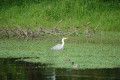
(4) Take a musical break, then walk round the pond to the north until you reach the D168 county road; cross it carefully and take the path opposite. Walk alongside the stream as far as the Étang de Gland.

(5) Walk round the pond to the north and follow the path due south to the hamlet of Le Boclos. On the village road, turn right and walk for 50 metres.

(6) Turn left onto the Chemin des Cinq Fontaines at the hamlet of Le Boclos and head due south towards the village; at the end of the Chemin des Marronniers, turn right onto Rue Saint-Denis and Rue des Bruyères, then further on, turn left up to the stadium (S/E).

Waypoints

  1. S/E : mi 0 - alt. 384 ft - Stadium car park
  2. 1 : mi 0.1 - alt. 374 ft - Pedestrian crossing
  3. 2 : mi 0.21 - alt. 351 ft - Hedge-lined country lane
  4. 3 : mi 0.63 - alt. 308 ft - Chemin Pont des Logis
  5. 4 : mi 1.5 - alt. 174 ft - Etang de Patouillet
  6. 5 : mi 2.43 - alt. 200 ft - Étang de Gland
  7. 6 : mi 2.86 - alt. 295 ft - Chemin du Boclos
  8. S/E : mi 3.72 - alt. 384 ft - Stadium car park

Notes

A bar in the centre is open, offering a chance to take a refreshing break. Various points along the route also provide pleasant spots to stop and rest.

The circular route follows a large part of the “des Cinq Fontaines” route: it is therefore directly accessible on foot from the Domaine de Kervallon for those staying there during their holiday.

Worth a visit

To explore the town’s heritage, two further photo spots require a detour from the route:
- Saint-Yves Chapel (at the hamlet of the same name, 4 km east of the village)
- The Sainte-Anne du Thay Chapel (in the hamlet of Le Thay, 4 km west of the village)
Places to see:
- Gland Pond
- Patouillet Pond
- Saint-Hervé Church
- The various photos along the route

Reviews and comments

4.3 / 5
Based on 2 reviews

Reliability of the description
4.5 / 5
Ease of following the route
4 / 5
Route interest
4.5 / 5
Lyonnais
Lyonnais
• Edited:

Overall rating : 4 / 5

Date of your route : Jun 26, 2023
Reliability of the description : ★★★★☆ Good
Ease of following the route : ★★★★☆ Good
Route interest : ★★★★☆ Good
Very busy route : No

A very lovely, shaded route that’s easy to follow. A few photos, but unfortunately no explanations.
A walk I’d recommend

Machine-translated

CURECINE
CURECINE
• Edited:

Overall rating : 4.7 / 5

Date of your route : Jun 14, 2023
Reliability of the description : ★★★★★ Very good
Ease of following the route : ★★★★☆ Good
Route interest : ★★★★★ Very good
Very busy route : No

A lovely walk through the countryside of Brittany, along a well-maintained and pruned path. The photos depict events from the first half of the 20th century.
I’m thinking of doing this walk again in the autumn with my family.

Machine-translated

Other walks in the area

For more walks, use our search engine .

The GPS track and description are the property of this route's author. Please do not copy them without permission.