Country:

 City:
City:


The walk starts from the Car Parking at Le Lays, which is next to the supermarket and the equestrian centre. If you are staying in Les Carroz, it is only a short walk to the car park.
(S/E) From the car park, walk North past a wooden chalet and towards the edge of some trees. Pick up a path next to the trees and turn right to follow the path with the road on your right; descend past the municipal works yard on the left to the road.Turn right and cross over with care to the Chemin du Lay (road) and follow this between apartments to where it turns right. Follow it around to the right and take the first turning on your left.
(1) Turn left and then turn immediately left again onto a narrow grassy path. Follow the grassy path past chalets to a road and then follow the road gently downhill, ignoring any turns on either side, until you arrive at a T junction and signpost (Les Torchets). Turn left and walk uphill, passing a signpost (Sur Frevuard) to a T junction and signpost (Frevuard).
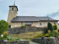
(2) Turn right and walk downhill to the Mairie of Araches-la-Frasse. Turn left and walk 50m to another T junction and sign; turn right and walk down to the main road, curve left to some parking in front of the church, followed by the war memorial.
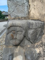
It is worth walking up to the church to look for the medieval stone carvings of faces.
When you have finished, return to the war memorial and on the opposite side of the road, you will see a signpost for Pierre a Laya. Cross over to the signpost.
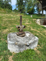
(3) Follow the road up past a stone water trough and to another sign (Araches d'en Bas). Turn left and follow the road to a large converted barn; walk past this and up to a sign (Araches d' en Haut) beneath a tree, where the track splits.
There are two ways of getting to Pierre a Laya; make sure you go right on the shorter route. (15 mins)
(4) Follow the track which ascends and curves to the left. It leads up onto a flatter grassy area with information signs about native trees and the odd picnic bench. As you walk, always go right to stay on the path; it will lead to a signpost where a right-pointing arrow leads to a narrow path and to the rock climbing at La Balme. (You are not going that way)
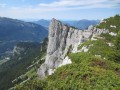
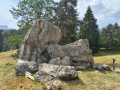
(5) Instead, turn left and follow the path to an information board and beyond this, the boulder of Pierre a Laya. When you have seen the boulder, return to the path and turn left. Walk with the valley on your right and look out for a split in the path at a sign warning you that the path on the right has a steep drop.
(6) Turn right onto this path and take care because there is a sheer drop beyond the few trees on your right-hand side.
Note: If you have young children or dogs, do not let them run ahead. If you are worried about the cliff edge, you can also take the left-hand split instead and arrive at (7).
Otherwise, follow the path with some emerging views between the trees up to a viewpoint and information board. Then continue along the path to where it rejoins the main path.
(7) Turn right and follow the path down to a junction, take the left-hand track and follow it through the trees to a signpost.
(8) Turn left and follow the narrower path to a wider track where you turn right and then left to follow the track past the equestrian centre and back to the parking.(S/E)
 Visorando Member
 Moderate
 Difficult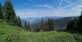
 Association / Club / Walk leader