


 Country:

 City:
City:


Start by taking the cable car from Les Carroz to La Kédeuze. The walk starts and ends at the telecabin station.
(S/E) From the telecabin station, take the broad track in a northerly direction following yellow signposts for Tête du Pré des Saix (1 hour 15 mins). The track leads under some cables and turns to the right to steadily ascend up to a viewpoint next to a BBQ and picnic tables.
There is a panoramic board so you can identify the mountains as you look northwards down the valley.
(1) Return to the broad track and continue following it. Pass a marker post for the Col de L'Airon where the track splits and the right-hand track descends to the Chalet de l'Airon. Ignore that track and keep following the main left-hand track steadily uphill to some chairlift stations at Pointe de Cupoire, signpost.
(2) Keep right and walk under the chairlift cables, again following signs for Tête du Pré des Saix. The track ascends and passes another yellow sign and splits in the track. This time keep right and keep walking uphill to pass under more chairlift cables and to arrive at a broad T-junction.
(3) Turn left and ascend to Tête du Pré des Saix. Walk past the chairlift station and towards an antenna. We took a grassy path downhill to join another broad stony track (4).
Note: It is possible to walk past the antenna and then turn right onto a grassy path above and to the left of the broad stony track.
Whichever way you choose, walk downhill to a T junction with another broad stony track (Col de Vernant (1963m).
(5) You are going to be following the track on the left but first of all cross over and take the narrow path which ascends and cuts the corner off the first bend in the track. It joins the track, and you follow this uphill to a second narrow path which cuts a further corner off the ascent of the track. Join it again and ascend steadily all the way to Les Grands Vas and two chairlift stations (Yellow marker post Les Grands Vans 2208m).
(6) Now the walk changes and the next section follows a ridge which requires a head for heights and involves a small section of easy scrambling where you need to use hands and feet. If you do not want to follow the ridge, an easier alternative route is given in the notes.
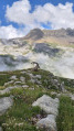
From the yellow signpost, walk between the two chairlift stations and pick up a narrow path which leads to the top of the ridge (great views of Les Grandes Platieres). Follow the ridge in its entirety; there is only one narrow path which sometimes takes the ridge top and sometimes the left (south) flank. It passes a hole in the rock with a view to Lac de Vernant, and there is one section where you need to scramble using hands and feet to ascend. The path eventually descends to a yellow signpost and picnic table at Col de Veret.
(7) The col is a good place to eat your sandwiches so long as the table is free and it's not too windy.
Otherwise, turn right and follow the narrow path downhill to the Lac de Vernant.
More picnic tables here if the col is busy or windy.
(8) From the lake, walk north and take the first track on the left; this leads up to a track which descends from the Col du Vernant. At the junction, turn left and follow the track past a chalet and look out for a yellow marker post on the right.
(9) Turn right at the signpost and start following a narrower path which leads into the woodland. Follow the path to another yellow signpost.
(10) Pass the (Les Bois de Corbalanche) signpost and continue to a second yellow signpost (Corbalanche Haut) and path on the right.
(11) Carry straight on, emerge from the trees and contour around to another yellow signpost (Alpage de l'Airon).
(12) At the signpost, carry straight on and walk to the lake, turn left and walk around to the Chalet de l'Airon (called Alpage de l'Airon), as shown on IGN maps.
(13) Walk north from the chalet to cross a bridge and join a track.
Note: There are three routes here:
- The wide track on the right leads uphill to the Col de l'Airon from where you can turn left and walk downhill to the telecabin La Kédeuze.
- The wide track on the left leads downhill and then up to the telecabin La Kédeuze.
- You are taking the middle path, which is a narrower grassy path which leads into woods. Follow this, more pleasant, path as it contours the hillside to a junction with the lower track and yellow sign (Pre Carre Haut).
(14) Turn right and follow the wider stony track up to the telecabin La Kédeuze.(S/E)
 Visorando Member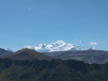

 Easy
Easy 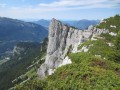
 Difficult
 Very difficult
