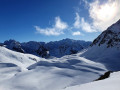
Warning! The ridge sections are exposed, and some very steep sections should be avoided if there is a high risk of avalanches.


 Country:

 City:
City:


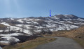
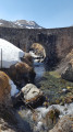
Park after the Pont de Saugué, in the commune of Gèdre-Gavarnie, if the car park is accessible; otherwise, park before the bridge, at the side of the road, depending on snow conditions.
(S/E) Take the Route des Granges de Saugé, which may be completely snow-covered.
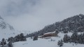
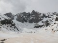
(1) At the ‘No Entry’ sign, head up the embankment on the left and climb south-west through the grassy, snow-covered meadows. The pass is visible as the rocky peak overlooking it (see photo).
(2) Bypass the Soum de Saugué (2007 m) on the right. Try to follow the snow-covered stream of the Barrancou des Laquettes. The route is easy, winding through gentle slopes and small flat sections.
From the reservoir at 2,040 m, the slope becomes steeper. The pass is clearly in view. At 2,108 m, pass a scree slope on the right.
The Col du Pourteillou is reached after a short but steep climb, which is rather tricky on snowshoes alone.
(3) Descending a few dozen metres to the west, you’ll reach the viewpoint overlooking Gavarnie.
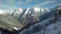
(4) Magnificent views, though obstructed to the east by the slopes of the Soum Braqué ridge. Retrace your steps back to the pass.
(3) Head south-west along the hillside towards the ridge. Depending on the season, this slope may still be completely covered in snow; it is possible to walk here on snowshoes. Reach the summit of the first ‘soum’ at 2,277 m.
(5) For the less adventurous, the route ends here.
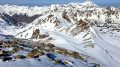
For the rest, continue safely along the ridge. Watch out for snow cornices by staying mainly on the southern face. Pass the 2,251 m mark and reach the false Soum Braqué at 2,303 m.
(6) Continue along a south-east-facing ridge to reach Soum Braqué at 2,304 m.
(7) The more intrepid may even continue along this same ridge, which descends towards the Soum des Canaux at 2,279 m, the end of the ridge (marked by a boundary stone).
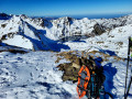
For a longer break (lunch or photos), it is best to head back to the ‘false’ Soum Braqué.
The return journey follows the same route until just before the 2,040 m mark and the reservoir, then turns right towards the Soum du Saugué (2,007 m). The terrain remains just as undulating. You’ll reach a flat area offering a final view towards Gavarnie and a beautiful vantage point over the Pimené (2,801 m).
(8) Then head north-east towards the Pont de Saugué, which is not yet visible, keeping well to the right of the steeper slopes to the east of the Granges de l’Ubac de Saugué. You’ll rejoin the route taken on the way out.
(2) Continue the descent and reach the Pont de Saugué (S/E).


 Visorando Member
 Moderate
 Very difficult