A short walk in the Kerlic area

A short, leisurely walk through the area where a health centre is currently being developed.
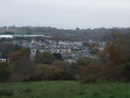
A lovely stretch along part ofthe GR® 38 with a view of the end of the Odet valley beyond the Stangala Gorges.

Details

n°16012102
Creation:
Last update:
Last review:
  • Walking
    Activity: Walking
  • ↔
    Distance: 2.63 mi
  • ◔
    Average duration: 1h 15 
  • ▲
    Difficulty: Easy

  • ⚐
    Back to start: Yes
  • ↗
    Ascent: + 75 ft
  • ↘
    Descent: - 75 ft

  • ▲
    Highest point: 151 ft
  • ▼
    Lowest point: 49 ft
  • ⚐ Country: France
  • ⚐ City: Quimper (29000)
  • ⚑
    Start/End: N 48.0119° / W 4.076494°
  • ❏
    IGN map(s): Ref. 0518OT, 0519ET, 0618OT
  • Hour-by-hour weather

Photos

Description of the walk

Park at the car-share area on Route de Cuzon, near the roundabout leading to the N165 Brest–Nantes.
Access by bus: Gouvily line.

GR®38: red and white markings.

(S/E) Leave the car park and head towards Route de Cuzon, then take the tarmac path which runs to the left of a large retention basin. Pass under the access road to the main road, then turn right to go round a furniture shop. Pass under another road, then under the N165 Brest–Nantes, and arrive at the Kerlic area, home to a healthcare hub with a new clinic.

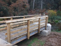
(1) Cross the road at the pedestrian crossing and join the new section ofthe GR® trail, which passes through a wetland area – this has required the installation of a boardwalk in one place (the purpleGR® route is no longer up to date). Continue along this path until you come out opposite a blue healthcare building (an ophthalmology centre).

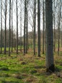
(2) Turn left onto a lovely lane lined with old oak trees and follow this path until it joins a small road near the Kerlic car park (one of the access points to the Odet and the Stangala site).

No signposting

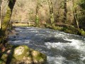
(3) Leave theGR® by turning right and follow this road. At the ‘Parking Kerlic’ sign, carry on straight ahead along a road signposted as a dead end. Pass the hamlet of Keridoret (a beautiful stone house on the left) and continue downhill to the entrance to the Moulin de Penhoat (private property). On your left, you’ll see the Odet and a former quarry that has been converted into a lake.

(4) Walk back up to the junction after Keridoret, then turn left to follow the small road until you reach a roundabout near the eye clinic.

(5) Continue along a wide pavement to return to the entrance to the Kerlic area.

GR ®38, marked in white and red.

(1) Retrace your steps along the route you took on the way there to return to the car-share car park (S/E).

Waypoints

  1. S/E : mi 0 - alt. 125 ft - Carpooling area on Route de Cuzon. Near the - Frout (ruisseau) - Affluent de l'Odet
  2. 1 : mi 0.43 - alt. 118 ft - Entrance to the Kerlic area
  3. 2 : mi 0.73 - alt. 141 ft - Junction
  4. 3 : mi 0.91 - alt. 148 ft - Road junction
  5. 4 : mi 1.41 - alt. 49 ft - Entrance to private property. Near - Odet
  6. 5 : mi 1.95 - alt. 151 ft - Roundabout
  7. S/E : mi 2.63 - alt. 125 ft - Carpooling area, Route de Cuzon

Notes

This area is currently undergoing development with the creation of a healthcare centre.
Between (1) and (3), theGR® route will remain unchanged (protected wetland) as will the return leg to the entrance to the Moulin de Penhoat.

Always be cautious and plan ahead when you're outdoors. Visorando and the author of this route cannot be held responsible for any accidents occurring on this route.

The GR® and PR® markings are the intellectual property of the Fédération Française de Randonnée Pédestre.

Reviews and comments

4.7 / 5
Based on 1 review

Reliability of the description
5 / 5
Ease of following the route
5 / 5
Route interest
4 / 5
Thygus29
Thygus29

Overall rating : 4.7 / 5

Date of your route : Apr 17, 2022
Reliability of the description : ★★★★★ Very good
Ease of following the route : ★★★★★ Very good
Route interest : ★★★★☆ Good
Very busy route : No

Hello,
A lovely walk, highly recommended on Sundays and public holidays to avoid the heavy traffic in Gourvily.
The Chemin de Keridoret is much quieter, and we’ll stop for a short break with the very friendly farmer and his animals at the farm of the same name.
Thanks for sharing!

Thierry & Marie

Machine-translated

Other walks in the area

For more walks, use our search engine .

The GPS track and description are the property of this route's author. Please do not copy them without permission.