Route de Cuzon and the banks of the Odet

Discovering the former parish of Cuzon, which became a commune in 1791.
Situated to the east and beyond the Ruisseau du Frout de Quimper, this neighbourhood remains, for the most part, a rural outlying area of Quimper.
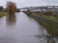
This route runs alongside the Odet, which is partly wild and partly channelled as it enters the town.

Details

n°188645
Creation:
Last update:
Last review:
  • Walking
    Activity: Walking
  • ↔
    Distance: 6.38 mi
  • ◔
    Average duration: 3h 15 
  • ▲
    Difficulty: Moderate

  • ⚐
    Back to start: Yes
  • ↗
    Ascent: + 367 ft
  • ↘
    Descent: - 348 ft

  • ▲
    Highest point: 217 ft
  • ▼
    Lowest point: 16 ft
  • ⚐ Country: France
  • ⚐ City: Quimper (29000)
  • ⚑
    Start/End: N 47.995226° / W 4.089922°
  • ❏
    IGN map(s): Ref. 0519ET, 0519OT, 0618OT
  • Hour-by-hour weather

Photos

Description of the walk

Park in the car park at the Impasse de l’Odet sports centre behind the station.

(S/E) From the car park, head towards the river, go round the old community centre on the left, then follow the river eastwards; on your right are the railway lines. Pass a footbridge on the left and continue until you reach the D783.

(1) Turn left, cross the bridge, then immediately take the underpass on your left (not always very clean). Go round the roundabout on the right and follow Rue Jules Verne to the right, opposite the Ambiance et Cuir shop. Follow this street northwards, passing the City of Quimper’s technical services department.

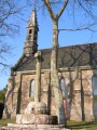
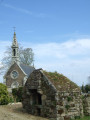
(2) At a glass recycling bin, turn left at a right angle into a wide, tree-lined lane. It curves to the right, crosses a road and climbs steadily up to the Cuzon Chapel.

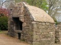
(3) At the chapel, turn left and head towards the bread oven, situated about 200 metres further on to the right. Continue to the right to complete the circular route that brings you back near the chapel. Turn left and follow Rue de la Chapelle de Cuzon, which descends gradually and continues as a wide path leading to the Odet.

(4) Turn left and head upstream along the river. Follow this path, which can be muddy in winter.

(5) The route suddenly leaves the riverbank to climb to the edge of the woodland, then continues back into the woodland, overlooking the N165 (a slightly noisy section).

(6) On leaving the woods, near the Cuzon business park, follow a path that veers left, skirting the business park. Pass the hamlet of Moulouyen on your right and continue along the path of the same name.

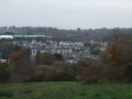
(7) Turn right to enter the craft industry estate, then veer left to pass by a former football pitch. Make a zigzag turn and begin the descent along the Chemin de Kermahonet (view of Kerfeunteun, a northern district of Quimper on the opposite hillside).

(8) Just before the D783, go through a barrier on the left and enter the retention basin area where the Frout, the third tributary of the Odet, flows. Go round the basin on the left and emerge at the Tréquefellec roundabout. Carefully follow the Route de Brest opposite for about 200 metres, using the cycle lane on the left, then turn into the first street on the left. Walk up Rue du Stade and, at the bend, take the footpath on the right (signposted) which runs between the hospital buildings and the street.

(9) At the end of the path, take Allée de Kerfily straight ahead, which leads into Gourmelen Hospital. Continue along this lane, which turns left, to reach the exit. Turn right onto the street and continue straight ahead at the next roundabout.

(10) Turn right at the first street. At the end of the street, make a sharp zigzag turn to enter a grassy area. Head slightly left to take the footbridge.

(11) Head back towards the starting point, heading due west.
Pass the former community centre on your right and head for the sports hall car park (S/E).

Waypoints

  1. S/E : mi 0 - alt. 16 ft - Sports centre car park
  2. 1 : mi 0.88 - alt. 33 ft - Bridge and underpass
  3. 2 : mi 1.43 - alt. 43 ft - Wide path on the left
  4. 3 : mi 1.88 - alt. 180 ft - Cuzon Chapel junction
  5. 4 : mi 2.56 - alt. 30 ft - Head back up the > - Odet
  6. 5 : mi 2.8 - alt. 30 ft - Leave the riverbank
  7. 6 : mi 3.22 - alt. 180 ft - Walk alongside the business park
  8. 7 : mi 3.6 - alt. 180 ft - Entrance to the industrial estate
  9. 8 : mi 4.24 - alt. 69 ft - Entrance to the retention basin area - Frout (ruisseau) - Affluent de l'Odet
  10. 9 : mi 5.08 - alt. 66 ft - Opposite, Allée de Kerfily
  11. 10 : mi 5.66 - alt. 23 ft - On the right: Rue Yves Quinquis
  12. 11 : mi 5.83 - alt. 23 ft - Footbridge
  13. S/E : mi 6.38 - alt. 16 ft - Sports centre car park

Notes

Semi-urban route.
Along the Odet, between (4 and 5), can be very muddy in winter.
(5) The section running alongside the motorway is noisy, but you soon leave this section behind and return to a quieter stretch.

Worth a visit

Reviews and comments

3.4 / 5
Based on 3 reviews

Reliability of the description
3.3 / 5
Ease of following the route
3.3 / 5
Route interest
3.7 / 5
FLOCH
FLOCH ★

No problem.
It might make the walk a bit more challenging
Kind regards

Machine-translated

le goff brigitte
le goff brigitte

Overall rating : 4.7 / 5

Date of your route : Jul 01, 2018
Reliability of the description : ★★★★☆ Good
Ease of following the route : ★★★★★ Very good
Route interest : ★★★★★ Very good

Hello
I was already partly familiar with this route, having done it five years ago, but I really enjoyed the new section – the Allée St Pierre, which I hadn’t been on before – and the descent towards the Odet to rejoin the route
This route is as lovely as ever
As for the reliability of the route description, I’m sorry but I do what I always do: I take photos of the map and have a look, rather than following the written instructions – it forces me to find my bearings…
My group were delighted
Thank you for suggesting something a bit different

Machine-translated

FLOCH
FLOCH ★

Thank you for your feedback.
I recognise that the section over the motorway (5) is noisy.
I’ll make that clear in my description.

However, to go so far as to label this route ‘disappointing’, I think the criticism is a bit exaggerated.
This suburban route does, however, allow you to explore a less-visited part of the town: the banks of the Odet and the Cuzon neighbourhood with its heritage sites (chapel, renovated bread oven).

Personally, I found some interesting spots there
More discoveries thanks to Visorando.
FLOCH (Moderator)

Machine-translated

sorando1
sorando1

Overall rating : 2.7 / 5

Date of your route : Nov 11, 2016
Reliability of the description : ★★★☆☆ Average
Ease of following the route : ★★★☆☆ Average
Route interest : ★★☆☆☆ Disappointing

The section of the route that runs alongside the motorway is very, very noisy and uninteresting. The bypass around the Cluzon area is poorly signposted.

Machine-translated

FLOCH
FLOCH ★

There’s one point I’m finding hard to understand:
the description is fine, yet the rating is set to ‘Average’

Reliability of the route on the map: Visorando asks for feedback on the reliability of the route, not on the print quality.

FLOCH (Moderator)

Machine-translated

bibi
bibi ★

The quality of the map actually depends on the print… with a printer that isn’t too old, you get the same quality as an IGN map… (I fell for it too )

Machine-translated

Yvette29000
Yvette29000

Overall rating : 3 / 5

Date of your route : May 31, 2016
Reliability of the description : ★★★☆☆ Average
Ease of following the route : ★★☆☆☆ Disappointing
Route interest : ★★★★☆ Good

The description is fine, but the map is too blurry and illegible

Machine-translated

Other walks in the area

For more walks, use our search engine .

The GPS track and description are the property of this route's author. Please do not copy them without permission.