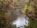
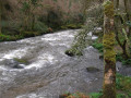
The former Kerrous quarry and the banks of the Odet at Stangala

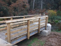
From the former aggregate quarry, which was converted into a walking area and water reservoir in late 2020, cross the Odet via a new footbridge installed in late 2021 to follow the river upstream. After another footbridge, head up into the upper Stangala valley. The return journey follows a small road passing through the hamlet of Squividan and its electricity substation, then the rapidly developing Kervouvois 2 industrial estate.

Details

n°19014975
Creation:
Last update:
Last review:
  • Walking
    Activity: Walking
  • ↔
    Distance: 5.61 mi
  • ◔
    Average duration: 2h 55 
  • ▲
    Difficulty: Moderate

  • ⚐
    Back to start: Yes
  • ↗
    Ascent: + 417 ft
  • ↘
    Descent: - 404 ft

  • ▲
    Highest point: 410 ft
  • ▼
    Lowest point: 49 ft
  • ⚐ Country: France
  • ⚐ City: Ergué-Gabéric (29500)
  • ⚑
    Start/End: N 48.011029° / W 4.063699°
  • ❏
    IGN map(s): Ref. 0518OT, 0519ET, 0618OT
  • Hour-by-hour weather

Photos

Description of the walk

Access: From Boulevard Président Allende (D783) – Quimper’s western bypass – at the Philippe Le Bon roundabout, take the D15 towards Coray. At the traffic lights, keep left, then take the first road on the left, signposted ‘Stangala site’. Follow this road straight on, go over the expressway and, at the roundabout, turn left towards Kerrous. Park in the car park of this former quarry.

(S/E) From the car park, head left to reach the banks of the Odet and walk alongside the river. After two ponds on the left, first turn right then left onto the wide path leading up to the former quarry, which has been converted into a water reservoir. After the small viewpoint, continue straight on, turn left onto the footpath and, at the bottom, turn right to reach a new footbridge over the Odet, opened in November 2021.

Signposting:GR® ®38 (white and red) andPR® (yellow)

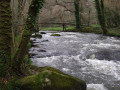
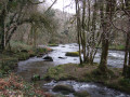
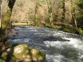
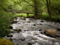
(1) After the footbridge, turn right onto the wide path which initially overlooks the river before drawing closer to it as it becomes more stony. Continue until you reach a signpost.

GR® ®38 signposting (white and red)

(2) Leave the yellow-marked path which climbs to the left and continue to follow the riverbank. Cross a wooden walkway and carry on along the path which moves away from the river slightly before rejoining it further on. This stony section may be muddy. Reach the old Meilh Poul footbridge (Meil Poul on the map).

Unmarked

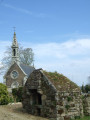
(3) Cross the footbridge and turn right (there is an old sign reading ‘Grifonnès 40 min’, but this section is no longer signposted). Begin a steep, winding ascent (80 m elevation gain). This is the most difficult part of the route. Pass a small fountain built into the low wall on the right, then further up, a beautiful stone trough, and arrive at another small fountain, also built into the wall. Continue the climb through the woodland, dominated by holly, and reach the plateau near a signpost indicating “Grifonnès viewpoint 100 m”

GR® ®38 white and red markings

(4) Turn right and rejoin theGR® near two large eucalyptus trees. Turn right, cross the car park (benches), continue along the track leading to this car park and carry on until you reach a tarmac area where you let theGR® carry on straight ahead.

No signposting

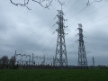
(5) Turn right under the high-voltage power lines and reach a road. Follow this road straight downhill, running parallel to the power lines, until you reach the Squividan substation.

(6) Walk through the hamlet of the same name (signposted) and continue along the wide pavement on the left, ignoring all the streets to the right and left, which are often dead ends. You’ll reach the ‘Keramus’ bus shelter.

(7) Leave the road and turn right onto a grassy strip running parallel to it, then follow this to the nearby roundabout.

(8) Turn right into Rue Albert Einstein and continue along the pavement on the left, past the Kervouvois 2 industrial estate, until you reach a barrier (with a transformer on the right). Turn left and follow the wide path that circles the entire industrial estate until it joins the road.

(9) Take the sharp right-hand bend and follow the footpath down towards a roundabout.

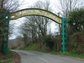
(10) Go round the roundabout on the right and take the path along the side of the road towards Kerrous. Pass the old entrance gate to the quarry and return to the car park (S/E.).


Waypoints

  1. S/E : mi 0 - alt. 49 ft - Car park at the former Kerrous quarry
  2. 1 : mi 0.39 - alt. 59 ft - Footbridge over the - Odet
  3. 2 : mi 1.03 - alt. 108 ft - Signpost
  4. 3 : mi 1.55 - alt. 141 ft - Meilh Poul footbridge
  5. 4 : mi 1.99 - alt. 377 ft - Signpost
  6. 5 : mi 2.62 - alt. 397 ft - Junction (end of the GR)
  7. 6 : mi 3.34 - alt. 289 ft - The hamlet of Squividan
  8. 7 : mi 3.81 - alt. 177 ft - Footpath
  9. 8 : mi 3.95 - alt. 180 ft - Rue Albert Einstein
  10. 9 : mi 4.88 - alt. 164 ft - Road junction
  11. 10 : mi 5.09 - alt. 92 ft - Roundabout
  12. S/E : mi 5.61 - alt. 49 ft - Car park at the former Kerrous quarry

Notes

The section through the Stangala site is classified as a medium-difficulty walk.
Muddy section in winter along the Odet.
Between points (5) and (8), then after (9), the route follows a stretch of quiet country lanes.
Picnic tables at the start car park.

Worth a visit

Always be cautious and plan ahead when you're outdoors. Visorando and the author of this route cannot be held responsible for any accidents occurring on this route.

The GR® and PR® markings are the intellectual property of the Fédération Française de Randonnée Pédestre.

Reviews and comments

4.3 / 5
Based on 2 reviews

Reliability of the description
4 / 5
Ease of following the route
5 / 5
Route interest
4 / 5
mcplomeur
mcplomeur

Overall rating : 4.5 / 5

Date of your route : Jan 12, 2026
Reliability of the description : ★★★★☆ Good
Ease of following the route : Not used / Not applicable
Route interest : ★★★★★ Very good
Very busy route : No

We set off from the quarry and walked along the right bank of the Odet to the second footbridge, then on to point 5, before returning along the left bank to the Men POul footbridge. 7.5 km with no elevation gain, but on a trail that was quite challenging at times. A very beautiful hike.

Machine-translated

FLOCH
FLOCH ★

Thank you for this review.

Having already posted several walks on the Stangala website, I wanted to suggest a circular route starting from the Kerrous quarry and making the most of the new footbridge.
It’s true that part of the route follows a country road, but it allows you to discover another side of this area.

Kind regards

Machine-translated

bruno carriou
bruno carriou

Overall rating : 4 / 5

Date of your route : Apr 11, 2022
Reliability of the description : ★★★★☆ Good
Ease of following the route : ★★★★★ Very good
Route interest : ★★★☆☆ Average
Very busy route : No

A lovely walk from the car park to point 5 on the map – for those who love nature without the noise of the city… it’s brilliant. However, the return journey from point 5 back to the car park… nothing but roads and power stations, and then they make us walk behind an industrial estate, which is really rather dull… So, for your next walk in this area, I’d suggest walkers take the route starting from the Kerrous Quarry car park to point 5, and then head back in the opposite direction from point 5 to the car park, so you can enjoy the real natural beauty of this place on both the outward and return journeys.

Machine-translated

Other walks in the area

For more walks, use our search engine .

The GPS track and description are the property of this route's author. Please do not copy them without permission.