Country:
 City:
City:


Park at Place Paul le Flem, on Rue Verdi near the CPAM.
(S/E) From the car park, cross Rue Verdi, then cross the car park behind the CPAM and turn left down Rue Ram Koz. Continue along Rue de la République until you reach the Tréquefellec roundabout.
GR®® signposting (white and red).
Go round the roundabout on the right, using the pedestrian crossings (heavy traffic ), and head down into the retention basin. Walk along the right-hand side of it.
After a bench, take a path on the right that leads uphill. Very soon, after two large stones, this path becomes suitable for vehicles. On your left, you’ll see the buildings of the Finistère Apprentice Training Centre.
(1) At the crossroad (signpost), turn right and walk for about a hundred metres. Turn left onto Rue de la Chapelle de Cuzon, pass by the beautiful, well-restored bread oven and walk round the Chapelle de Cuzon. Ignore a narrow lane on the left and join the Route de Cuzon at the water tower. Take the signposted footpath on the right (sign).
No signposting.
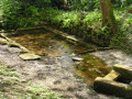
(2) Turn right and continue straight on along this access road to the hamlet of Mouliouen (known locally as Moulouyen), which is signposted as a dead end. At the end, a sign points to the fountain, but be careful: the path, which is poorly maintained, is on the right just past the sign (white gate on the left-hand side). Follow this track down to the wash house that once served this hamlet.
(3) Return to the road and turn left. After about a hundred metres, look out for a wooden post on the right; this is all that remains of the signpost. Turn right to cross a grassy area which leads into Rue Jacques Anquetil, which runs through this industrial estate (lodge offices on the right). Ignore thefirst street, Rue Pierre Cloarec.
Follow Rue Jacques Anquetil, which runs through the Cuzon Industrial Estate, and at the bottom take the hairpin bend into Rue de Cuzon (with a ‘Courtepaille’ sign on the left).
GR®® markings (white and red).
(4) Immediately turn left onto a lovely path (large boulder at the entrance) and follow this uphill track overlooking market gardens (view of the Kerfeunteun neighbourhood on the opposite slope). You’ll come out onto the road; head up it to the right, then turn right onto Chemin de Kermahonnet (sign indicating a vegetable stall and a 30 zone).
No signposting
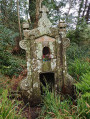
Walk down this small road, which passes close to the Manoir de Kermahonnet (stone fountain depicting the dragon from the manor’s legend).
Walk along the left-hand side of a lovely area of pasture (ponies, sheep) until you come out opposite the Route de Brest (D783).
(5) Cross this road with extreme caution (no pedestrian crossing and heavy traffic), turn left and walk past a memorial stone (Compagnie de Briec). Opposite the road sign indicating the next roundabout, take a discreet path that climbs into a rather overgrown woodland. At the top, where you’ll find wild rhododendrons, turn right and leave the woods.
You’ll emerge onto a street and, after about fifty metres, head up to the left, between the houses, up the wide flight of steps leading up the hillside. At the top, turn left and follow the path (view of the Kermoguer neighbourhood). At the end of the path, turn right into the residential area and continue straight on until you reach an inconspicuous passage between two houses.
(6) Turn left and follow this path between the houses and the woods. Carry on, going round a stormwater basin. On your left, you’ll look out over a block of flats under construction (March 2020).
Ignore a wooden gate on the right leading into this residential area and turn left. Pass a small grassy triangle and continue down the sloping street.
Near a street lamp, turn left into a discreet passageway between the houses, then turn right
At the three-way junction, take the left-hand street, which continues between the houses and leads out near a storm water basin overgrown with weeds.
(7) Turn right into Rue de la République and return to the car park via the same route as on the way there (S/E).



 Visorando Member

 Moderate