


Refine your search for walks in Penta-di-Casinca
Penta-di-Casinca walks


 Circular Penta Di Casinca via Palustrico and Castello
 Visorando Member
 4.73 mi
 +1,234 ft
 -1,257 ft
 3h 15
3h 15
 Moderate
 Departure from Penta-di-Casinca (Haute-Corse)
Circular in the Penta Di Casinca valley among the cork oaks and scrubland.
The Porri Cave
 2.42 mi
+958 ft
-971 ft
1h 55
Moderate
Departure from Porri (Haute-Corse)
2.42 mi
+958 ft
-971 ft
1h 55
Moderate
Departure from Porri (Haute-Corse)
In Haute-Corse, the village of Porri was one of the strongholds of the island's resistance movement. Near the village, a refuge cave known as the "Grotte des Maquisards" (Maquis Cave), which served as the Resistance's headquarters, recalls the contribution of Porri and the Casinca region to the liberation of Corsica. It is well guarded by the Vincetti, Vittori, Bébé Arrighi, Antoine Battesti, Noël Agostini and many others.
Source: France 3 Corse ViaStella
Double circular route between Vescovato and Olmu
 7.50 mi
+1,969 ft
-1,972 ft
5h 10
Moderate
Departure from Haute-Corse
7.50 mi
+1,969 ft
-1,972 ft
5h 10
Moderate
Departure from Haute-Corse
This walk forms a circular route linking the villages of Vescovato and Olmu. It starts in Vescovato, where the architectural heritage is well worth exploring for the curious, and passes through the village of Olmu, which will delight lovers of the ‘old stone’ architecture found in island villages. The landscapes you pass through are varied, ranging from woodland to oak groves and open, exposed areas such as the ridges. Thus, as you move from one slope to another, from one bank to the other, you will have the opportunity to enjoy views of both the sea and the islands bordering Corsica, as well as views of the mountains, which are sometimes snow-capped depending on the season.
Sant'Angelo from Silvarecciu
 4.23 mi
+1,801 ft
-1,795 ft
3h 30
Moderate
Departure from Silvareccio (Haute-Corse)
4.23 mi
+1,801 ft
-1,795 ft
3h 30
Moderate
Departure from Silvareccio (Haute-Corse)
Sant Angelo (1,200 m) is a peak located between Casinca and Castaniccia. At its summit, you can enjoy a 360° view of the sea, the Biguglia lagoon and the surrounding villages and valleys.
The hike takes place in the undergrowth, mostly under the protection of chestnut trees.
Croce Niolo and Monte Taglio ridges via Fiuminale
 9.53 mi
+2,756 ft
-2,746 ft
6h 45
9.53 mi
+2,756 ft
-2,746 ft
6h 45
 Difficult
Departure from Pero-Casevecchie (Haute-Corse)
Difficult
Departure from Pero-Casevecchie (Haute-Corse)
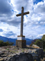
This circular hike, which is not difficult but does require a certain level of fitness, will take you through varied and unspoilt vegetation. Along the way, you will discover the two hamlets of Fiuminale and forests of hundred-year-old chestnut trees. From the summit of Croce Niolo at an altitude of 995 m, you will have a 360° panorama. To the west, you can see Monte San Petrone, the highest peak in Castagniccia. To the east, the Tuscan archipelago: Elba and Monte Cristo. To the north, Casinca and the Bastia region. Unspoilt by mass tourism, you will have the opportunity to visit three traditional villages in the upper Costa Verde region.
Mont Sant'Angelo from Carogne
 5.32 mi
+1,926 ft
-1,926 ft
4h 05
Difficult
Departure from Monte (Haute-Corse)
5.32 mi
+1,926 ft
-1,926 ft
4h 05
Difficult
Departure from Monte (Haute-Corse)
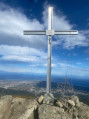
This circular route will take you through pleasant woodland at 1,200 metres above sea level, on Mont Sant'Angelo, which overlooks the Biguglia plain and the sea. Unlike the traditional trail that starts from Silvareccio, the departure from Carogne or Monte will take you off the beaten track on old, abandoned paths and trails and has the advantage of being circular.
(!) Old description, some paths seem to have disappeared, see reviews.
Return trip to Fiuminale, a village in ruins
3.35 mi
+991 ft
-991 ft
2h 25
Moderate
Departure from Velone-Orneto (Haute-Corse)
A shaded walk along the Canapajo stream to the ruins of the village of Fiuminale, a restored village accessible only on foot, by donkey or on horseback. Round-trip hike.
Monte Castellare loop
 3.64 mi
+1,401 ft
-1,401 ft
2h 55
Moderate
Departure from Campile (Haute-Corse)
3.64 mi
+1,401 ft
-1,401 ft
2h 55
Moderate
Departure from Campile (Haute-Corse)
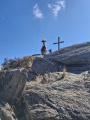
This magnificent loop on the slopes of Monte Castellare offers breathtaking views of the neighbouring valleys, the plain of Bastia, Elba Island and, on a clear day, even the Italian coast.
It alternates between wooded and open sections until you reach the summit at 1,000 metres, where a magnificent oak tree provides welcome shade for a picnic or a siesta.
The descent takes you through the charming hamlet of Costa.
Santa Lucia di Moriani Circular Route
 6.91 mi
+1,709 ft
-1,706 ft
4h 40
Moderate
Departure from Santa-Lucia-di-Moriani (Haute-Corse)
6.91 mi
+1,709 ft
-1,706 ft
4h 40
Moderate
Departure from Santa-Lucia-di-Moriani (Haute-Corse)
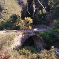
The walk takes place mainly in woodland, particularly chestnut trees. It is very pleasant to walk alongside various streams such as the Ruisseau de Canapajo, after the Pont de l'Enfer. The ruins of an old mill are also visible. The route also passes through the hamlet of Serrale.
San-Nicolao (San Niculaiu) circular loop
 2.07 mi
+420 ft
-413 ft
1h 20
2.07 mi
+420 ft
-413 ft
1h 20
 Easy
Departure from San-Nicolao (Haute-Corse)
Easy
Departure from San-Nicolao (Haute-Corse)
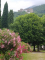
Starting from the parish church of San Niculaiu, a listed historical monument, this short, easy, shaded circular family walk will take you through part of the municipality of San Nicolao with its two small hamlets.
Circular walk starting from the village of Parata
 4.53 mi
+2,041 ft
-2,054 ft
3h 50
Moderate
Departure from Parata (Haute-Corse)
4.53 mi
+2,041 ft
-2,054 ft
3h 50
Moderate
Departure from Parata (Haute-Corse)
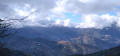
Nestled in the Castaniccia region at the end of the D46 departmental road lies the rural village of Parata, which serves as the starting point for several walks. The walk suggested here climbs up to the ridges, passing by the Chapel of San Bartolomeu. The views on either side of the ridge you follow offer vistas of both the Tyrrhenian Sea and the Castaniccia region with its villages.
Three villages in Castagniccia starting from Piedicroce
 4.04 mi
+1,148 ft
-1,142 ft
2h 50
Moderate
Departure from Piedicroce (Haute-Corse)
4.04 mi
+1,148 ft
-1,142 ft
2h 50
Moderate
Departure from Piedicroce (Haute-Corse)
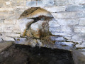
This circular route in Castagniccia offers both a remarkable natural and cultural setting. Passing through villages and other built-up areas, it allows you to discover Corsican heritage: houses, chapels, churches, a convent (near Piedicroce), as well as wash houses and fountains. The circular path, mostly in the woods, is shaded while offering exceptional views of the various villages in the region. Small streams provide refreshing breaks in summer, while remaining passable in winter.
Carchetu circular
 1.88 mi
+394 ft
-384 ft
1h 10
Easy
Departure from Carcheto-Brustico (Haute-Corse)
1.88 mi
+394 ft
-384 ft
1h 10
Easy
Departure from Carcheto-Brustico (Haute-Corse)
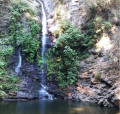
This circular loop can be done with the family, for example, or simply to discover the Orezza region on a short and easy hike. During this walk, you can discover the region's natural heritage (waterfall) as well as its architectural heritage.
Summit of Monte San Petrone in a circular route from Pie-d'Orrezza
 9.10 mi
+3,960 ft
-3,960 ft
7h 40
Difficult
Departure from Pie-d'Orezza (Haute-Corse)
9.10 mi
+3,960 ft
-3,960 ft
7h 40
Difficult
Departure from Pie-d'Orezza (Haute-Corse)
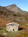
This alternative route to Monte San Petrone from the village of Pie-d'Orezza is much more challenging, but also more beautiful than the classic route via the Col de Prato. At 1,767 metres, San Petrone is the highest peak in Castaniccia. The summit offers a remarkable 360° panorama. You will have a view of Cap Corse to the east coast, the whole of Castaniccia and the mountain range of the island's highest peaks. This hike can be classified as very difficult for hikers who are not used to fairly long distances and significant elevation gains. You can shorten it by avoiding the return trip to the summit of San Petrone from the Col de Bocca di San Pietro. Nevertheless, it will still be a very beautiful circular hike with varied landscapes and unobstructed views.
Circular route starting from Campodonico
 5.11 mi
+1,844 ft
-1,854 ft
3h 55
Moderate
Departure from Pie-d'Orezza (Haute-Corse)
5.11 mi
+1,844 ft
-1,854 ft
3h 55
Moderate
Departure from Pie-d'Orezza (Haute-Corse)
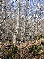
This circular route starting from Campodonico traverses varied mountain landscapes in the heart of Castagniccia. On the plateau, a breathtaking view allows you to admire the mountain range of central Corsica and the remarkable villages of Castagniccia, whilst enjoying a distant view of the sea. Furthermore, there are traces of ancient buildings to admire at Bocca al Prato.