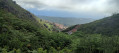
The hills of the Costa Verde

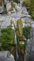
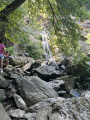
On the hillside, in the municipality of San-Nicolao, you’ll wander along this route through the centuries-old chestnut groves of the Castagniccia, with the inviting shores of the Costa Verde in the distance. The local architectural heritage is evident throughout the landscapes you pass through.

Details

n°43668636
Creation:
Last update:
Last review:
  • Walking
    Activity: Walking
  • ↔
    Distance: 6.47 mi
  • ◔
    Average duration: 3h 50 
  • ▲
    Difficulty: Difficult

  • ⚐
    Back to start: Yes
  • ↗
    Ascent: + 942 ft
  • ↘
    Descent: - 928 ft

  • ▲
    Highest point: 915 ft
  • ▼
    Lowest point: 13 ft
  • ⚐ Country: France
  • ⚐ City: San-Nicolao (20230)
  • ⚑
    Start/End: N 42.368895° / E 9.529352°
  • ❏
    IGN map(s): Ref. 4349OT, 4351OT
  • Hour-by-hour weather

Description of the walk

Access by car or bus; check the timetables of the Bastia Intercity Transport Company (STIB). The route starts at Padullela Park, on the RT10 in Moriani, in the municipality of San-Nicolao.

(S/E) From the car park, take the main path, cross the park to reach the Route de Poggiole, which you should follow to the left until you reach the old railway line, now known as the “spassiverde”.

(1) Take the road on the left until you reach the first junction.

(2) Turn right and follow Route de Vangali. Pass the stadium, then at the junction veer left and continue to the bridge.

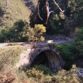
(3) Cross the bridge and take the first path on the right, before following a track, then a small path on the right to the Genoese Bridge.

Orange markings

(4) Cross the bridge, pass the hamlet of Ponte and head up the path on the left. Ignore a track on the left and continue to a Fork in the road.

(5) Turn left to follow the steep path towards the ruins of the village of Raggia. Continue to the D330, keeping right once and then left once, until you reach the RD330 at Fano.

(6) Follow the road to the right, pass to the right of the chapel and enter the village of Piedigrado by turning immediately right at the chapel, then turning left onto Via A. Simon Paoli.

(7) Further down, turn left into a narrow lane which leads to a gate; make sure to close it behind you. Continue to the San Nicolao road and its cemetery.

(8) Head down this road to the left, pass the cemetery and take the first path (Mare à Mare Nord) on the right. Cross the road twice, then shortly after the second junction, turn right. Join a road and, almost at the end of the descent, you’ll reach a car park.

(9) Walk a few dozen metres past the car park and take the first path leading uphill on the right. Then follow the road to the left. At the end of the road, turn left onto Route de Timone and continue to the San-Nicolao town hall.

End of orange signposting

(10) Turn right, pass the school at Moriani-plage and follow the road along the old railway line. Ignore the first three paths branching off to the left and continue to the fourth. Take this path on the left, which leads onto Route de Poggiole, where you’ll find the entrance to Padulella Park almost directly opposite. Walk diagonally across the park to the left to reach the car parks (S/E).

Waypoints

  1. S/E : mi 0 - alt. 13 ft - Parc Padulella
  2. 1 : mi 0.25 - alt. 30 ft - Spassiverde
  3. 2 : mi 0.56 - alt. 26 ft - Junction with the Vangali Road
  4. 3 : mi 1.55 - alt. 95 ft - Bridge over the River Bucatoggio
  5. 4 : mi 1.8 - alt. 112 ft - Genoese bridge
  6. 5 : mi 2.44 - alt. 436 ft - Fork in the road; take the left-hand path
  7. 6 : mi 2.97 - alt. 909 ft - Fano, RD330
  8. 7 : mi 3.44 - alt. 837 ft - Piedigrado
  9. 8 : mi 4.11 - alt. 561 ft - Cemetery - Église San Nicolao (San Nicolao)
  10. 9 : mi 4.93 - alt. 131 ft - Car park
  11. 10 : mi 5.82 - alt. 36 ft - Moriani Plage Town Hall, San Nicolao
  12. S/E : mi 6.47 - alt. 13 ft - Parc Padulella

Notes

Make sure you take plenty of water with you. There are no places to buy food along the route.

Worth a visit

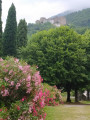
(S/E) Padulella Park.
(4) Genoese Bridge.
Ruins of the village of Raggia.
Chestnut groves.
Castellana Chapel.
(8) Church of San Nicolao.

Reviews and comments

4.7 / 5
Based on 1 review

Reliability of the description
4 / 5
Ease of following the route
5 / 5
Route interest
5 / 5
User 28507221

Overall rating : 4.7 / 5

Date of your route : Jun 20, 2026
Reliability of the description : ★★★★☆ Good
Ease of following the route : ★★★★★ Very good
Route interest : ★★★★★ Very good
Very busy route : No

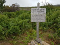
A very pleasant walk, with a lovely view from higher ground halfway along the route. Please note, however, that you’ll need to take a short detour between waypoints 3 and 4 (the path across the field is closed), which adds about 15 minutes to the walk.
This walking route offers the chance to enjoy a variety of magnificent landscapes: forests, fields, mountains, the ruins of a hamlet, small villages perched high up, and more...
There are numerous steep sections along this route, but nothing insurmountable if you’re in good shape and take a few breaks. Remember to take water with you, and avoid doing this route in the height of summer heat!

Machine-translated

Other walks in the area

For more walks, use our search engine .

The GPS track and description are the property of this route's author. Please do not copy them without permission.