Circular walk along the Penta di Casinca heritage trail

A walk through the listed hilltop village of Penta di Casinca, with its narrow streets and panoramic viewpoints.

Details

n°39891858
Creation:
Last update:
Last review:
  • Walking
    Activity: Walking
  • ↔
    Distance: 0.74 mi
  • ◔
    Average duration: 0h 25 
  • ▲
    Difficulty: Easy

  • ⚐
    Back to start: Yes
  • ↗
    Ascent: + 89 ft
  • ↘
    Descent: - 85 ft

  • ▲
    Highest point: 1,302 ft
  • ▼
    Lowest point: 1,214 ft

Photos

Description of the walk

The walk starts from the village’s visitor car park; the other car parks are for residents only.
Signposted with arrows and iron signs.

(S/E) Turn left, walking past Follelli Primary School, go down the steps on the left and turn right at the bottom. 40 metres further on, on the left, is the start of the Follelli Heritage Route.

(1) Walk downhill, then turn right and continue along the grassy path for 300 m. At the iron arrow on the wall, turn right and walk up the street for 100 m.

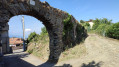
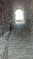
(2) Turn left and go under the stone archway between two houses, admire the view, then retrace your steps and head straight on along Rue U Carrughju for 100 metres. Turn left, then right onto Rue U Casone and, after 20 metres, take a first turn left then right, then turn right to rejoin the main road.

(3) Turn left onto Rue U Carrughju, opposite the Chapel of the Annunciation, and, after 80 m, turn left at the corner between the church and the bistro (the church is very beautiful – you can visit it). Turn right into the narrow streets and, after 60 m, turn left. Take a short detour to the right onto Rue A Teppa, with its promontory and view over the valley, then retrace your steps to continue to the right and reach Rue de Porta a Penta further down.

(4) Walk to the steps on the right, climb them and you’ll reach the village square. Head towards the town hall, then walk back up to the car park on the right, 100 m away (S/E) .

Waypoints

  1. S/E : mi 0 - alt. 1,299 ft - Visitor car park near the school
  2. 1 : mi 0.07 - alt. 1,270 ft - Descent and fork in the path
  3. 2 : mi 0.28 - alt. 1,266 ft - Junction
  4. 3 : mi 0.39 - alt. 1,289 ft - Rue U Carrughju
  5. 4 : mi 0.54 - alt. 1,263 ft - Steps on the right
  6. S/E : mi 0.74 - alt. 1,302 ft - Visitor car park near the school

Notes

Water points in the village, with several restaurants and cafés.
Clothing suitable for the weather.
Walking poles recommended.
Sturdy footwear.

Worth a visit

Numerous photos along the route depicting traditional trades and village life.
Visit the beautiful Saint-Michel Church.

Reviews and comments

5 / 5
Based on 1 review

Reliability of the description
5 / 5
Ease of following the route
5 / 5
Route interest
5 / 5
F8DHA
F8DHA

Overall rating : 5 / 5

Date of your route : Jun 08, 2026
Reliability of the description : ★★★★★ Very good
Ease of following the route : ★★★★★ Very good
Route interest : ★★★★★ Very good
Very busy route : No

A lovely circular route that takes you round the village. It’s not very big, but there are a few information boards. Do feel free to wander through the streets. Unfortunately, the church was closed, which is a shame as the exterior is quite striking for such a small village.
Please note there’s no parking in the village, and the road from the visitor car park isn’t easy to take when you’re arriving, but you can turn round in the village to get going in the right direction.

Machine-translated

Other walks in the area

For more walks, use our search engine .

The GPS track and description are the property of this route's author. Please do not copy them without permission.