Between hedgerows and woodland in Obies

On the agenda: an investigation into the identity of Gustave, the mysterious visitor. As you follow the route, full of questions and games, explore Obies and uncover the identity of a very strange visitor who, one day, turned up in the village....

Details

1326681
Creation:
Last update:
Last review:
  • Walking
    Activity: Walking
  • ↔
    Distance: 2.32 mi
  • ◔
    Average duration: 1h 05 
  • ▲
    Difficulty: Easy

  • ⚐
    Back to start: Yes
  • ↗
    Ascent: + 26 ft
  • ↘
    Descent: - 26 ft

  • ▲
    Highest point: 515 ft
  • ▼
    Lowest point: 476 ft

Photos

Description of the walk

Park in front of the town hall in the village of Obies, 200 Rue de la Wiarde (car park).

(S/E) Set off on foot along the road leading towards the village centre.

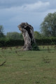
(1) Turn right at the crossroads, towards Bavay. Head towards this large building, which used to be Obies town hall. Continue along the main road, following in Gustave’s footsteps, until you reach an orchard on your right. Look out for the tree with a bump at its base.

(2) At the crossroads in the hamlet of Croisette, turn left onto Voie Lallemant.
Stop in front of the old farm and complete thesecond game.

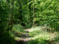
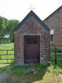
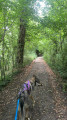
Carry on and stop in front of the wayside shrine to read the information, then continue towards the forest. Take the opportunity to look at the pollarded trees. Continue along the path until you reach a crossroads a few metres before a copse of trees.

(3) Turn left and find the hidden bunker. Carry on until you reach the farm.

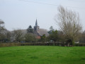
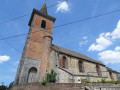
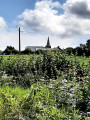
(4) At the road, turn left and head towards the small chapel overgrown with vegetation (on your right). Carry on to the church at Obies, then head to the car park in front of the town hall (S/E).


Waypoints

  1. S/E : mi 0 - alt. 489 ft - Town hall car park
  2. 1 : mi 0.13 - alt. 492 ft - Turn right towards Bavay
  3. 2 : mi 0.29 - alt. 495 ft - Croisette hamlet, on the left
  4. 3 : mi 1.24 - alt. 502 ft - At the crossroads, turn left
  5. 4 : mi 1.33 - alt. 512 ft - Road, on the left
  6. S/E : mi 2.32 - alt. 489 ft - Town hall car park

Notes

To follow this route and get more information, download the Baladavesnois app before you set off
https://www.parc-naturel-avesnois.fr/blo...
Once installed, it works offline.

Once you’ve downloaded it onto your phone or tablet, you no longer need an internet connection.

Reviews and comments

4.3 / 5
Based on 2 reviews

Reliability of the description
4 / 5
Ease of following the route
4 / 5
Route interest
5 / 5
PNR de l'Avesnois
PNR de l'Avesnois

Hello,

This route does not include any private sections. The farmer’s gates can be opened and closed; there are no padlocks fitted.
Regarding the games, have you downloaded and used the Baladavesnois app on your phone? You need to use this app to access the information and games, as stated on the information sheet.
Visorando only provides directions.
Please do not hesitate to contact us if you require any further information
Kind regards
Annie TROTIN
Economic Development Research Assistant
Avesnois Regional Nature Park
4, Cour de l’Abbaye
59550 MAROILLES
Tel: 03 27 77 52 64 – 06 77 97 04 20
annie.trotin@parc-naturel-avesnois.com
www.parc-naturel-avesnois.fr
Baladavesnois app: heritage discovery games

Machine-translated

Babouduf
Babouduf
• Edited:

Overall rating : 3 / 5

Date of your route : Mar 02, 2025
Reliability of the description : ★★★☆☆ Average
Ease of following the route : Not used / Not applicable
Route interest : Not used / Not applicable
Very busy route : No

There were no signs or signposts. Some sections were on private land. A really uninteresting walk.
We didn’t see any questions or games (as mentioned on the information sheet).

Machine-translated

Brigetrene
Brigetrene

Overall rating : 4.7 / 5

Date of your route : May 17, 2020
Reliability of the description : ★★★★★ Very good
Ease of following the route : ★★★★☆ Good
Route interest : ★★★★★ Very good
Very busy route : No

Just a quick note on point 3: it’s impossible to reach point 4 – the farmer has put up a gate. However, you can carry on along the path through the woods and then join the route again on the right. This adds 400 metres to the walk, but it’s just as good.

Machine-translated

Other walks in the area

For more walks, use our search engine .

The GPS track and description are the property of this route's author. Please do not copy them without permission.