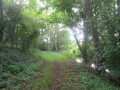
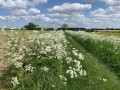
The Druids’ Trail in Mecquignies

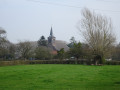
To the north of the Mormal Forest, this family-friendly route takes you on a journey of discovery through the Avesnois bocage.
The proximity of the Gallo-Roman settlement of Bavay, the abundance of mistletoe in the hedgerow landscape and the imposing Mormal forest have inspired the route’s name.

Details

1546494
Creation:
Last update:
Last review:
  • Walking
    Activity: Walking
  • ↔
    Distance: 4.58 mi
  • ◔
    Average duration: 2h 15 
  • ▲
    Difficulty: Easy

  • ⚐
    Back to start: Yes
  • ↗
    Ascent: + 135 ft
  • ↘
    Descent: - 164 ft

  • ▲
    Highest point: 525 ft
  • ▼
    Lowest point: 413 ft

Photos

Description of the walk

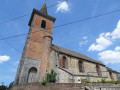
Starting point: Ladzout church (small car park).

(S/E) Take Rue de l’Église heading north-east. At the corner of the second cemetery, turn right to join the RD154 opposite the sawmill.

(1) Cross the road carefully and take Rue Magdeleine, which is opposite and slightly to the left. At La Tomblaine, turn right.

(2) 120 metres further on, turn left onto Chemin des Vaches.
This quiet, winding little road cuts across a road at the Quatorze Faisses crossroads and leads into the
state-owned forest of Mormal.

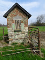
(3) Pass by the Chapelle Fatrez and a typical farmhouse, noting the old well in the courtyard as you go. Go through the metal gate and head diagonally right into the forest, an area undergoing regeneration, onto the Bon Wez forest track.

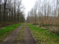
(4) Note the majestic beech forest on your right; follow this tree-lined lane to the left for 350 metres, then turn right and continue along Route Attorne.

(5) When you reach the Route d’Obies, cross it and veer slightly to the right to pass close to an old blockhouse. Turn left straight away to follow the Route du Camp for 50 metres before turning right onto a path at the edge of the woodland that goes round the Obies Forest House.
Leave the forest and take the stony track known as the Voie Lallemant, which crosses pastures and orchards. This 2km-long track leads to the RD154 at a place called La Croisette.

(6) Cross the departmental road and join the tarmac Rue du Cimetière opposite.
After the cemetery, at the three-way junction, turn right and then right again to come out onto a road (RD154) at an imposing wayside cross.

(7) Turn left. At the next junction, turn right and, about thirty metres before the sawmill, cross over to take the small street that leads back to the church (S/E).

Waypoints

  1. S/E : mi 0 - alt. 456 ft - Mecquignies Church
  2. 1 : mi 0.29 - alt. 417 ft - RD154, sawmill
  3. 2 : mi 0.65 - alt. 420 ft - At the crossroads, turn left
  4. 3 : mi 1.5 - alt. 512 ft - Fatrez Chapel
  5. 4 : mi 1.82 - alt. 509 ft - Route du Bon Wez – Hêtraie
  6. 5 : mi 2.48 - alt. 525 ft - Obies Road
  7. 6 : mi 3.74 - alt. 495 ft - RD154
  8. 7 : mi 4.29 - alt. 430 ft - Crossroads, wayside cross
  9. S/E : mi 4.58 - alt. 453 ft - Mecquignies Church

Notes

In wet weather, waterproof footwear is essential.

Car park at the church at the starting point.

Route listed in the PDIPR (Departmental Plan for Walking and Hiking Routes).

Follow the yellow markings.

Alternative route via Obies:

From the point (6): walk along the right-hand side of the departmental road until you reach Obies church.
Then turn left towards Mecquignies. Pass the town hall and the school, and not far from (2) on your right. Once at (7), follow the main route back to the start.

Reviews and comments

5 / 5
Based on 2 reviews

Reliability of the description
5 / 5
Ease of following the route
5 / 5
Route interest
5 / 5
michel tout court
michel tout court

Overall rating : 5 / 5

Date of your route : Jun 06, 2020
Reliability of the description : ★★★★★ Very good
Ease of following the route : ★★★★★ Very good
Route interest : ★★★★★ Very good
Very busy route : No

To be combined with the clog-makers’ trail

Machine-translated

Buzzrando
Buzzrando

Overall rating : 5 / 5

Date of your route : Jul 31, 2019
Reliability of the description : ★★★★★ Very good
Ease of following the route : ★★★★★ Very good
Route interest : ★★★★★ Very good

Une route calme et facile

Machine-translated

Other walks in the area

For more walks, use our search engine .

The GPS track and description are the property of this route's author. Please do not copy them without permission.