From Sainte-Aldegonde to Patton

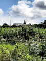
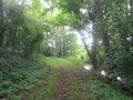
Explore the town of La Longueville, the Sainte-Aldegonde Fountain and the Patton Memorial, following paths and narrow streets in complete safety.

Details

n°64347750
Creation:
Last update:
Last review:
  • Walking
    Activity: Walking
  • ↔
    Distance: 6.28 mi
  • ◔
    Average duration: 2h 55 
  • ▲
    Difficulty: Moderate

  • ⚐
    Back to start: Yes
  • ↗
    Ascent: + 66 ft
  • ↘
    Descent: - 69 ft

  • ▲
    Highest point: 509 ft
  • ▼
    Lowest point: 463 ft

Photos

Description of the walk

Park in the car parks near La Longueville Town Hall.

S/E: With your back to the Town Hall Square, turn left onto Rue Maxime Quévy. Go straight on, ignore a path on the right, and take the first left onto Rue de la Fontaine (note the Sainte-Aldegonde Fountain on your left). Continue straight on until you reach Rue Guynemer.

(1) Turn right onto this street. Carry straight on to the junction, then turn right onto Rue Maxime Quévy until you reach Rue Maréchal Leclerc.

(2) Turn left onto this street, ignore the first street on the left, and take the second left, Résidence les Châtaigniers. When you reach the Longueville Care Home, turn left; at the end of the street, turn right onto Rue Roger Salengro to reach Rue de la Gare.

(3) Cross over to the opposite side, onto Impasse de la Gare, to discover, on your right, a bunker and the Patton memorial, in the meadow where his plane and body were found.

(4) Retrace your steps back to Rue de la Gare.

(3) Turn right and, at the roundabout, take the first right onto Rue des Usines; carry on straight ahead. Cross the Hogneau stream and continue until you reach the first path on the left, the Chemin de Bavay.

(5) Carry on straight ahead (bunker) and cross the level crossing to reach a Fork in the road at a place called Capiau Sart.

(6) You can opt for the shorter 8.33 km route by turning right; otherwise, carry on straight ahead to the next junction.

(7) Turn right; at the end, turn right again onto Rue Alban Voisin, then immediately turn right onto the Vieux Chemin de Bavay. Carry on straight ahead until you reach the cemetery, where you’ll come to Rue de Bavay (D95).

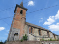
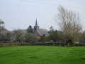
(8) Turn right onto Rue de Bavay. Ignore three paths on the left and one on the right. Take the steps to reach Sainte-Aldegonde Church, walk past the façade, and continue to Rue de Mons, which you take on the right, leading to Place de la Mairie (S/E).

Waypoints

  1. S/E : mi 0 - alt. 469 ft - Place de la Mairie in La Longueville
  2. 1 : mi 0.5 - alt. 482 ft - Rue Guynemer
  3. 2 : mi 0.88 - alt. 479 ft - Rue Maréchal Leclerc
  4. 3 : mi 1.3 - alt. 482 ft - Junction. Return to the memorial stone
  5. 4 : mi 1.49 - alt. 476 ft - Commemorative plaque. - Mémorial Patton (La Longueville)
  6. 5 : mi 2.31 - alt. 492 ft - Chemin de Bavay
  7. 6 : mi 3.39 - alt. 489 ft - Capiau Sart, Chemin de Bavay
  8. 7 : mi 4.01 - alt. 476 ft - Crossroads
  9. 8 : mi 5.97 - alt. 466 ft - Rue de Bavay - Hogneau (rivière) - Affluant de la Haine
  10. S/E : mi 6.28 - alt. 472 ft - Place de la Mairie in La Longueville

Notes

Short alternative route to take at point (6): turn right onto the Vieux Chemin de Bavay, then continue to the right, following the rest of the route description.

Worth a visit

Reviews and comments

3.8 / 5
Based on 2 reviews

Reliability of the description
4 / 5
Ease of following the route
3.5 / 5
Route interest
4 / 5
jean-marie 59144
jean-marie 59144

Overall rating : 3.7 / 5

Date of your route : Oct 26, 2026
Reliability of the description : ★★★★☆ Good
Ease of following the route : ★★★☆☆ Average
Route interest : ★★★★☆ Good
Very busy route : No

no signposting
a lovely, easy route

Machine-translated

SG59
SG59

Overall rating : 4 / 5

Date of your route : Nov 03, 2025
Reliability of the description : ★★★★☆ Good
Ease of following the route : ★★★★☆ Good
Route interest : ★★★★☆ Good
Very busy route : No

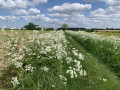
A lovely route through fields with no elevation gain.

Machine-translated

Other walks in the area

For more walks, use our search engine .

The GPS track and description are the property of this route's author. Please do not copy them without permission.