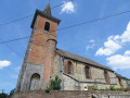
The Quarrymen’s Trail in Bettrechies

This route in the heart of the Hogneau Valley complements the ‘Marble Valley Route’. Accessible all year round.

Details

30102215
Creation:
Last update:
Last review:
  • Walking
    Activity: Walking
  • ↔
    Distance: 4.31 mi
  • ◔
    Average duration: 2h 10 
  • ▲
    Difficulty: Easy

  • ⚐
    Back to start: Yes
  • ↗
    Ascent: + 210 ft
  • ↘
    Descent: - 207 ft

  • ▲
    Highest point: 410 ft
  • ▼
    Lowest point: 230 ft

Photos

Description of the walk

Car park: Place de Bettrechies

(S/E) Discover the fountain on La Place. With your back to this fountain, head towards Rue Saint-Waast; you’ll notice a fountain on your right. Continue along this uphill road, passing the chapel on your right. Carry on until you reach the junction.
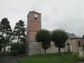
Turn right onto Rue Cailleresse. Just before the cemetery, take the path on the right. At the end of the path, you’ll reach the town hall car park, with Bettrechies Church on your right; turn left and walk past the town hall.

(1) Turn right onto Rue Cailleresse, carry on straight ahead, ignoring a road on your right. At the Fork in the road, continue straight ahead onto Rue des Pâturettes; at the next T-junction, turn left onto Rue d’en Bas. At the junction on your left, carry on straight ahead onto Chemin de Roisin.

(2) At the junction, turn right and carry on straight ahead until you reach the T-junction; turn right onto Chemin du Piémont, passing the Au Baron brasserie, then the restaurant of the same name.

(3) At the bridge over the Hogneau, turn right onto Chemin de la Halte. Turn left onto the path that runs alongside the Hogneau

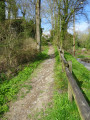
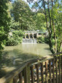
(4) Follow the path on the right, skirting the quarry pond; continue along this path until you emerge onto Rue d’en Bas.

(5) Turn left onto this street and immediately turn right onto the path running alongside a hedge, passing behind the municipal campsite.

(6) Turn left onto Rue de Meaurain, passing a beautiful house: a former customs barracks.

(7) At the Fork in the road, take Rue Crocqu’âne on the left, then turn right at the statue of the Muse Salomé onto Rue Gillette and head back to the square, your starting point (S/E). 

Waypoints

  1. S/E : mi 0 - alt. 341 ft - Place de Bettrechies
  2. 1 : mi 1.15 - alt. 397 ft - Rue Cailleresse
  3. 2 : mi 1.84 - alt. 371 ft - Chemin du Piémont
  4. 3 : mi 2.56 - alt. 230 ft - L’Hogneau
  5. 4 : mi 3.07 - alt. 292 ft - Quarry basin
  6. 5 : mi 3.67 - alt. 335 ft - Rue d’en bas
  7. 6 : mi 3.95 - alt. 387 ft - Rue de Meaurain
  8. 7 : mi 4.06 - alt. 367 ft - Rue Crocqu’âne
  9. S/E : mi 4.31 - alt. 341 ft - Place de Bettrechies

Notes

Route listed in the PDIPR, accessible all year round.

Worth a visit

(3) ‘Chez Mireille’ hiking café in Gussignies

Reviews and comments

5 / 5
Based on 2 reviews

Reliability of the description
5 / 5
Ease of following the route
5 / 5
Route interest
5 / 5
User 9947728

Overall rating : 5 / 5

Date of your route : Jul 05, 2025
Reliability of the description : ★★★★★ Very good
Ease of following the route : ★★★★★ Very good
Route interest : ★★★★★ Very good
Very busy route : No

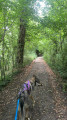
A magnificent hike, the first part of which takes you along country roads through pretty villages between France and Belgium, and the second part along a wooded path beside a stream leading to the quarries. The hilly, wooded trail passes through villages with authentic, charming little houses. It's a real change of scenery and very rejuvenating! I highly recommend this hike! For your information, we did it with our dogs.

Machine-translated

naya59!
naya59!

Overall rating : 5 / 5

Date of your route : Mar 22, 2025
Reliability of the description : ★★★★★ Very good
Ease of following the route : ★★★★★ Very good
Route interest : ★★★★★ Very good
Very busy route : No

A 2-hour walk through the forest, taking in some pretty villages – very pleasant and fairly easy

Machine-translated

Other walks in the area

For more walks, use our search engine .

The GPS track and description are the property of this route's author. Please do not copy them without permission.