


Refine your search for walks in Orchies
Orchies walks


 Route des Voyettes d'Orchies
 Visorando Member
 5.75 mi
 +30 ft
 -30 ft
 2h 40
2h 40
 Easy
Easy
 Departure from Orchies (Nord)
A walk through the capital of the Pévèle region. It allows you to admire the town’s historical heritage, but also to see how the town has expanded over the last century.
Around Landas
 5.60 mi
+36 ft
-36 ft
2h 35
Easy
Departure from Landas (Nord)
5.60 mi
+36 ft
-36 ft
2h 35
Easy
Departure from Landas (Nord)
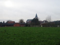
Discover the beauty of the countryside around Landas on a picturesque walk that will take you through the charming streets, lanes and paths of this delightful village in the Pévèle region. This walk is suitable for everyone and offers a chance to relax in the heart of the countryside.
Circular walk through the Marchiennes State Forest
4.20 mi
+10 ft
-10 ft
1h 55
Easy
Departure from Beuvry-la-Forêt (Nord)
A circular route taking you around the Marchiennes State Forest.
Farms of the Pévèle
3.87 mi
+39 ft
-39 ft
1h 50
Easy
Departure from Cappelle-en-Pévèle (Nord)
Welcome to the Pévèle, a vast agricultural region. Our starting point is the Florimond Desprez farm, which will soon be celebrating its 200th anniversary. This walk, taking in farm tracks and country lanes, allows you to discover pretty farmhouses and open countryside. This easy walk includes several shortcuts if you’re with children and aren’t yet sure how far they can walk, or simply if you’re unsure about the weather!
Walk in Cappelle-en-Pévèle
1.67 mi
+30 ft
-30 ft
0h 50
Easy
Departure from Cappelle-en-Pévèle (Nord)
A short walk in Cappelle-en-Pévèle, where you can discover the Zécart and the beautiful Saint-Nicolas Church.
Accessible to all, it is very easy to do, preferably in dry weather.
Circular loop from Zécart to Blatiers
1.75 mi
+13 ft
-13 ft
0h 50
Easy
Departure from Cappelle-en-Pévèle (Nord)
A short, leisurely walk for the whole family, taking you over the Zécart. You will also pass close to the Cultiv'Arts media library.
Chemin du Marais in Flines-lez-Raches
3.28 mi
+7 ft
-7 ft
1h 30
Easy
Departure from Flines-lez-Raches (Nord)
Short walking route, suitable for children on two-wheeled bikes. Scooters and other similar vehicles are not permitted.
Ideal for introducing children to walking and for a Sunday stroll. The only tricky bit is crossing the main road.
A walk through the fields where you can admire the locally grown vegetables and discover a small, open and safe blockhouse.
Between Cobrieux and Bachy
7.51 mi
+167 ft
-171 ft
3h 35
 Moderate
Departure from Cobrieux (Nord)
Moderate
Departure from Cobrieux (Nord)
A pleasant stroll across the plain between the villages of Bachy and Cobrieux, just a stone's throw from the Franco-Belgian border.
A walk through the countryside and town of Flines-Lez-Raches
3.63 mi
+10 ft
-10 ft
1h 40
Easy
Departure from Flines-lez-Raches (Nord)
This walk takes you through the fields of Flines, passing over the Pont des Vaches and the Pont des Maraichons, before returning through the town via the Cattelet and Montreuil neighbourhoods.
The Franco-Belgian Wings
15.29 mi
+197 ft
-197 ft
7h 10
 Difficult
Departure from Bachy (Nord)
Difficult
Departure from Bachy (Nord)
The route is partially signposted; please print out the map or use a GPS.
Make sure you wear good walking shoes as this route follows farm tracks
Between Pévèle and Belgium, a butterfly-shaped walk through the Belgian countryside of Hainaut and then across the plains of Pévèle.
A great opportunity to understand the cat-and-mouse games that customs officers and smugglers might have played before the European Union.
A chance to admire the pollarded willows and votive chapels.
The cross-border section between Bachy and Rumes
9.59 mi
+118 ft
-118 ft
4h 30
Moderate
Departure from Bachy (Nord)
A pleasant walk between France and Belgium with no real change in altitude.
Cross-border trail - Bachy Rumes Bachy
6.70 mi
+105 ft
-105 ft
3h 10
Moderate
Departure from Bachy (Nord)
A walk between France and Belgium in the Pévèle and Hainaut plains. This trail crosses the path of Monique, a Resistance fighter who evacuated Allied pilots who had fallen during the war. It also gives an idea of the work of the customs officers who guarded this border and the tricks that smugglers could use to thwart their surveillance.
Around Bachy
3.52 mi
+66 ft
-66 ft
1h 40
Easy
Departure from Bachy (Nord)
This route between the Bachy plain and the Belgian border allows you to discover Mont Saint-Aubert in Belgium. You will discover part of the route used by "Monique", a member of the Resistance who helped airmen escape between France and the town of Rumegies in Belgium.
A rejuvenating walk along the River Scarpe
 4.43 mi
+10 ft
-10 ft
2h 05
Easy
Departure from Anhiers (Nord)
4.43 mi
+10 ft
-10 ft
2h 05
Easy
Departure from Anhiers (Nord)
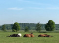
On the edge of the Plaine Scarpe–Escaut Regional Nature Park, explore the commune of Anhiers, where nature is gradually reclaiming the area – a former mining village ravaged by the war between 1914 and 1918. Today, you’ll come across old structures such as the concrete headframe dating from 1920. The post-industrial atmosphere immerses us in this past of social struggle, before we resume our walk along the banks of the Scarpe.
The Argales slag heap in Rieulay
 2.41 mi
+82 ft
-82 ft
1h 10
Easy
Departure from Rieulay (Nord)
2.41 mi
+82 ft
-82 ft
1h 10
Easy
Departure from Rieulay (Nord)
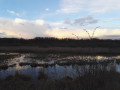
The Argales slag heap was the largest in the Nord-Pas-de-Calais coalfield, covering 140 hectares. Its re-mining – which involved recovering the pieces of coal deposited on the slag heap along with the waste rock – led to major changes to the landscape. Due to its immense weight, the slag heap sank into the ground. The local council created a fishing pond there in 1977.
Today it is an outdoor leisure area, the Parc des Argales,
 From Taintignies to Lac du Héron
34.67 mi
+236 ft
-262 ft
3 hrs
Moderate
Departure from Rumes (Hainaut)
Gravel or hybrid bike route from Taintignies to the Marais de Fretin and Lac du Héron. The route is mainly on tarmac at the start, then there are quite a few ‘white’ tracks. A very lovely ride, with Lac du Héron as the highlight.
Between marsh and pasture around Fretin
 5.11 mi
+16 ft
-16 ft
2h 20
Easy
Departure from Fretin (Nord)
5.11 mi
+16 ft
-16 ft
2h 20
Easy
Departure from Fretin (Nord)
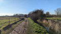
A hike that begins by circling the Marais de Péronne, then moves on to the hamlet of Maresqueldes and ends at the Marais du Warlet. This loop offers diverse landscapes, between water (the Marque (stream), marsh, pond), and fields and pastures. It runs alongside two small roads, otherwise it's all on footpaths.On the program: observation of marsh birds, fish in a fishing pond and a variety of native wildlife.
From Fretin to Sainghin-en-Mélantois, along the Marque
9.39 mi
+7 ft
-7 ft
4h 20
Moderate
Departure from Fretin (Nord)
A circular loop that is almost a round trip, passing from the Warlet Marshes (Fretin) to the Bonance Marshes (Péronne-en-Mélantois) and arriving at the Bois de la Noyelle (Sainghin-en-Mélantois) along the Marque.You will walk along well-maintained paths and quiet roads through the woods and along the marshes. In the right season, you can observe the flora and fauna as well as an impressive willow sculpture (Eldorado Lille 3000 Festival). Crossing of two busy roads.
Lallaing: starting from the mining estates
 5.71 mi
+13 ft
-13 ft
2h 40
Easy
Departure from Lallaing (Nord)
5.71 mi
+13 ft
-13 ft
2h 40
Easy
Departure from Lallaing (Nord)
I suggest a walk starting from the Cité de la Fosse Bonnel, a route that circles the town through accessible natural areas.A varied walk combining history, nature and landscapes typical of the mining basin. Explore the Germignie Sud slag heap and part of the landscape.