


From Taintignies to Lac du Héron


Gravel or hybrid bike route from Taintignies to the Marais de Fretin and Lac du Héron. The route is mainly on tarmac at the start, then there are quite a few ‘white’ tracks. A very lovely ride, with Lac du Héron as the highlight.
Details
Creation:
Last update:
Last review:
–
–
-
 Activity: Touring/Gravel
 -
 Distance: 34.67 mi
 -
 Duration according to the author: 3 hrs
 -
 Difficulty: Moderate
 -
-
 Back to start: Yes
 -
 Ascent: + 236 ft
 -
 Descent: - 262 ft
 -
-
 Highest point: 249 ft
 -
 Lowest point: 72 ft
 Country:
 City:
City:


Waypoints
- S/E : mi 0 - alt. 197 ft - Monument
- 1 : mi 0.67 - alt. 148 ft - Petit Rumes
- 2 : mi 0.99 - alt. 180 ft - Coeur Joyeux
- 3 : mi 2.02 - alt. 197 ft - Le Rouvroir
- 4 : mi 2.77 - alt. 184 ft - Rumes
- 5 : mi 3.74 - alt. 154 ft - Bridge and railway line
- 6 : mi 4.1 - alt. 148 ft - Pont d’Eau
- 7 : mi 4.6 - alt. 161 ft - Esplechin
- 8 : mi 5.39 - alt. 151 ft - Maraiche
- 9 : mi 6.22 - alt. 171 ft - La Vache Bleue
- 10 : mi 7.31 - alt. 144 ft - Wannehain
- 11 : mi 8.73 - alt. 167 ft - Bourghelles
- 12 : mi 10.09 - alt. 121 ft - Cysoing
- 13 : mi 11.58 - alt. 128 ft - Bouvines
- 14 : mi 13.89 - alt. 89 ft - Motorway - Marque (rivière)-à finaliser
- 15 : mi 15.56 - alt. 82 ft - Fork in the road - Marque (rivière)-à finaliser
- 16 : mi 15.87 - alt. 79 ft - Junction - Marque (rivière)-à finaliser
- 17 : mi 16.7 - alt. 79 ft - Marque (rivière)-à finaliser
- 18 : mi 17.66 - alt. 75 ft - Lac du Héron (Villeneuve d'Ascq)
- 19 : mi 19.47 - alt. 75 ft - Marque (rivière)-à finaliser
- 20 : mi 20.8 - alt. 79 ft - Roundabout
- 21 : mi 23.21 - alt. 79 ft - Les Six Bonniers Leisure Centre
- 22 : mi 24.23 - alt. 89 ft - Baisieux - Gare de Baisieux
- 23 : mi 25.57 - alt. 92 ft - Border
- 24 : mi 26.29 - alt. 79 ft - Cornet
- 25 : mi 26.94 - alt. 85 ft - Les Petites Empires
- 26 : mi 27.68 - alt. 102 ft - Quenoque
- 27 : mi 28.75 - alt. 131 ft - N7
- 28 : mi 29.54 - alt. 217 ft - Haudion
- 29 : mi 31.48 - alt. 154 ft - Cornuhaut
- S/E : mi 34.67 - alt. 197 ft - Monument
Other walks in the area
From Lille to the cobbled sections of Paris-Roubaix
 Visorando Member
 40.19 mi
+167 ft
-164 ft
4 hrs
40.19 mi
+167 ft
-164 ft
4 hrs
 Difficult
 Departure from Lille (Nord)
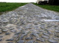
This route starts from Lille’s main square and explores numerous cobbled sections. You’ll also ride the Paris-Roubaix route in reverse, covering 7 cobbled sections including the famous Carrefour de l’Arbre. A gravel bike is recommended for this route.
For more walks, use our search engine .
The GPS track and description are the property of this route's author. Please do not copy them without permission.

