A walk through the countryside and town of Flines-Lez-Raches

This walk takes you through the fields of Flines, passing over the Pont des Vaches and the Pont des Maraichons, before returning through the town via the Cattelet and Montreuil neighbourhoods.

Details

4551634
Creation:
Last update:
Last review:
  • Walking
    Activity: Walking
  • ↔
    Distance: 3.63 mi
  • ◔
    Average duration: 1h 40 
  • ▲
    Difficulty: Easy

  • ⚐
    Back to start: Yes
  • ↗
    Ascent: + 10 ft
  • ↘
    Descent: - 10 ft

  • ▲
    Highest point: 66 ft
  • ▼
    Lowest point: 56 ft

Description of the walk

Park on Rue Gabriel Péri in Flines-lez-Raches.

(S/E) Head west, then turn into the first street on the left, Rue du Pont des Vaches. Continue along the dirt track suitable for vehicles until you reach the Pont des Vaches.

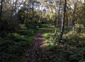
(1) Continue left along the track, with a woodland on your right and a stream (the Noirot) on your left. The track can be quite muddy! Make sure you’re properly kitted out! You’ll reach a junction with the remains of a bunker on your left.

(2) Cross the road carefully and take the path opposite, which continues straight ahead. You’ll reach the Pont des Maraichons.

(3): A cobbled street (Rue Maurand), typical of the North, branches off to the left: take this and enter Flines.
Continue by taking the first street on the left, Rue du Maraichon, and follow it until you reach a four-way junction. You’ll see a small chapel on the right after 500 metres: there are many of them in Flines.

(4) Turn right, still on Rue du Maraichon.

(5) Turn into the first street on the left, Rue Moïse Lambert, and follow it to the end, where it meets Rue Gabriel Péri.

(6) Turn left to reach the car park (S/E).

Waypoints

  1. S/E : mi 0 - alt. 66 ft - Rue Gabriel Péri
  2. 1 : mi 0.3 - alt. 62 ft - Pont des Vaches
  3. 2 : mi 1.12 - alt. 62 ft - Junction
  4. 3 : mi 1.75 - alt. 59 ft - Pont des Maraichons
  5. 4 : mi 2.52 - alt. 62 ft - Junction
  6. 5 : mi 3.01 - alt. 66 ft - Rue Moïse Lambert
  7. 6 : mi 3.56 - alt. 62 ft - Rue Gabriel Péri
  8. S/E : mi 3.63 - alt. 66 ft - Rue Gabriel Péri

Notes

In wet weather, make sure you wear waterproof shoes, as the dirt tracks can get muddy!

Worth a visit

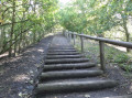
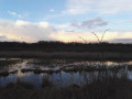
During the walk, you’ll be able to admire the typical Flinois countryside: woods, streams, fields, cobbled streets and a chapel.

Reviews and comments

3.9 / 5
Based on 4 reviews

Reliability of the description
4 / 5
Ease of following the route
4 / 5
Route interest
3.8 / 5
patman59310
patman59310

Overall rating : 4 / 5

Date of your route : Mar 02, 2026
Reliability of the description : ★★★★☆ Good
Ease of following the route : ★★★★☆ Good
Route interest : ★★★★☆ Good
Very busy route : Yes

A lovely little route, although you have to share most of it with mountain bikes, and . . make sure you're well equipped after rain along the forest path....

Machine-translated

randonneurnord
randonneurnord

Overall rating : 3.3 / 5

Date of your route : Jan 19, 2025
Reliability of the description : ★★★★☆ Good
Ease of following the route : ★★★★☆ Good
Route interest : ★★☆☆☆ Disappointing
Very busy route : No

A disappointing route due to the soggy, waterlogged paths, particularly along the stretch beside the River Noirot (Pont des Vaches/Pont du Croquet: point 1/point 2). This is hardly surprising, given that the area is marshy. Added to this was the grey weather that day, which offered no views whatsoever. The experience would no doubt be completely different in dry weather! We therefore decided to shorten the route and head straight to point 4: a large part of the route follows the GR121B on a tarmac road. It’s worth noting that you can start the walk right at the edge of Rue du Pont des Vaches (plenty of parking available).

Machine-translated

Jacky dum
Jacky dum

Overall rating : 4.3 / 5

Date of your route : Sep 23, 2023
Reliability of the description : ★★★★☆ Good
Ease of following the route : ★★★★☆ Good
Route interest : ★★★★★ Very good
Very busy route : No

A lovely route

Machine-translated

Locri
Locri

Overall rating : 4 / 5

Date of your route : Aug 01, 2021
Reliability of the description : ★★★★☆ Good
Ease of following the route : ★★★★☆ Good
Route interest : ★★★★☆ Good
Very busy route : No

An easy walk, but make sure you wear waterproof shoes in wet weather. It’s fairly easy to find your way, but be careful: some landmarks are obscured by vegetation and become invisible.

Machine-translated

Other walks in the area

For more walks, use our search engine .

The GPS track and description are the property of this route's author. Please do not copy them without permission.