


Refine your search for walks in Olmeta-di-Capocorso
Olmeta-di-Capocorso walks


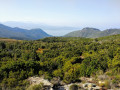
 Monte Stellu via Olmeta di Capicorsu
 Visorando Member
 9.22 mi
 +3,379 ft
 -3,360 ft
 7h 10
 Difficult
 Departure from Olmeta-di-Capocorso (Haute-Corse)
A hike in a magnificent corner of Cap Corse. Very beautiful view on both sides at the summit. From the village to the summit, a true corner of Corsica. Pure. Authentic.
Circular route from Bracolaccia via the Col de San Leonardo and San Ghjacintu
 Association / Club / Walk leader6.04 mi
+2,907 ft
-2,907 ft
5h 20
Difficult
Departure from Farinole (Haute-Corse)
Starting from the hamlet of Bracolaccia in Farinole, this mountainous route takes walkers along the Cap Corse ridge via the Col de San Leonardo. With views on both sides of the cape.
The chosen direction allows you to enjoy a remarkable panorama throughout the descent from San Ghjacintu towards Farinole, passing by the old iron mines – A Ferrera.
The old magnetite mine at A Ferrera
1.98 mi
+538 ft
-538 ft
1h 25
 Easy
Departure from Farinole (Haute-Corse)
Climb from the village of Farinole to the old magnetite mine. Panoramic view of the Gulf of Saint-Florent and the Agriates desert.
Chjassu di u Cunventu in Farinole
 Local authority
 3.23 mi
+699 ft
-699 ft
2h 05
 Moderate
Departure from Farinole (Haute-Corse)
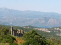
The Chjassu di u Cunventu is a village loop trail that allows you to discover Farinole and its breathtaking landscapes. Starting from the Church of Saints Cosmas and Damian, the route passes through the village before reaching the maquis. It runs alongside the Marianda convent, then takes a panoramic path from which you can see the marina and the Genoese tower of Farinole. Finally, the path rejoins the forest canopy before returning to the village.
Monte Stello
 9.16 mi
+3,553 ft
-3,566 ft
7h 20
Difficult
Departure from Brando (Haute-Corse)
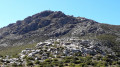
At an altitude of 1,307 metres, Monte Stello is the second highest peak in Cap Corse. This viewpoint on the central ridge of Cap Corse offers a magnificent panorama of the east and west coasts.
Patrimonio – Pigno – Bocca di San Leonardo circular loop
 11.50 mi
+3,825 ft
-3,855 ft
8h 35
Difficult
Departure from Patrimonio (Haute-Corse)
A challenging hike starting from Patrimonio, offering a variety of landscapes and magnificent sea views on both the Cap Corse and Bastia sides. There are no major difficulties along the route, although the distance means this hike should be planned as a day trip.
The heritage trail in Patrimonio
2.08 mi
+446 ft
-430 ft
1h 20
Easy
Departure from Patrimonio (Haute-Corse)
Thanks to this route, which takes in places and monuments steeped in history as well as magnificent natural surroundings, the municipality of Patrimonio—which initiated and oversaw this project—offers a lovely walk of just over 3 km. This informative walk allows you to discover the village’s historical and architectural heritage via well-shaded paths or riverside routes, which are very pleasant in summer and, for the lucky residents, at any time of year.
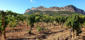
In the vineyards of Patrimonio
 5.99 mi
+456 ft
-469 ft
3h 10
Moderate
Departure from Patrimonio (Haute-Corse)
A beautiful walk, surrounded by the vineyards of Patrimonio, between Monte San'Angelo and Col de Teghime.
Route from the Genoese Bridge to Erbalunga
2.34 mi
+607 ft
-607 ft
1h 35
Easy
Departure from Brando (Haute-Corse)
Climb up to see the Genoese Bridge and enjoy a view overlooking Erbalunga.
Mausoleo and Silgaggia as seen from Erbalunga
3.92 mi
+997 ft
-991 ft
2h 40
Moderate
Departure from Brando (Haute-Corse)
With its crumbling Genoese tower, picturesque narrow streets, vaulted passageways and fishing harbour, the village of Erbalunga is a renowned holiday destination, brimming with charm and poetry. Situated on the east coast of Cap Corse, this picturesque listed site has inspired many local painters who have come to capture its spirit on canvas. Brando’s marina welcomes you to a setting suspended in time. From the village of Erbalunga, you’ll head inland from the coast into the Corsican mountains towards Silgaggia, then Castello and finally Mausoleo, before returning to Erbalunga.
Chjassu Napuleone in Barbaggio
 1.86 mi
+79 ft
-761 ft
0h 55
Easy
Departure from Barbaggio (Haute-Corse)
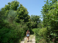
Starting from Barbaggio town hall (heading downhill), the Chjassu Napuleone crosses the village before entering a forest, where you can see old agricultural gardens on either side of the path. The richness of this route continues when you take the "imperial road" that gave the trail its name. Before becoming emperor, Napoleon Bonaparte is said to have walked this road.
The trail can also be taken in the opposite direction (uphill), starting from the bridge at the intersection of Strada San Petru and Strada Napuleone. If you are only doing a one-way trip, i.e. not returning, remember to leave one car at the starting point and another at the end.
The Brietta Spring at Patrimonio
 2.90 mi
+771 ft
-758 ft
2h 00
Easy
Departure from Barbaggio (Haute-Corse)
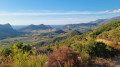
This walk offers a splendid panoramic view of the Patrimonio valley and its vineyards, in conditions that are very rare in Corsica over this distance: a wide, easy-to-walk path that winds along the mountainside. It is therefore a very easy route, though it does involve some elevation gain. Above all, it offers extraordinary views of the vineyards, the limestone cliffs and the sea between the hills. Best done at the end of the day in hot weather, or very early in the morning to catch the beautiful light that photographers will appreciate. The only slightly frustrating thing is that it’s a return trip.
From Olzu Beach to Calanca di à Torre
3.36 mi
+180 ft
-177 ft
1h 40
Easy
Departure from Saint-Florent (Haute-Corse)
From Olzu beach, follow the coastal path to admire the beautiful coves and inlets. Wear sturdy footwear.
Circular glacier loop starting from Bastia
 10.71 mi
+2,720 ft
-2,720 ft
7h 20
Moderate
Departure from Bastia (Haute-Corse)
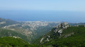
A beautiful circular hike offering views of both the city of Bastia and Saint-Florent at its highest point on the ridge trail. It is well shaded with several water sources and follows part of the heritage trail near Pietrabugno. There are a few sections on the road near Bastia, but these are fairly quiet.
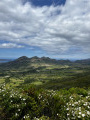
Balcony Trail from the Barbaggio Belvedere
 5.84 mi
+1,053 ft
-1,047 ft
3h 35
Moderate
Departure from Barbaggio (Haute-Corse)
The Balcons trail, starting from the Belvédère de Barbaggio (downhill) or the RD238 (uphill), offers a nearly 10 km round trip with continuous views of the vineyards and the Conca d'Oru. It can also be taken as a one-way trip (5 km) by leaving a car at the end point and another at the starting point.
Surrounded by scrubland, this trail offers remarkable views of the landscapes of the Grand Site de France Conca d'Oru, the Patrimonio vineyards, the Gulf of Saint-Florent and the limestone chain of Mont Sant'Anghjulu, whose six iconic hills are the visual signature of the area.
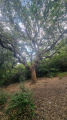
Short circular loop around Ponticellu
 2.36 mi
+397 ft
-390 ft
1h 25
Easy
Departure from Pietracorbara (Haute-Corse)
A superb circular walk above Ponticellu, in the municipality of Pietracorbara. The first section passes through the village before heading into woodland to reach Oreta and Selmace. You then move into the second section, which alternates between woodland and maquis. There are two very beautiful Genoese bridges, with a deep pool beneath the first one that’s ideal for a swim. In many places, you can enjoy magnificent views of the cirque that surrounds the area.
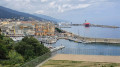
The Citadel and the old port of Bastia
 2.42 mi
+167 ft
-164 ft
1h 15
Easy
Departure from Bastia (Haute-Corse)
This short, easy walking route takes you around Bastia’s old town, the old harbour, the magnificent Aldilonda footpath and the citadel.
The Annunziata to Conchigliu trail
1.16 mi
+344 ft
-315 ft
0h 50
Easy
Departure from Barrettali (Haute-Corse)
A walk suitable for everyone, offering the chance to discover part of the heritage of the village of Barrettali.
From the Citadel of Saint-Florent to Campu Maggiore Beach in Farinole
8.47 mi
+673 ft
-656 ft
4h 30
Moderate
Departure from Saint-Florent (Haute-Corse)
From Saint-Florent to Farinole along the coast, this return route allows you to discover hidden swimming spots as well as the path carved into the limestone cliffs, “marking the transition between the schistose Cap Corse peninsula and the Agriate Desert”.
The scenery, perfect for photography, is fabulous. On the outward journey, you’ll see the gulf, the ridge of Cap Corse and, on rare occasions, the mainland coastline, which can be glimpsed on clear, windy days. On the return journey, the view opens up to the south towards Saint-Florent, the Nebbiu plain and its foothills, notably featuring the Tenda range and its highest peak, Monte Astu. To the west, the coastline stretches widely from Anse de Fornali to Punta di Cuza, situated between the beaches of Lotu and Saleccia.
⚠️ Hiking is prohibited from March to August as this is the nesting season. See practical information.
From Saint Florent to Saleccia via the coastal path
11.03 mi
+423 ft
-413 ft
5h 25
Moderate
Departure from Saint-Florent (Haute-Corse)
This coastal hike allows you to explore this desert via a very pleasant trail and swim in idyllic coves.
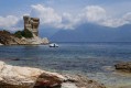
Loto Beach via the coast from Saint-Florent
 13.86 mi
+912 ft
-899 ft
7h 10
Difficult
Departure from Saint-Florent (Haute-Corse)
This hike takes you through part of the Agriates desert along the coastal path, from Saint-Florent to Loto beach, passing through picture-postcard landscapes.
Circular walk from Roya to Punta di Cepo via the coastal path
6.19 mi
+528 ft
-505 ft
3h 20
Easy
Departure from Saint-Florent (Haute-Corse)
A lovely circular route along the coastal path starting from Roya Beach in Saint-Florent. A smooth ride along the coast on the outward leg. The return leg follows an inland track with panoramic views of the gulf, Cap Corse, Saint-Florent and the mountain range surrounding the Nebbiu region.
See restrictions on use of the route in the practical information section, subject to weather conditions