


Refine your search for walks in Nécropole Nationale (Sainte-Marie-aux-Mines)
Nécropole Nationale (Sainte-Marie-aux-Mines) walks


 Col Sainte-Marie-aux-Mines / Paths of Memory
 Visorando Member
 6.72 mi
 +1,325 ft
 -1,329 ft
 4h 15
 Moderate
 Departure from Wisembach (Vosges)
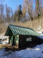
A beautiful historical hike near the Wisembach National Forest.A reminder of the facts:1871 - Alsace/Moselle are annexed by Germany, which modernises many areas.1914 - The heir to the Austrian throne is assassinated / Germany declares war on Russia, France and Belgium. Soldiers occupy villages and mountains.November 1918: the trenches are filled in, the blockhouses and other structures destroyed, but around a hundred remain visible in the heights of the Val d'Argent.
From the Col de Sainte-Marie-aux-Mines to the Chaume de Lusse
8.51 mi
+1,526 ft
-1,526 ft
5h 15
 Difficult
Departure from Wisembach (Vosges)
This circular hike links the Col de Sainte-Marie-aux-Mines to Chaume de Lusse, through typical Vosges forests of beech, fir, blueberry and high-altitude meadows. The forest paths and roads offer beautiful panoramic views of the Val d'Argent and Meurthe valleys. This is a fairly dynamic route that leads to Chaume de Lusse via a varied course, including sustained climbs (which is why we rate it as difficult), forest passages and open ridges. Part of the route runs between Alsace and Lorraine on paths and trails marked by the GR®531, the former border from 1871 to 1918, with boundary stones marked D (Deutschland), often hammered, and F, marking the historic border and named "Chemins de la Grande Guerre" (Paths of the Great War).
Walks near Nécropole Nationale (Sainte-Marie-aux-Mines)
Col de Bagenelles – Schupferen
 10.77 mi
+2,694 ft
-1,847 ft
7h 20
Moderate
Departure from Le Bonhomme (Haut-Rhin)
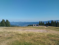
This third day follows the Sentier des Crêtes for the most part, passing through the burnt-out fields with beautiful panoramic views. A walk of moderate difficulty with several opportunities to stop and enjoy a blueberry tart
Schelmenkopf – Col des Bagenelles
 10.60 mi
+1,818 ft
-1,289 ft
6h 25
Moderate
Departure from Ribeauvillé (Haut-Rhin) (Haut-Rhin)
A leisurely second stage, apart perhaps from the total distance. It takes place mainly in the shade on mostly flat paths. You’ll pass beneath the Petit Brézouard and give the Grand Brézouard a wide berth – as it is a wildlife sanctuary – before heading directly to Le Haïcot and then on to the Col des Bagenelles.
Ribeauvillé–Hunawihr via the vineyards
1.75 mi
+299 ft
-220 ft
1h 05
 Easy
Departure from Ribeauvillé (Haut-Rhin) (Haut-Rhin)
A lovely little walk that follows the edge of the woodland alongside the vineyards. Superb views of the surrounding villages.
Ribeauvillé - Le Bonhomme
 Tourism professional
 17.75 mi
+3,858 ft
-2,444 ft
11h 30
 Very difficult
Departure from Ribeauvillé (Haut-Rhin) (Haut-Rhin)
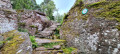
Stage thirteen, from Ribeauvillé to Le Bonhomme, is very long and involves a significant climb. It marks the hiker’s entry into the Hautes-Vosges and its first major peaks: Hirzberg and Brézouard, via the Lapoutroie valley. With a mountain atmosphere and superb views in store.
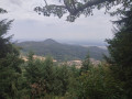
Kintzheim – Schelmenkopf
 9.38 mi
+2,949 ft
-1,188 ft
6h 55
Moderate
Departure from Kintzheim (Bas-Rhin)
This first stage starts in Kintzheim, passes by Haut-Koenigsbourg Castle, then crosses the pretty village of Thanenkirch before heading up alongside the ‘pagan wall’ with its beautiful rock formations to the Schelmenkopf mountain hut. It is not particularly difficult and is a good way to warm up for the rest of the journey.
Crossing the Southern Vosges from Kintzheim to Willer-sur-Thur
 56.12 mi
+10,161 ft
-9,600 ft
5 days
Difficult
Departure from Kintzheim (Bas-Rhin)
This route takes you across the Vosges in the Haut-Rhin, with moderate daily stages ranging from 15 to 20 km and an elevation gain generally between 800 and 900 m. These stages take between 6 and 7 hours, always ending near a mountain refuge, which must be booked in advance. The route follows paths marked by the Club Vosgien and passes through a wide variety of landscapes.
Schupferen – Hahnenbrunnen
 12.27 mi
+1,798 ft
-1,762 ft
7h 15
Moderate
Departure from Stosswihr (Haut-Rhin)
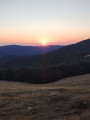
A stage of around twenty kilometres that begins in the shade of the forest, then runs alongside the Hirschsteine and Spitzenfels rocks, with a few sections secured by metal steps and fixed handrails, before continuing along the ridges after the Col de la Schlucht and passing beneath thethird-highest peak in the Vosges, the Hohneck.
Châtenois - Ribeauvillé
 12.79 mi
+2,238 ft
-2,028 ft
7h 50
Difficult
Departure from Châtenois (Bas-Rhin) (Bas-Rhin)
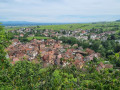
With this superb twelfth stage of the Vosges crossing proposed by Passion Vosges magazine, published by Les Dernières Nouvelles d’Alsace and L’Alsace, the hiker visits a series of castles, starting with the iconic Haut-Koenigsbourg. After a lovely detour into the valley of the mountain village of Thannenkirch, a final climb leads to the steep and spectacular site of the three castles overlooking the charming wine-growing town of Ribeauvillé, the end point of this 20-kilometre route.
 Vosges Mountain Biking Day 5: Chatenois – Aubure (Part 1)
9.60 mi
+2,021 ft
-436 ft
4 hrs
Difficult
Departure from Châtenois (Bas-Rhin) (Bas-Rhin)
This route forms the first part of the fifth stage of a 7-day tour on the Alsatian side of the Vosges. The route follows mainly forest tracks in good condition. The signposting, which is excellent, consists of signs bearing an orange or red mountain bike logo accompanied by the letters TMV (Traversée du Massif Vosgien).