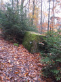
Kintzheim – Schelmenkopf

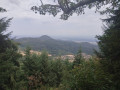
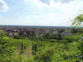
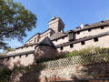
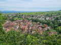
This first stage starts in Kintzheim, passes by Haut-Koenigsbourg Castle, then crosses the pretty village of Thanenkirch before heading up alongside the ‘pagan wall’ with its beautiful rock formations to the Schelmenkopf mountain hut. It is not particularly difficult and is a good way to warm up for the rest of the journey.

Details

n°102232841
Creation:
Last update:
Last review:
–
  • Walking
    Activity: Walking
  • ↔
    Distance: 9.38 mi
  • ◔
    Average duration: 6h 55 
  • ▲
    Difficulty: Moderate

  • ⚐
    Back to start: No
  • ↗
    Ascent: + 2,949 ft
  • ↘
    Descent: - 1,188 ft

  • ▲
    Highest point: 3,176 ft
  • ▼
    Lowest point: 682 ft
  • ⚐ Country: France
  • ⚐
  • ⚐ City: Kintzheim (67600)
  • ⚑
    Start: N 48.255077° / E 7.395205°
  • ⚑
    End: N 48.222589° / E 7.259246°
  • ❏
    IGN map(s): Ref. 3617ET, 3617ETR, 3717ET, 3718OT, 3718OTR
  • Hour-by-hour weather

Photos

Description of the walk

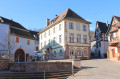
Start in Kintzheim, not far from Sélestat. Access by bus from Sélestat station, line C, ‘mairie’ stop.

(S) Follow the road leading to Haut-Koenigsbourg Castle until you reach the edge of the village. Car park P1 at the Volerie des Aigles.

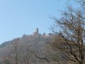
(1) Take the GR® Rouge Blanc Rouge trail which climbs to Kintzheim Castle and the Volerie des Aigles (check opening times if necessary). Then follow the Red Rectangle markings of the GR®5 trail to climb up to Haut-Koenigsbourg Castle. The path passes beneath the castle to go round it (visits possible – check opening times). The climb is steady and shaded all the way to the Schaentzel car park.

(2) Head down a path running parallel to the D42 to reach the car park before the village of Thanenkirch.

(3) Walk through the village to join the ‘Yellow Cross’ signposted path, then climb up to the hamlet of Melkerhof.

(4) Continue up a steep climb as you leave the hamlet. The path then winds its way up in hairpin bends before skirting the Mur Païen to the Rocher des Géants.

(5) Carry on, passing the Rocher des Reptiles. Descend past the Abri Kutzigbuech, then come to a Y-junction shortly after the Roche des Trois Tables.

(6) Keep left on the path marked with a Blue Cross until you reach the Club Vosgien refuge at Schelmenkopf (E), today’s destination.

Waypoints

  1. S : mi 0 - alt. 682 ft - Kintzheim Town Hall
  2. 1 : mi 0.37 - alt. 797 ft - Volerie des Aigles car park
  3. 2 : mi 3.65 - alt. 1,909 ft - Schaentzel
  4. 3 : mi 4.77 - alt. 1,614 ft - Thanenkirch - Église Sainte-Catherine (Thannenkirch)
  5. 4 : mi 5.8 - alt. 1,942 ft - Melkerhof
  6. 5 : mi 7.33 - alt. 3,009 ft - Rocher des Géants
  7. 6 : mi 8.15 - alt. 3,173 ft - Y-junction - Abri Kutzig Buech
  8. E : mi 9.38 - alt. 2,438 ft - Chalet du Schelmenkopf

Notes

Accessible by train to Sélestat station, then by bus (line C) to Kintzheim (not to be confused with the village of Kientzheim near Kaysersberg).
A shaded route. Water is available along the way.
(3) Thanenkirch: drinking water at the entrance to the village.
(E) Schelmenkopf mountain hut: booking recommended.

Worth a visit

Between (1) and (2), there are several places to visit along the way: the Eagle Sanctuary and Haut-Koenigsbourg Castle.
(5) Rocher des Géants: beautiful panoramic views.

Always be cautious and plan ahead when you're outdoors. Visorando and the author of this route cannot be held responsible for any accidents occurring on this route.

The GR® and PR® markings are the intellectual property of the Fédération Française de Randonnée Pédestre.

Other walks in the area

For more walks, use our search engine .

The GPS track and description are the property of this route's author. Please do not copy them without permission.