


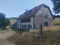
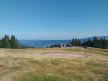
You should always check that the mountain huts are open and book in advance.
Take a sleeping bag liner with you. There’s no need to carry a full sleeping bag.
Remember to take water and protect yourself from the sun. It isn’t always possible to find somewhere to eat lunch, particularly on the first two stages. You’ll need to take a packed lunch for two days. After that, you’ll be able to have at least a pie at a farmhouse inn, or even a full meal.
For dinner, there’s always a farmhouse inn near the mountain refuge. Just make sure it’s actually open on the day you’re passing through.
Stage 1: Schelmenkopf Mountain Hut
Stage 2: Col de Bagenelles refuge
Stage 3: Schupferen Mountain Hut
Stage 4: Hahnenbrunnen mountain hut
Crossing the Southern Vosges from Kintzheim to Willer-sur-Thur


This route takes you across the Vosges in the Haut-Rhin, with moderate daily stages ranging from 15 to 20 km and an elevation gain generally between 800 and 900 m. These stages take between 6 and 7 hours, always ending near a mountain refuge, which must be booked in advance. The route follows paths marked by the Club Vosgien and passes through a wide variety of landscapes.
Details
Creation:
Last update:
Last review:
–
–
-
 Activity: Walking
 -
 Distance: 56.12 mi
 -
 Average duration: 5 days
 -
 Difficulty: Difficult
 -
-
 Back to start: No
 -
 Ascent: + 10,161 ft
 -
 Descent: - 9,600 ft
 -
-
 Highest point: 4,281 ft
 -
 Lowest point: 682 ft
-
 Country:
France
Country:
France
-
 Area: Vosges mountains
 -
 City:
Kintzheim (67600)
City:
Kintzheim (67600) -
 Start: N 48.255077° / E 7.395205°
 -
 End: N 47.843451° / E 7.0708°
 -


 Hour-by-hour weather
Photos
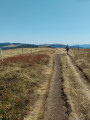
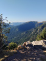
Stages of the route
This route needs several days, find the details below:
Notes
This route passes through multiple protected areas, which may be subject to special regulations:
Worth a visit
Kintzheim Castle, Volerie des Aigles, Haut-Koenigsbourg Castle, the peaks of Hohneck and Grand Ballon
Other walks in the area
Kintzheim – Schelmenkopf
 Visorando Member
 9.38 mi
+2,949 ft
-1,188 ft
6h 55
9.38 mi
+2,949 ft
-1,188 ft
6h 55
 Moderate
Departure from Kintzheim (Bas-Rhin)
Moderate
Departure from Kintzheim (Bas-Rhin)
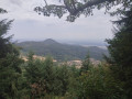
This first stage starts in Kintzheim, passes by Haut-Koenigsbourg Castle, then crosses the pretty village of Thanenkirch before heading up alongside the ‘pagan wall’ with its beautiful rock formations to the Schelmenkopf mountain hut. It is not particularly difficult and is a good way to warm up for the rest of the journey.
The Hahnenberg from Châtenois and La Montagne des Singes
 6.05 mi
+1,270 ft
-1,253 ft
3h 55
Moderate
Departure from Châtenois (Bas-Rhin) (Bas-Rhin)
6.05 mi
+1,270 ft
-1,253 ft
3h 55
Moderate
Departure from Châtenois (Bas-Rhin) (Bas-Rhin)
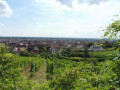
A circular hike starting from Châtenois, which takes us to the summit of Hahnenberg, where we can enjoy a beautiful view of the central Alsace plain.
The route continues around the Montagne des Singes animal park, then returns through the vineyards above Kintzheim.
Haut-Koenigsbourg via La Wick
 Tourist office
 6.26 mi
+1,240 ft
-1,247 ft
3h 55
Moderate
Departure from Kintzheim (Bas-Rhin)
6.26 mi
+1,240 ft
-1,247 ft
3h 55
Moderate
Departure from Kintzheim (Bas-Rhin)
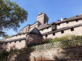
Situated in the heart of Alsace, on the heights of the wine-growing village of Orschwiller, Haut-Koenigsbourg Castle majestically overlooks the entire plain at an altitude of 755 m. It is impossible to miss this iconic landmark, one of the region’s most visited monuments.
This iconic site is also the starting and finishing point for numerous hikes. It offers nature lovers a wide variety of trails through stunning landscapes and provides sublime panoramic views.
An artistic tour of Orschwiller
 0.89 mi
+102 ft
-102 ft
0h 30
0.89 mi
+102 ft
-102 ft
0h 30
 Easy
Departure from Orschwiller (Bas-Rhin)
Easy
Departure from Orschwiller (Bas-Rhin)
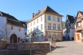
Take time to discover Orschwiller on this short 1-hour tour. Soak up the village's remarkable built heritage and the works of contemporary art scattered around the village.
Châtenois - Ribeauvillé
 Tourism professional
 12.79 mi
+2,238 ft
-2,028 ft
7h 50
Difficult
Departure from Châtenois (Bas-Rhin) (Bas-Rhin)
12.79 mi
+2,238 ft
-2,028 ft
7h 50
Difficult
Departure from Châtenois (Bas-Rhin) (Bas-Rhin)
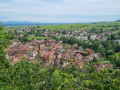
With this superb twelfth stage of the Vosges crossing proposed by Passion Vosges magazine, published by Les Dernières Nouvelles d’Alsace and L’Alsace, the hiker visits a series of castles, starting with the iconic Haut-Koenigsbourg. After a lovely detour into the valley of the mountain village of Thannenkirch, a final climb leads to the steep and spectacular site of the three castles overlooking the charming wine-growing town of Ribeauvillé, the end point of this 20-kilometre route.
From Orschwiller to Châtenois via the Camino de Santiago and the GR®5
 8.53 mi
+1,030 ft
-1,024 ft
4h 50
Moderate
Departure from Orschwiller (Bas-Rhin)
8.53 mi
+1,030 ft
-1,024 ft
4h 50
Moderate
Departure from Orschwiller (Bas-Rhin)
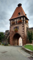
This hike will allow you to meet pilgrims on their way to Compostela and to walk through the woods following theGR®5. There are no orientation difficulties, as all the paths are marked. A variant will allow you to climb up to the Château du Haut Koenigsbourg.
The Haut-Koenigsbourg Castle
 7.75 mi
+1,650 ft
-1,631 ft
5h 00
Moderate
Departure from Saint-Hippolyte (Haut-Rhin) (Haut-Rhin)
7.75 mi
+1,650 ft
-1,631 ft
5h 00
Moderate
Departure from Saint-Hippolyte (Haut-Rhin) (Haut-Rhin)
A beautiful circular hike from the wine route to Haut-Koenigsbourg Castle. Climb up through the beautiful valley of the mills. Loop around Haut-Koenigsbourg and return via Langenberg. Beautiful views of the Alsace plain and the Black Forest, with an orientation table.
The castle courtyard is free to visit. Don't hesitate to make a detour from (6) or (7).
The Rocher du Sanglier and the Roche des Fées as seen from Saint-Hippolyte
 4.17 mi
+771 ft
-761 ft
2h 35
Easy
Departure from Saint-Hippolyte (Haut-Rhin) (Haut-Rhin)
4.17 mi
+771 ft
-761 ft
2h 35
Easy
Departure from Saint-Hippolyte (Haut-Rhin) (Haut-Rhin)
A lovely little walk at the foot of Haut-Koenigsbourg Castle, passing by the Rocher du Sanglier and the Roche des Fées, then descending through the pretty Vallon des Moulins.
For more walks, use our search engine .
The GPS track and description are the property of this route's author. Please do not copy them without permission.

