Country:

 City:
City:


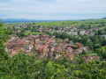
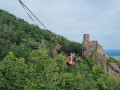
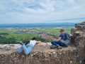
Start in front of Châtenois Town Hall.
The entire route follows the Red Rectangle, unless otherwise stated.
(S) From Châtenois Town Hall, with the building on your left, head south along Rue du Maréchal Foch until you reach the junction with Rue Saint-Georges (opposite the next school on the left).
(1) Turn right onto Rue Saint-Georges and go round the ramparts on the left until you reach Rue Geogenbrunn.
(2) Head left up towards the Col du Rotenberg (which is 40 minutes away). Go round two bends and you’ll come to a Fork in the road with a track.
(3) Continue straight on along the track to the Col du Rotenberg.
(4) Continue south to the hamlet of Wick, the gateway to the Montagne des Singes park.
(5) Continue along the main track. Then leave the track to the right and continue to the left towards Kreuzweg. Turn right, then left, and join a small road.
(6) Then turn right onto the path running alongside the D159. Keep going straight ahead, following the road until you reach Kreuzweg.
(7) Follow the climb towards Haut-Koenigsbourg Castle. Then continue uphill until you cross the road a second time.
(8) Take the path leading uphill to the left. Climb up to a four-way junction. Keep going straight on. The climb gets a bit steeper towards the end. Go up to the right, then to the left until you reach Haut-Koenigsbourg.
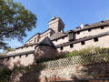
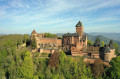
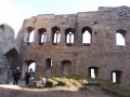
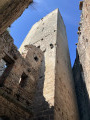
(9) At Haut-Koenigsbourg, an iconic site in Alsace, a visit is a must.
Then continue left at the foot of the ramparts, straight ahead and downhill, towards the Schaentzel crossroads. You’ll reach the access road.
(10) Cross it twice, continuing straight on, to reach Schaentzel.
(11) Follow signs for the village of Thannenkirch. Cross the crossroads, then turn left along the road. Continue straight ahead until you reach Thannenkirch.
(12) Cross the village by following the road straight ahead, then taking the street on the left. Follow it to the end.
(13) Take the road on the left and head towards the cemetery. Pass the cemetery and leave the village at the hairpin bend.
(14) Head straight on along a track towards Château du Haut-Ribeaupierre and Ribeauvillé. At the track, turn left, then right, before continuing straight on to reach the bottom of a small valley.
(15) Climb up the other side. At the pass, turn right then immediately left towards the Hinterluetzelbach.
(16) Leave the path and turn left. At the next junction, continue uphill towards Haut-Ribeaupierre Castle.
(17) Continue downhill to Saint-Ulrich Castle.
(18) Head down the steep, rocky path towards Ribeauvillé. Take the opportunity to admire the third castle in the area, the Girsberg. Continue downhill, keeping straight ahead, until you reach the street. Head down to the right towards the town.
(19) Carry on, then keep left at the end of the street to cross the town centre via the main road. Follow it to Ribeauvillé Town Hall (E).

 Visorando Member
 Moderate
 Easy
Easy  Tourist office