Hills and countryside in Ligny-lès-Aire: alternative route

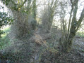
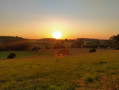
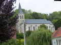
A very pleasant walk through the countryside with lovely scenery to look forward to. A superb little church built of white stone and brick is well worth a visit.

Details

n°26422803
Creation:
Last update:
Last review:
  • Walking
    Activity: Walking
  • ↔
    Distance: 5.80 mi
  • ◔
    Average duration: 2h 55 
  • ▲
    Difficulty: Easy

  • ⚐
    Back to start: Yes
  • ↗
    Ascent: + 269 ft
  • ↘
    Descent: - 256 ft

  • ▲
    Highest point: 436 ft
  • ▼
    Lowest point: 184 ft

Photos

Description of the walk

Park in the church car park.
Follow the yellow markings for the route called ‘Monts et Campagne’ or ‘Monts et Campagne – 9 km variant’.

(S/E) Enter the cemetery through the main gate. After about ten metres, turn right until you reach a small gate overlooking the road. Head towards the road and, once on the pavement, turn left until you reach the crossroads at the village exit.

(1) Turn left and walk for about 1 km, then turn right to follow the grassy path that runs alongside the road for a few hundred metres.

(2) Cross over the county road and carry on. When you reach a farm, cross the small bridge over a track and walk a few dozen metres.

(3) Leave the grassy path on the left to follow the alternative route. Once on the tarmac road opposite the farm, turn right and, further on, take the right-hand bend.

(4) Take the country lane on the left and you’ll come to a distinctive spot resembling a ford, as the path is interrupted for about twenty metres by a cultivated field.

(5) Do not hesitate to cross the field and take the straight path that opens up on your left (Chemin Brunehaut) towards the wind turbines.

(6) Once you reach the wind turbines, cross the road and continue to follow the yellow markers opposite, which indicate the country lane.

(7) At the edge of a wooded area, turn left for the final stretch towards the village. Keep going as straight as possible; you won’t see the church where you’ve parked until the very end of the route.

(8) At the junction, follow the road opposite, called Rue du Moulin, for about 1 km.

(9) Cross Rue de Thérouanne at the triangular junction and carry straight on to join Rue de la Tiremande. All you have to do now is turn right to return to the church car park (S/E).

Waypoints

  1. S/E : mi 0 - alt. 292 ft - Church car park
  2. 1 : mi 0.4 - alt. 305 ft - Three-way junction - Chapelle Sainte Berthe (Ligny-lès-Aire)
  3. 2 : mi 1.03 - alt. 240 ft - Bridge over the departmental road
  4. 3 : mi 1.66 - alt. 207 ft - Start of the alternative route
  5. 4 : mi 1.87 - alt. 253 ft - Country lane on the left
  6. 5 : mi 2.12 - alt. 276 ft - Crossing a field
  7. 6 : mi 2.72 - alt. 289 ft - Crossing the road
  8. 7 : mi 3.96 - alt. 436 ft - Turn left at the fork
  9. 8 : mi 5.09 - alt. 325 ft - Crossroads, opposite
  10. 9 : mi 5.49 - alt. 302 ft - Rue de Thérouanne
  11. S/E : mi 5.8 - alt. 292 ft - Church car park

Notes

Please note: this walk offers little shade in the height of summer; avoid it during periods of intense heat and remember to take a hat.
Some sections often have deep ruts. However, the route remains very passable, though it is a little more challenging for two-wheelers.

Worth a visit

Reviews and comments

4.7 / 5
Based on 1 review

Reliability of the description
4 / 5
Ease of following the route
5 / 5
Route interest
5 / 5
Fabipo
Fabipo

Overall rating : 4.7 / 5

Date of your route : Jan 16, 2025
Reliability of the description : ★★★★☆ Good
Ease of following the route : ★★★★★ Very good
Route interest : ★★★★★ Very good
Very busy route : No

A walk in the snow – very pleasant, though the climb through the snow was quite long and, as a result, more strenuous.

Machine-translated

Other walks in the area

For more walks, use our search engine .

The GPS track and description are the property of this route's author. Please do not copy them without permission.