The ‘Paysages à énergies’ fitness trail in Enquin-les-Mines

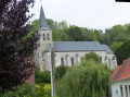
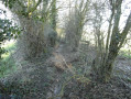
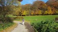
This long and challenging route forms part of the development of the wind farm at the Carnoye site, where six turbines have been installed. The trail is designed to enhance the area’s tourist and cultural appeal. In particular, it will enable walkers to discover the area, its heritage and history, as well as the various sources of energy, thanks to the information panels dotted along the route.

Details

n°2054007
Creation:
Last update:
Last review:
  • Walking
    Activity: Walking
  • ↔
    Distance: 17.02 mi
  • ◔
    Duration according to the author: 8 hrs 
  • ▲
    Difficulty: Very difficult

  • ⚐
    Back to start: Yes
  • ↗
    Ascent: + 761 ft
  • ↘
    Descent: - 791 ft

  • ▲
    Highest point: 558 ft
  • ▼
    Lowest point: 128 ft
  • ⚐ Country: France
  • ⚐ City: Enquin-les-Mines (62145)
  • ⚑
    Start/End: N 50.586937° / E 2.292365°
  • ❏
    IGN map(s): Ref. 2304E, 2304O, 2305E, 2305O
  • Hour-by-hour weather

Description of the walk

Start from the car park opposite Enquin-les-Mines Town Hall.

(S/E) From the car park, turn right onto Rue du Château d’Eau and turn right at the water tower. Follow the path for approximately 800 metres, without veering off course, until you reach Rue des Templiers (D159).

(1) Turn left and then right at the three-way junction to head up Rue de la Barre.

(2) At the top of the hill, turn right onto Rue de la Carnoye. Carry on straight ahead, staying on the tarmac.

(3) In front of the Carnoye farm, carry on to your left and follow the dirt track to the next junction.

(4) Turn left and carry on for just over a kilometre until you reach another junction (there are houses next to this junction).

(5) Turn right onto Rue d’Enquin. Continue along this road until you reach a 90° right-hand bend that goes round a building. Leave the road and take the path on the left which leads into the slag heap site in the commune of Ligny-lès-Aire.

(6) At the end of the slag heap, turn right and continue to the junction with the D341. Turn left and, a few metres further on, at the right-hand bend, follow the tarmac path to the right (just before the crash barrier), Rue du Goudou. Continue to the next junction (D186).

(7) Turn right and, about 200 metres further on, just before No. 1185, take the path on the left and head towards Liettres.

(8) At Allée du Criquet, carry on straight ahead until you reach the junction. Then turn left and you’ll come onto the D186 E2. Follow this road for about 800 metres and, after the sign marking the end of the built-up area of Liettres, you’ll reach a tarmac road leading uphill to the right.

(9) Follow this road for about 1 km without changing direction. You’ll come out onto Rue de Blessy; go up this street and turn left at the next junction.

(10) Cross the Chaussée Brunehaut (D341) and continue straight ahead towards Serny. Continue for about 900 metres until you reach a junction.

(11) Pass Rue de la Thieuloye on your right, continue straight on for a few metres and turn right onto Rue Saint-Germain. Follow this road for about 350 metres without changing direction. As you leave the village, take the grassy path leading down to the left.

Cross the D158E2 road, ‘Rue d’Enguinegatte’, and join the Chemin de la Gonze. Follow this path without changing direction until you reach a tarmac road (D130), 1.40 km further on.

(12) Turn right, then left at the next junction. Enter Enguinegatte and, at the four-way junction (with the Virgin Mary statue opposite), continue left, follow Rue Longue and reach the junction with the D77.

(13) Turn right onto Rue de Thérouanne, then left onto Rue du Presbytère, before the church. At the T-junction, turn right, then left a few metres further on. Continue straight on for about 1.80 km until you reach a junction approximately 150 m after passing a small wood on your right.

(14) At this junction, turn left and follow the path without straying from it until you reach the D130. Cross the D130 and take the path opposite towards Erny Saint-Julien. Taking care to stay on this path, continue until you reach a four-way junction with a farm building. Carry on straight ahead until you reach two paths. Ignore the path leading down to the left and continue along the track until you reach the D193. Turn left and follow the road to the bridge over the Laquette.

(15) Carry on straight ahead for about 1.1 km, keeping well on the tarmac road.

(16) At the four-way junction, carry on straight ahead, passing the annexe to the Erny Saint-Julien cemetery, and head up towards the Bois de Bomy. Follow the track called “La Voie de Laires” without changing direction until you reach the edge of the woods. Carry on for a few more metres until you reach a junction with a track on the left.

(17) Turn left and follow this path for 1.7 km until you reach a junction with a road. Turn left, then continue along the path on the right a few metres further on. You will reach the summit of the Côte de Cuhem.

(18) At the top of the Côte de Cuhem, turn left onto the D77 and head back down towards Enquin. In the left-hand bend, about 350 metres further on, you’ll find a grassy path on the right. Follow this path to reach Rue du Calvaire in Enquin-les-Mines. Ignore the path coming from the right which descends from the Bois de l’Hermitage and head towards the junction of Rue du Calvaire and Rue des Écoles.

(19) At the ‘Stop’ sign on Rue du Calvaire, carry on straight ahead along Rue Adam until you reach the river and the Moulin Espagnol. Cross the river via the ford or the footbridge and turn right. Follow the tarmac road to the right, Rue de la Brasserie, then head up this road, staying on this route, until you reach Rue des Écoles.

(20) At the top of Rue de la Brasserie, carry on straight ahead along Rue des Écoles and return to the car park (S/E).

Waypoints

  1. S/E : mi 0 - alt. 269 ft - Car park opposite the Town Hall
  2. 1 : mi 0.7 - alt. 184 ft - Fléchinelle - D159
  3. 2 : mi 1.03 - alt. 269 ft - Top of the hill – Rue de la Barre
  4. 3 : mi 1.62 - alt. 322 ft - Ferme de la Carnoye
  5. 4 : mi 2.11 - alt. 292 ft - Chemin de la Bredeuille junction
  6. 5 : mi 2.83 - alt. 249 ft - Junction with Rue d’Enquin
  7. 6 : mi 3.79 - alt. 203 ft - Terril Exit
  8. 7 : mi 4.62 - alt. 141 ft - D186 road. Crossing the - Laquette (rivière)
  9. 8 : mi 5.04 - alt. 167 ft - Allée du Criquet
  10. 9 : mi 5.78 - alt. 177 ft - Junction, on the right
  11. 10 : mi 6.67 - alt. 249 ft - D341
  12. 11 : mi 7.24 - alt. 230 ft - Junction with Rue de la Thieuloye
  13. 12 : mi 8.59 - alt. 322 ft - Chemin de la Gonze
  14. 13 : mi 9.67 - alt. 292 ft - Rue du Presbytère
  15. 14 : mi 10.99 - alt. 282 ft - D130 route
  16. 15 : mi 12.46 - alt. 249 ft - Erny Saint-Julien Bridge
  17. 16 : mi 13.21 - alt. 361 ft - Crossroads, annex to the Erny Saint-Julie cemetery
  18. 17 : mi 14.2 - alt. 531 ft - Bois Bomy exit, on the left
  19. 18 : mi 15.77 - alt. 354 ft - D77 road
  20. 19 : mi 16.44 - alt. 253 ft - Rue Adam
  21. 20 : mi 16.93 - alt. 262 ft - Top of Rue de la Brasserie
  22. S/E : mi 17.02 - alt. 269 ft - Car park opposite the Town Hall

Notes

Tables and benches are available for you to take a break.

Reviews and comments

5 / 5
Based on 1 review

Reliability of the description
5 / 5
Ease of following the route
5 / 5
Route interest
5 / 5
joorange
joorange

I went for a walk yesterday (15 August) around Enquin.

So I came across this route and followed parts of it.

I’d like to congratulate Enquin Town Council on their work.

The two picnic spots I came across are superb,

The footbridge over the Lacquette allows you to cross in complete safety (some people used to be worried when using the old one).

The information boards and the lovely blue arrows are the icing on the cake, and finally, I was delighted to be able to use the path leading to the Enquin Calvary again.

.

Machine-translated

joorange
joorange

Reading Nathalie’s reply to Fast_Hiking/Climbing, I realised why she was one of the moderators.

I think I would have been much harsher with that pretentious know-it-all (a cross between the ‘me-me’ and ‘I’m-so-great’ types).

He ought to take to heart one of the local sayings: ‘All talk, no action.’

Machine-translated

Rando59223
Rando59223

Overall rating : 5 / 5

Date of your route : Dec 07, 2019
Reliability of the description : ★★★★★ Very good
Ease of following the route : ★★★★★ Very good
Route interest : ★★★★★ Very good

A lovely late-autumn walk with some beautiful views.
There are regular signs explaining local features.
Signposting (blue signs bearing the name of the walk) is in place all along the route, which is very pleasant. Except at point 8, where it says: “Then turn left onto the D186 E2 (Rue d’Aire). Follow this road for about 800 metres...”. When you reach the D186E2, the text doesn’t say whether you should turn left or right, and there’s no blue sign (has it been removed?). You’ll need to have the map with you, otherwise… At point 14, after crossing the D130, you take a grassy track: it’s been rutted by motorbikes. You walk through ruts 30 cm deep, which isn’t easy in wet weather.

Machine-translated

grandin
grandin ★
• Edited:

Fast_Hiking/Climbing

Visorando is a website for everyone. Why should weekend hikers be looked down upon? Is it really so hard to imagine that a 27 km route might be challenging for some people?

If you don’t use our route descriptions and maps, why make this sort of comment? As a very experienced hiker, you’re perfectly capable of assessing the difficulty of a hike for yourself simply by looking at a map.

If you’re looking for a site for

off-piste alpine hiking, with steep slopes everywhere, proper elevation gain, and no signposting whatsoever, requiring specialist kit,

then you haven’t chosen the right hiking site for you.

Machine-translated

Fast_Hiking/Climbing

I’m probably not going to make any friends with this comment.
When I see the difficulty rating for this route… it makes my hair stand on end. Where’s the ‘very difficult’ and ‘challenging’ bit on a flat, tarmac route as flat as a pancake, perfect for a morning jog?

I was born in the mountains and am a keen mountaineer, trail runner, race walker and multi-day trekker… it’s happened several times now that routes have been suggested with vastly overrated difficulty ratings. I’d invite a few ‘weekend hikers’ to try a proper hike. It might feel a bit strange to them.

An alpine hike entirely off-piste, with steep slopes all round, proper elevation gain, no markings whatsoever and requiring specialist kit – what difficulty rating would that get? Abominable (like a via ferrata)? Well, that sort of thing doesn’t exist here…
Yes, grading is subjective and needs to be put into perspective, but in this case… if we convert it to something standardised (the IBP index)… we end up with a ridiculous route.

To be honest, I don’t use the suggested routes; I just use them to get ideas for places to visit. I’m happy to map out my own routes and download the GPX files.
A few members do suggest routes that are genuinely described as difficult (bouvierjr, kcnarf…).

Sorry for being a bit blunt.

Machine-translated

Other walks in the area

For more walks, use our search engine .

The GPS track and description are the property of this route's author. Please do not copy them without permission.