


Refine your search for walks in Montjustin
Montjustin walks
 From the Priory of Carluc to Les Roux
 Visorando Member
 5.40 mi
 +915 ft
 -892 ft
 3h 15
3h 15
 Easy
Easy
 Departure from Céreste (Alpes-de-Haute-Provence)
An easy walk through woods and countryside, valleys and ridges, allowing you to discover the variety and beauty of the Luberon’s landscapes.
The Priory of Carluc from Céreste
 3.91 mi
+387 ft
-387 ft
2h 10
Easy
Departure from Céreste (Alpes-de-Haute-Provence)
3.91 mi
+387 ft
-387 ft
2h 10
Easy
Departure from Céreste (Alpes-de-Haute-Provence)
An easy hike from Céreste to the Priory of Carluc, along farmland, lavender fields and oak woods.
Route around Montjustin from Céreste
 5.42 mi
+843 ft
-817 ft
3h 15
5.42 mi
+843 ft
-817 ft
3h 15
 Moderate
Departure from Céreste (Alpes-de-Haute-Provence)
Moderate
Departure from Céreste (Alpes-de-Haute-Provence)
Route around the village of Montjustin. Magnificent views of the Grand Lubéron and the Encrême valley.
From Céreste to Apt via the plain, Auribeau and Saignon
 13.87 mi
+1,532 ft
-2,051 ft
7h 45
13.87 mi
+1,532 ft
-2,051 ft
7h 45
 Difficult
Departure from Céreste (Alpes-de-Haute-Provence)
Difficult
Departure from Céreste (Alpes-de-Haute-Provence)
The final stage of this route is long and varied. The first section takes place on the plain at the foot of the Luberon ridges, which were traversed in the opposite direction during the second stage. We then gain altitude, climbing successively to the villages of Glorivette, Castellet-en-Lubéron and Auribeau, the latter two boasting a rich heritage. We then descend all the way, passing through the beautiful village of Saignon along the way.
The Encrême Valley
12.95 mi
+1,614 ft
-1,637 ft
7h 20
Moderate
Departure from Céreste (Alpes-de-Haute-Provence)
Set off to explore the Encrême Valley, with its varied landscapes, villages and the ruins of Carluc Priory.
 The Largue Circuit
14.78 mi
+1,677 ft
-1,693 ft
1.5 hrs
Difficult
Departure from Reillanne (Alpes-de-Haute-Provence)
A mix of rugged paths, lovely tracks and quiet country lanes… Some magnificent views of the distant Alps from the Lincel ridge.
From Montfuron to Villemus
 4.58 mi
+512 ft
-509 ft
2h 35
Easy
Departure from Montfuron (Alpes-de-Haute-Provence)
4.58 mi
+512 ft
-509 ft
2h 35
Easy
Departure from Montfuron (Alpes-de-Haute-Provence)
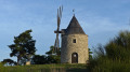
A walk between two small hilltop villages in the Luberon: Montfuron, with its castle and windmill, and Villemus, with its 12th-century chapel and paved slanting streets.
Montfuron to Villemus circular – long version
 7.38 mi
+968 ft
-971 ft
4h 15
Moderate
Departure from Montfuron (Alpes-de-Haute-Provence)
7.38 mi
+968 ft
-971 ft
4h 15
Moderate
Departure from Montfuron (Alpes-de-Haute-Provence)
Whilst Montfuron and Villemus are already featured on Visorando, here is a longer circular route that incorporates a different version of the signposted route as you leave Villemus, and a detour via the ruins of the old plaster mill.Don’t be surprised if you see a large dog wandering along the paths around Villemus. He’s peaceful and harmless. He’s (most likely) the one from Café Restaurant Les Tilleuls.
The first 1,000 metres of the Grand Lubéron on the eastern side
 7.17 mi
+1,417 ft
-1,421 ft
4h 30
Moderate
Departure from Céreste (Alpes-de-Haute-Provence)
7.17 mi
+1,417 ft
-1,421 ft
4h 30
Moderate
Departure from Céreste (Alpes-de-Haute-Provence)
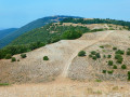
The Luberon massif, whether the ‘small’ or ‘large’ Luberon, is mainly forested.It is only from an altitude of 1,000 metres that the forest gives way to open areas offering a 360° panoramic view of the entire region, provided you are on the ridge.Starting from the Col de l’Aire Deï Masco at 700 m, between Céreste-en-Lubéron and Vitrolles-en-Lubéron, the route heads westwards to tackle the first two peaks of the Grand Lubéron, both over 1,000 m in altitude. From there, the view is magnificent, both to the south and to the north.As an added bonus, there’s the signal at the summit of Mourre Nègre on the western side.Whilst the climb along the GR® on the way out may leave you feeling there’s no hope of ever making it, the reward is complete after just 4 km.On the return journey, the suggested route follows the track, which is easy, open and offers some lovely views to the south at the start of the descent.The fittest walkers will probably not hesitate to continue along the ridge to Mourre Nègre… but not on a scorching hot day!
Route des Agasses – Piegros
5.36 mi
+1,125 ft
-1,106 ft
3h 25
Moderate
Departure from Céreste (Alpes-de-Haute-Provence)
Wooded areas and panoramic views punctuate this route north of Vitrolles-en-Lubéron
From Aire des Mascas to Coteau de la Combe and back via Vallon des Roumis
6.86 mi
+1,302 ft
-1,312 ft
4h 15
Moderate
Departure from Vitrolles-en-Lubéron (Vaucluse)
A lovely hike along the Luberon ridges, often through woodland with views on both sides. Views of the Pre-Alps and the Vaucluse mountains during the first part and of the Aigues valley and the Durance valley and beyond, weather permitting. A few kilometres on the DFCI track overlooking the valleys, but the view is well worth it.
From Vitrolles to Céreste via Montjustin
 9.01 mi
+915 ft
-1,312 ft
4h 55
Moderate
Departure from Vitrolles-en-Lubéron (Vaucluse)
9.01 mi
+915 ft
-1,312 ft
4h 55
Moderate
Departure from Vitrolles-en-Lubéron (Vaucluse)
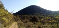
The third stage is the shortest of this route. After a very pleasant walk along a track at the foot of wooded hills, we take a narrow path that allows us to cross from the southern to the northern side of the massif. We then climb up to the pretty village of Montjustin, before descending via a ridge offering superb views.
Discovering the heritage of La Bastide-des-Jourdans from Vitrolles
 9.98 mi
+1,332 ft
-1,342 ft
5h 45
Moderate
Departure from Vitrolles-en-Lubéron (Vaucluse)
9.98 mi
+1,332 ft
-1,342 ft
5h 45
Moderate
Departure from Vitrolles-en-Lubéron (Vaucluse)
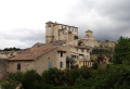
A hike with two circular loops, combining pleasant forest trails with a stroll through the narrow streets of La Bastide-des-Jourdans to discover its rich heritage: ancient gate, fountain column, church, old castle, tower,...
From Vitrolles-en-Lubéron to Oppedette
 16.74 mi
+2,434 ft
-2,405 ft
9h 50
Difficult
Departure from Vitrolles-en-Lubéron (Vaucluse)
16.74 mi
+2,434 ft
-2,405 ft
9h 50
Difficult
Departure from Vitrolles-en-Lubéron (Vaucluse)
This fourth stage begins with a route halfway up the wooded slope of the Vallat de Pissaire before entering the Ravin du Gancet and then crossing the Aiguebelle valley to reach the hilltop village of Montjustin. The route follows the ridge of the hill separating this valley from that of the Encrême and descends to reach Céreste, situated at their confluence. It crosses the remarkable Pont de la Baou before revealing, nestled in the woods, the medieval Priory of Carluc. It climbs the side of the valley and swings over to that of the Grand Vallat, then ascends its sunny slope towards Sainte-Croix-à-Lauze, from where it reaches the top of the Cavalon valley before descending it to reach the village of Oppedette.
Les small passes du Luberon Est
 11.14 mi
+1,772 ft
-1,781 ft
6h 40
Difficult
Departure from La Bastide-des-Jourdans (Vaucluse)
11.14 mi
+1,772 ft
-1,781 ft
6h 40
Difficult
Departure from La Bastide-des-Jourdans (Vaucluse)
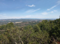
Hike in the eastern foothills of the Luberon between La Bastide-des-Jourdans and Vitrolles-en-Luberon.
Extended version of the small passes of Luberon East
 13.26 mi
+1,995 ft
-2,005 ft
7h 50
Difficult
Departure from La Bastide-des-Jourdans (Vaucluse)
13.26 mi
+1,995 ft
-2,005 ft
7h 50
Difficult
Departure from La Bastide-des-Jourdans (Vaucluse)
An easy circular walk in the eastern part of the Luberon between La Bastide des Jourdans and Vitrolles-en-Luberon, offering magnificent views over the Vaucluse hills and the Montagne de Lure. The vegetation is varied. The village of Vitrolles-en-Luberon is magnificent.
An extended version of a route published by pbrion (many thanks!) See § During the walk or nearby.