


 Country:

 City:
City:


Parking is available on Chemin Délestic, in the car park in front of the Municipal Technical Centre, next to the motorhome area.
(S/E) At the junction of Chemin Délestic and the D14, turn left and follow the road until you reach the outskirts of Reillanne. Turn left onto Chemin de Bissargues.
(1) At the junction with a grassy traffic island, take the track on the left which goes uphill… it’s quite bumpy!
Carry on straight ahead until you reach a road (Chemin du Largue).
(2) Turn right onto Chemin du Largue, pass the entrance to the recycling centre and join the small road on the left about a hundred metres further on.
(3) Follow this road, which runs alongside the Ravin de Valvissorgues towards Le Largue. Head downhill for about 2 km and, at the crossroads, keep to the left.
(4) Cross a paved ford (almost always dry) and leave the tarmac to take the track leading down to the right.
Cross Le Largue (usually 20 to 30 cm of water) then walk for about fifty metres.
(5) Cross straight across the field, then find a narrow, barely visible path that leads into the woods. On an increasingly steep and technical climb, take the first hairpin bend to the right, then the second to the left, and you’ll reach the Plateau de Lincel.
(6) Enjoy the breathtaking views of the Alps, the Observatory and its domes, then continue along the lovely track for about 6 km until you reach the Route de Banon, ignoring the turn-offs to the right and left.
(7) Turn left and follow the road for 1.5 km until you reach a junction with a road on the left that winds away in a hairpin bend.
(8) Follow this picturesque little road towards Aubenas-les-Alpes for about 5 km, ignoring the turn-offs to the right and left.
(9) At the D14 (information sign saying “Vous êtes à Vachères”), turn left and drive up to the pass.
(10) Take the track branching off to the left towards the convent (a carved stone block with an engraved image of a church). Walk downhill for 1.3 km until you reach a “gate” (two stone pillars) marking the entrance to the convent.
(11) Take the small path branching off to the right and follow it for about a hundred metres.
(12) Turn onto the path that winds sharply to the left and follows the bottom of the valley. You’ll reach a fork with a turning area.
(13) Cross the dry ford on the right and continue straight on along the path, going round the ridge and reaching the next valley.
(14) Cross the ford and continue along this particularly rocky track. Ignore the paths branching off on either side and join a cross-valley track at the bottom of the valley.
(15) Turn right and you’ll come out onto the tarmac road (D14).
(16) Follow the road for 200 m and take the first road on the left, Chemin du Caï. Continue straight on until you reach the ‘Stop’ sign.
(17) Turn left onto the D14, then head for the car park in front of the Municipal Technical Centre (S/E).

 Visorando Member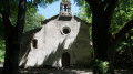

 Easy
Easy 
