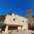
The Encrême Valley

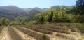
Set off to explore the Encrême Valley, with its varied landscapes, villages and the ruins of Carluc Priory.

Details

831597
Creation:
Last update:
Last review:
  • Walking
    Activity: Walking
  • ↔
    Distance: 12.95 mi
  • ◔
    Average duration: 7h 20 
  • ▲
    Difficulty: Moderate

  • ⚐
    Back to start: Yes
  • ↗
    Ascent: + 1,614 ft
  • ↘
    Descent: - 1,637 ft

  • ▲
    Highest point: 2,018 ft
  • ▼
    Lowest point: 1,188 ft
  • ⚐ Country: France
  • ⚐
    Area: Luberon
  • ⚐ City: Céreste (04280)
  • ⚑
    Start/End: N 43.856101° / E 5.590316°
  • ❏
    IGN map(s): Ref. 3242OT, 3243OT, 3342OT
  • Hour-by-hour weather

Description of the walk

Several car parks around the Tourist Office.

(S/E) Tourist Office.
Walk past the Tourist Office, go up Rue de l’Église, turn left onto Rue Victor Hugo, walk past the church, then turn right onto the Route de Vitrolles en Luberon (D31). After the cemetery, take the first road on the left until you reach the Aiguebelle stream.

(1) Signpost: Ravin de l’Aiguebelle.
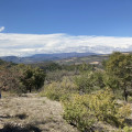
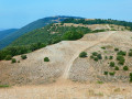
Cross the stream and follow the path which climbs through the oak and boxwood trees. At the junction, La Roque – 420m, take the path on the right which climbs and follows the ridge, offering views of the northern slope of the Grand Luberon. The path runs below the village of Montjustin – 550 m. Take the time to visit the village, cross the road and then continue straight on along the ridge path for 2.5 km, ignoring any other paths.

(2) Saint Roman signpost.
Leave theGR® and head down the northern slope to the left, staying on the main path. Once at the bottom, walk along a large meadow, passing the Ferme des Courbons (lodge) on your right. Follow the path until you reach the N100.

(3) Cross the D4100, turn left then right onto the D214 towards Reillanne. Stay on this road until you reach the sign for Reillanne

(4) Reillanne.
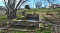
After the sign for Reillanne, turn left and go up the steps on your right. At the top of the steps, turn right. At the fountain and washhouse, carry on straight ahead along Rue Daniel Reynaud. When you reach Place de l’Ormeau, turn left under the arched passageway. The alley branches off to the left; then turn right, then right again into Rue des Rosiers. At the next junction, turn left onto Rue Grande. Take the steps on your right to reach Rue du Moulin, which you follow to the right. Climb the steps on your left to come out onto Rue du Planet, which you follow to the left. Take the steps on your right, then turn right onto the paved slanting street; this leads to the Saint-Denis Chapel (an ideal picnic spot with a forest table).

(5) Saint-Denis Chapel
With your back to the chapel, go down the steps on your left near the orientation table, then turn right and head towards Place Raoul Anglès (on your left, you’ll see the remains of a gate and the ramparts). Turn right, then head left down Rue Rompe-cul (more steps). Turn right onto Rue de l’Ancien Village, then left to reach Boulevard Long Barri, which you follow to the right until you reach Place Lucien Arnaud.

(6) Lucien Arnaud signpost.
Turn left onto Rue de Tréchiou, passing the cemetery. Ignore the road on your left (Chemin des Amandiers) and continue to the next junction. Turn left onto Boulevard Jean Jaurès, and follow this road for approximately 1.8 km – it later becomes Chemin de Reclapous – ignoring any roads branching off to the right or left.

(7) Pierrefeu signpost.
Turn left onto the path leading down into the Cure valley, following theGR® markings and the main path to the ruins of the Priory of Carluc.

(8) Take some time to visit the site, then head off to the right. At the next junction, continue to the left along the road, following it for about 700 metres until you reach a right-hand bend.

(9) Bel Air signpost
Take the dirt track opposite. Walk through a small wood. Pass under the power line and continue along the track. At the T-junction, turn right. At Gare Est – 360m – leave the road on your left and walk past the holiday centre on your right. Pass a road on your left, then turn left at the next junction.

(10) Cross the Roman bridge. Just before the Stop sign, turn right and walk past the Notre-Dame-de-Piété Chapel, then turn left to rejoin the N100, which you follow to the right to return to the starting point (S/E).


Waypoints

  1. S/E : mi 0 - alt. 1,257 ft - Tourist Office
  2. 1 : mi 0.57 - alt. 1,211 ft - Signpost: Ravin de l’Aiguebelle
  3. 2 : mi 4.16 - alt. 2,001 ft - Saint Roman signpost
  4. 3 : mi 5.62 - alt. 1,417 ft - Crossing the D4100
  5. 4 : mi 6.65 - alt. 1,663 ft - Sign for Reillanne
  6. 5 : mi 6.99 - alt. 1,916 ft - Saint-Denis Chapel
  7. 6 : mi 7.32 - alt. 1,811 ft - Marked by Lucien Arnaud.
  8. 7 : mi 8.75 - alt. 2,018 ft - Pierrefeu signpost
  9. 8 : mi 10.76 - alt. 1,444 ft - Priory of Carluc
  10. 9 : mi 11.45 - alt. 1,385 ft - Bel Air signpost
  11. 10 : mi 12.6 - alt. 1,188 ft - Roman bridge - Encrême (rivière)
  12. S/E : mi 12.95 - alt. 1,257 ft - Tourist Information Centre

Notes

A walk with no particular difficulty apart from its length.

Worth a visit

The village of Montjustin
The village of Reillanne
Ruins of Carluc Priory
Village of Céreste

Always be cautious and plan ahead when you're outdoors. Visorando and the author of this route cannot be held responsible for any accidents occurring on this route.

The GR® and PR® markings are the intellectual property of the Fédération Française de Randonnée Pédestre.

Reviews and comments

3.8 / 5
Based on 3 reviews

Reliability of the description
3.7 / 5
Ease of following the route
3.7 / 5
Route interest
4 / 5
caiddesoyats
caiddesoyats

Overall rating : 3.7 / 5

Date of your route : Feb 21, 2021
Reliability of the description : ★★★★☆ Good
Ease of following the route : ★★★★☆ Good
Route interest : ★★★☆☆ Average
Very busy route : No

It’s a bit of a long drive, though you can avoid part of it between points 3 and 4 by taking a small dirt track a little further on, which is better than the tarmac on the D214

Machine-translated

georges philibert
georges philibert

Overall rating : 3.3 / 5

Date of your route : Feb 28, 2019
Reliability of the description : ★★★☆☆ Average
Ease of following the route : ★★★☆☆ Average
Route interest : ★★★★☆ Good

A very lovely route, especially the first part up to where it crosses the main road.
After that, there’s far too much road, although you can avoid part of it between points 3 and 4 by following the yellow-marked PR path which starts at the pizzeria on the old road lined with plane trees, 200 metres to the left of the national road crossing.
The walk around the Encreme Valley is very well signposted with red and white GR markings and, in part, with yellow PR markings – why not mention this?

Machine-translated

buno1308
buno1308

Overall rating : 4.3 / 5

Date of your route : Feb 22, 2019
Reliability of the description : ★★★★☆ Good
Ease of following the route : ★★★★☆ Good
Route interest : ★★★★★ Very good

A lovely route – well worth a walk

Machine-translated

georges philibert
georges philibert

Yet another case of plagiarism from the guidebook *The Luberon Nature Park on Foot*.
The author hasn’t even changed the title.
He could at least cite his sources and point out that this walk is fully signposted (red, white and yellow) by volunteers from clubs belonging to the French Hiking Federation.
I’m astonished by the laxity of the Visiorando moderators.

Machine-translated

Other walks in the area

For more walks, use our search engine .

The GPS track and description are the property of this route's author. Please do not copy them without permission.