


Refine your search for walks in Marigny-Brizay
Marigny-Brizay walks


 Montfaucon route from Jaunay-Marigny
 Visorando Member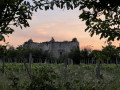
 7.55 mi
 +289 ft
 -289 ft
 3h 45
3h 45
 Moderate
 Departure from Marigny-Brizay (Vienne)
Set amongst market gardens and private castles, the Montfaucon route takes you to explore, in particular, the castle of the same name, a fine example of a small medieval keep. Built inthe 14th century, Montfaucon is the oldest civil building in the commune. It was remodelled inthe 15th century, at which point it lost some of its defensive character in favour of a more residential function.
Jaunay-Marigny Cave Dwellings Route
 8.70 mi
+466 ft
-479 ft
4h 25
Moderate
Departure from Marigny-Brizay (Vienne)
8.70 mi
+466 ft
-479 ft
4h 25
Moderate
Departure from Marigny-Brizay (Vienne)
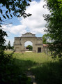
Route proposed by the municipality of Jaunay-Marigny and certified by the Vienne Departmental Hiking Committee. A route exploring the troglodytic landscapes, created by the exploitation of the Tuffeau quarries, with beautiful views over the Envigne valley. The route is marked in green, starting from the Marigny-Brizay town hall.
In the Colombiers forest
 6.52 mi
+302 ft
-295 ft
3h 15
Moderate
Departure from Colombiers (Vienne) (Vienne)
6.52 mi
+302 ft
-295 ft
3h 15
Moderate
Departure from Colombiers (Vienne) (Vienne)
A lovely walk, partly through the forest. There are also beautiful views over the Ouzilly plain, with the chance to see tuffeau stone dwellings and a few cave dwellings.
Le Rouhet
 Tourist office
 6.09 mi
+279 ft
-276 ft
3h 05
6.09 mi
+279 ft
-276 ft
3h 05
 Easy
Departure from Colombiers (Vienne) (Vienne)
Easy
Departure from Colombiers (Vienne) (Vienne)
Take a break in nature along these beautiful wooded paths.
Walk from Clos Barault to Colombiers
4.17 mi
+194 ft
-210 ft
2h 05
Easy
Departure from Colombiers (Vienne) (Vienne)
A lovely family walk through the woods with beautiful views over the Envigne valley and Haut-Clairvaux.
The Marais de la Palu and the Gallo-Roman site of Tours Mirandes
 6.30 mi
+213 ft
-207 ft
3h 05
Moderate
Departure from Vendeuvre-du-Poitou (Vienne)
6.30 mi
+213 ft
-207 ft
3h 05
Moderate
Departure from Vendeuvre-du-Poitou (Vienne)
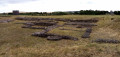
After climbing a hill offering sweeping views, the route takes you through former marshes now used for market gardening. A few castles dot the route, the highlight of which is the Gallo-Roman site, whose ruins, whilst not spectacular, are moving.
Dissay Vineyard Route
 3.62 mi
+135 ft
-135 ft
1h 45
Easy
Departure from Dissay (Vienne)
3.62 mi
+135 ft
-135 ft
1h 45
Easy
Departure from Dissay (Vienne)
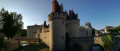
A walk through the fields.
Route suggested by the municipality of Dissay and the Les Randonneurs Pédestrians association.
The Pendants route in Dissay
 4.41 mi
+240 ft
-236 ft
2h 15
Easy
Departure from Dissay (Vienne)
4.41 mi
+240 ft
-236 ft
2h 15
Easy
Departure from Dissay (Vienne)
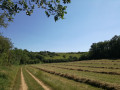
A walk through the fields, with panoramic views.
Route recommended by the Dissay local council and the Les Randonneurs Pédestrians association.
Circular Baudiment in Naintré
6.76 mi
+312 ft
-305 ft
3h 25
Moderate
Departure from Naintré (Vienne)
Magnificent views of Moussais Castle and Colombiers Forest. This route has it all, from botany to built heritage, from the arboretum along the green corridor to the Beaumont Tower and the Madeleine Chapel. You'll be amazed!
Route of Châteaux starting from Saint-Genest-d’Ambière
7.81 mi
+203 ft
-197 ft
3h 45
Moderate
Departure from Saint-Genest-d'Ambière (Vienne)
As you walk through Ambigaria (the former name of the commune of Saint-Genest), you’ll pass through market gardens and fields of asparagus.
Along the way, you’ll come across Puygareau Castle, fortified from 1434 onwards, with its two towers and 15th-century residential quarters.
At the Château d’Abin, you’ll see an old hemp kiln; the hemp-growing industry was a major part of the local economy in the 19th century.
Lencloître circular loop
 7.74 mi
+92 ft
-92 ft
3h 40
Moderate
Departure from Lencloître (Vienne)
7.74 mi
+92 ft
-92 ft
3h 40
Moderate
Departure from Lencloître (Vienne)
An easy hike that mainly takes place amongst cultivated fields and vineyard plots on the hillsides. The church in Lencloître adds a superb touch of heritage.
Route designed and signposted by the Grand Châtellerault Tourist Office, under the name "Entre Vignes et Jardins" and number 24.
Via Haut Clairvaux
5.93 mi
+351 ft
-338 ft
3h 00
Moderate
Departure from Scorbé-Clairvaux (Vienne)
You start your walk at the foot of the Haut-Clairvaux keep, built in the 11th and 12th centuries, where you can admire the many panoramic views stretching as far as the eye can see!
You will then descend towards Bas-Clairvaux, where your path will cross the famous greenway cycle route, the ‘Ligne Verte’, a former railway line linking Châtellerault to Loudun, before heading back up towards your destination.
The site of the Battle of Poitiers, starting from Old Poitiers
 6.88 mi
+236 ft
-230 ft
3h 20
Moderate
Departure from Naintré (Vienne)
6.88 mi
+236 ft
-230 ft
3h 20
Moderate
Departure from Naintré (Vienne)
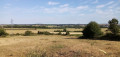
The Battle of Poitiers in the year 732 has been the subject of numerous myths, the foremost of which concerns the very location of the battle itself! This walk takes you to the site considered by contemporary historians to be the most likely location, situated considerably further north than the ancient capital of the Pictaves. The walk starts from the ruins of the Gallo-Roman amphitheatre in Old Poitiers.
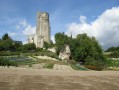
The Ligne Verte, from the railway to the greenways, towards Scorbé-Clairvaux
 11.40 mi
+308 ft
-308 ft
5h 30
Moderate
Departure from Thuré (Vienne)
11.40 mi
+308 ft
-308 ft
5h 30
Moderate
Departure from Thuré (Vienne)
This lovely route winds its way through the countryside and follows sections of the Ligne Verte, a former railway line converted into a 37km path for pedestrians and cyclists, between Châtellerault and Loudun. It also takes you along some lovely sunken lanes and leads to the rich heritage of Scorbé-Clairvaux: the keep and chapel of Haut Clairvaux, the wash house, the old market halls, the castle which houses the chess museum (over 150 sets from 70 countries), and the old station.
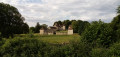
The castles of Barbelinière and La Massardière as you wind through the woods
 6.99 mi
+338 ft
-348 ft
3h 30
Moderate
Departure from Thuré (Vienne)
6.99 mi
+338 ft
-348 ft
3h 30
Moderate
Departure from Thuré (Vienne)
A hike mainly through woodland with a few sections through fields. Two beautiful châteaux mark the route: the Château de la Barbelinière, visible from a distance, and the Château de la Massardière, which you pass right by. The ruins of the Tour de Pouillé and the church in Thuré add to the heritage appeal of this hike.
Hike designed and signposted by the Vienne departmental committee of the FFRP.
Around Cenon-sur-Vienne
7.87 mi
+171 ft
-171 ft
3h 45
Moderate
Departure from Cenon-sur-Vienne (Vienne)
This route takes us along the ancient Roman road and introduces us to the remains of the Gallo-Roman site of Old Poitiers. Take the time to stop for a break in the magnificent Parc de la Grande Maison and, if time allows, take a trip on an electric boat.
The Pinail Nature Reserve starting from Vouneuil-sur-Vienne
 Association / Club / Walk leader6.74 mi
+256 ft
-256 ft
3h 20
Moderate
Departure from Vouneuil-sur-Vienne (Vienne)
Association / Club / Walk leader6.74 mi
+256 ft
-256 ft
3h 20
Moderate
Departure from Vouneuil-sur-Vienne (Vienne)
A very beautiful hike with access to the Pinail Nature Reserve.
Short tour of the natural environments in Migné-Auxances
3.13 mi
+98 ft
-98 ft
1h 30
Easy
Departure from Migné-Auxances (Vienne)
A nature walk between fields and the banks of the Auxance. A short, easy walk.
Route developed by the Greater Poitiers Urban Community and the Departmental Hiking Committee.
Industrial trail in Châtellerault
4.74 mi
+46 ft
-49 ft
2h 15
Easy
Departure from Châtellerault (Vienne)
Starting from the former arms factory and a walk along the banks of the Vienne, passing along both the left and right banks and criss-crossing the railway tracks.
From the centre of Montamisé to the forest
 4.14 mi
+167 ft
-167 ft
2h 05
Easy
Departure from Montamisé (Vienne)
4.14 mi
+167 ft
-167 ft
2h 05
Easy
Departure from Montamisé (Vienne)
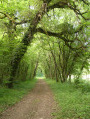
A mainly shaded walk through woodland, though with a large number of tarmac roads.
A ‘nature walk’ organised by the Greater Poitiers Urban Community, the town of Montamisé and the CDRP.
In the Moulière forest
 6.87 mi
+98 ft
-98 ft
3h 15
Moderate
Departure from Montamisé (Vienne)
6.87 mi
+98 ft
-98 ft
3h 15
Moderate
Departure from Montamisé (Vienne)
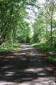
A bucolic hike in the forest with very little road walking.
Tree lovers should not hesitate to bring a book or app to help them identify the different species.
Le Caillou de Saint-Martin
 4.70 mi
+177 ft
-194 ft
2h 20
Easy
Departure from Orches (Vienne)
4.70 mi
+177 ft
-194 ft
2h 20
Easy
Departure from Orches (Vienne)
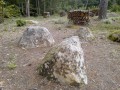
A short walk along field paths, forest trails and small roads, taking in a Neolithic polishing stone, a few cave dwellings and a beautiful church.
This hike partly follows a route designed and marked out by the Grand Châtellerault Tourist Office.
Nature and views starting from Orches
7.15 mi
+335 ft
-361 ft
3h 35
Moderate
Departure from Orches (Vienne)
With its many panoramic views of the villages, the pretty surrounding hamlets and its paths that are by turns wooded and undulating, this route certainly lives up to its name.
The Châteaux of Coussay and La Tour de Ry
 8.46 mi
+253 ft
-243 ft
4h 05
Moderate
Departure from Coussay (Vienne)
8.46 mi
+253 ft
-243 ft
4h 05
Moderate
Departure from Coussay (Vienne)
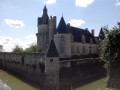
A heritage hike in the countryside and woods of Haut Poitou with two Renaissance-style castles up close and a Romanesque church.
Route designed and marked by the Vienne departmental committee of the FFRP.
Circular route around Valençay Castle
8.46 mi
+463 ft
-482 ft
4h 15
Moderate
Departure from Antran (Vienne)
As you follow the path, you’ll walk along the banks of the Vienne, then pass through the woods of La Rabellerie, La Pagerie and Valençay, before skirting the magnificent Maisonneuve Park to rejoin the Vienne.
The cliffs of Beauvoir
 4.16 mi
+144 ft
-144 ft
2h 00
Easy
Departure from Vouneuil-sous-Biard (Vienne)
4.16 mi
+144 ft
-144 ft
2h 00
Easy
Departure from Vouneuil-sous-Biard (Vienne)
Short hike through woods and fields in the Auxance valley.
La Motte Castle and Remeneuil Priory
 6.36 mi
+272 ft
-269 ft
3h 10
Moderate
Departure from Usseau (Vienne) (Vienne)
6.36 mi
+272 ft
-269 ft
3h 10
Moderate
Departure from Usseau (Vienne) (Vienne)
This hike, which mainly takes place on field paths and small roads with very little traffic, offers beautiful heritage sites and views.
For the most part, the route has been designed and marked by the Vienne departmental committee of the FFRP (the end ofthe PR®® has been short-circuited as it is of limited interest and runs too close to the A10 motorway).
(Please note) The route is interrupted between (8) and (9) due to the closure of a passage through an active quarry (see messages posted on 10/12/25). A detour is being considered. In the meantime, please use the alternatives described in the practical information section.
More walks in Marigny-Brizay
Select a point of interest below: