Dissay Vineyard Route

A walk through the fields.
Route suggested by the municipality of Dissay and the Les Randonneurs Pédestrians association.

Details

1254150
Creation:
Last update:
Last review:
  • Walking
    Activity: Walking
  • ↔
    Distance: 3.62 mi
  • ◔
    Average duration: 1h 45 
  • ▲
    Difficulty: Easy

  • ⚐
    Back to start: Yes
  • ↗
    Ascent: + 135 ft
  • ↘
    Descent: - 135 ft

  • ▲
    Highest point: 344 ft
  • ▼
    Lowest point: 200 ft
  • ⚐ Country: France
  • ⚐ City: Dissay (86130)
  • ⚑
    Start/End: N 46.698772° / E 0.427617°
  • ❏
    IGN map(s): Ref. 1826SB
  • Hour-by-hour weather

Photos

Description of the walk

The walk starts at the car park in front of the primary school, where you’ll find the information board for the walks.

(S/E) Leave the car park via the entrance road, turn right and then immediately left onto Place Pierre d’Amboise, running alongside the château (it is also possible to park in front of the château, though the school car park offers more shade).
Just after the bridge leading to the château, leave the main road by turning right onto Rue du Trait de la Charbonnière. At the junction, continue uphill to the left, down the cul-de-sac.
The road becomes a gravel track, which leads out at the top onto Rue de Bellevue; carry on straight ahead along this road until you reach the ‘stop’ sign at the crossroads with the D15.

(1) Turn right onto the D15.
Leave this road via the first grassy track branching off to the right, just before the entrance to the cemetery.

(2) At the next junction, turn left onto theGR® de Pays des Trois Batailles de Poitiers. Cross the D15 (Route de Vouneuil) and continue straight on along the dirt track.
When the track joins a tarmac road, take it to the right.

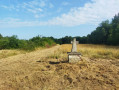
(3) Shortly afterwards, turn onto the second dirt track on the left (the one that branches off at the foot of the stone cross).

(4) After the telecoms pylon, turn left, before the “Saint-Cyr” sign.
Carry on straight ahead at the next junction and pass under a power line.

(5) After the descent into the woods, join the road (D4 – watch out for vehicles) by continuing straight on.
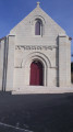
Stay on this road after entering Dissay; it passes in front of the church and then heads back towards the castle. Walk alongside the castle, then turn right onto the D15 to reach the car park (S/E).

Waypoints

  1. S/E : mi 0 - alt. 210 ft - Car park in front of the primary school
  2. 1 : mi 0.51 - alt. 285 ft - Junction with the D15
  3. 2 : mi 0.91 - alt. 325 ft - Junction with the GRP
  4. 3 : mi 1.67 - alt. 325 ft - Dirt track on the left at the cross
  5. 4 : mi 2.15 - alt. 269 ft - Pylon
  6. 5 : mi 3.02 - alt. 210 ft - Junction with the D4
  7. S/E : mi 3.62 - alt. 210 ft - Car park in front of the primary school

Notes

Green markings throughout the route (sometimes difficult to see); very limited markings in the opposite direction.

Worth a visit

- Dissay Castle
- There are two other walks in Dissay (the routes partially overlap)

Always be cautious and plan ahead when you're outdoors. Visorando and the author of this route cannot be held responsible for any accidents occurring on this route.

The GR® and PR® markings are the intellectual property of the Fédération Française de Randonnée Pédestre.

Reviews and comments

4.4 / 5
Based on 3 reviews

Reliability of the description
5 / 5
Ease of following the route
5 / 5
Route interest
3.3 / 5
Odeladetout
Odeladetout

Overall rating : 4.7 / 5

Date of your route : Feb 28, 2021
Reliability of the description : ★★★★★ Very good
Ease of following the route : ★★★★★ Very good
Route interest : ★★★★☆ Good
Very busy route : No

A pleasant walk, but not particularly interesting.

Machine-translated

AYRAULT DANIELLE
AYRAULT DANIELLE

Overall rating : 4.3 / 5

Date of your route : Nov 03, 2018
Reliability of the description : ★★★★★ Very good
Ease of following the route : ★★★★★ Very good
Route interest : ★★★☆☆ Average

Nothing out of the ordinary

Machine-translated

CHAMPALOU Didier
CHAMPALOU Didier

Overall rating : 4.3 / 5

Date of your route : Oct 16, 2018
Reliability of the description : ★★★★★ Very good
Ease of following the route : ★★★★★ Very good
Route interest : ★★★☆☆ Average

Mark-up not explicit
Can be done in 1 hour 30 minutes

Machine-translated

Other walks in the area

For more walks, use our search engine .

The GPS track and description are the property of this route's author. Please do not copy them without permission.