Country:
 City:
City:


Park in one of the two car parks at the church in Vandeuvre-du-Poitou.
No signposting
(S/E) Facing the main entrance to the church, turn left and walk between a bakery (on the left) and the tourist information office (on the right). Immediately afterwards, when the street bends to the right, carry on straight ahead and walk through a residential area. After passing some public toilets (on the right), turn left with the street. At the Stop sign, follow the road to the right and stay on the wide right-hand verge. Pass the Cité des Érables on your right and take the next street on the right, Rue de Brochereau. The tarmac soon gives way to a track that climbs a hill.
Green signposting for the Chemin de Saint-Martin
At every major junction, there is a limestone marker engraved with the initials ‘D ST M’, which stand for Doyenneté Saint-Martin. An arrow (green in the direction of travel, red in the opposite direction) is positioned on a sort of compass rose.
(1) At the junction at the top of the hill, turn right. At a three-way junction, veer to the right. Just past a house (on the left-hand side), ignore a faint path branching off to the left, carry on straight ahead and head downhill.
(2) At the bottom, cross the D21 and turn immediately right onto a small road (do not take the path opposite, which is private). The small road immediately turns left and heads downhill. Further on, the tarmac gives way to a stony track that winds its way through fields and meadows. At a three-way junction, turn left.
(3) Take thefirst track on the right and walk past a sports ground on your left. At the Stop sign, cross the road and continue straight ahead onto a track. Walk alongside a woodland on your left and note the view of the Château des Roches on your right. Further on, pass a pumping station and then cross a stream.
(4) As you come off the footbridge without railings, turn left onto the track, then immediately right to pass between market garden plots (Marais Communal de la Palu). At the T-junction, follow the track to the right, which is lined with market garden plots. Ignore a path coming from the right and continue along the track beside a stream. At the T-junction, turn left.
No signposting
(5) You’ll come out onto a small road; follow it to the right (let the Chemin de Saint-Martin continue straight ahead). At the end, follow the D757 to the right, staying on its wide right-hand verge (caution: busy road). Cross a river and immediately look out for the start of a track suitable for vehicles on the left.
(6) Cross the D757 very carefully and turn onto the track. Walk along the right-hand side of a river, then through the Marais du Grand Gué (market garden area). Continue straight ahead and, after a metal gate on the right-hand side, turn left with the track. Cross a stream and turn right with the track.
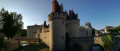
(7) You’ll come out onto a small road; follow it to the right for about 700 m. Note the dovecote at Château du Fort opposite.
(8) Just before the dovecote, level with two electricity poles on either side of the road, turn right onto a grassy path (yellow arrow). Cross a river, either by fording or via a wooden footbridge, and head up the other side along a tarmac lane.
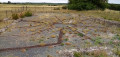
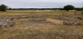
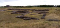
(9) At the next junction, keep to the right. After house number 16, ignore a dead-end on the right and turn left. At the Stop sign, follow the D15 to the right and leave Cheneché. After about a hundred metres, turn left into a dead-end with a worn tarmac surface. Pass through a gate leading to the Gallo-Roman site of Les Tours Mirandes.
(10) Then turn left (red and green arrow) to go round the site on the left-hand side. Pass the remains of small buildings, a circular temple and a basilica, which is now fenced off (central information board). Then turn right onto the gravel path and walk along the right-hand side of a vast grassy area, the remains of the Gallo-Roman site’s esplanade. At the end, walk past the car park and continue straight on, following the wall of a property. Cross a stream and walk gently uphill.
(11) At the Stop sign, turn right and, at the junction immediately ahead, turn right onto Rue de la Pierre qui Vire (green marker). Take thefirst left, into Rue Charles Martineau. At the end, turn left. Take thefirst right, into Rue du Quatorze Juillet. Cross the D757 at the pedestrian crossing and you’ll come back to the church car park (S/E).


 WE DO THIS TOUR ONCE A YEAR AND ARE ALWAYS VERY IMPRESSED BY THE QUALITY OF THE VEGETABLE GARDENS ALONG THE PALU.
 Visorando Member


 Tourist office
 Easy
Easy