


 Country:
 City:


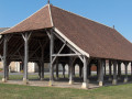
Start from the car-sharing area at the Saint-Genest-d’Ambière sports complex, on the edge of Rue du Stade.
(S/E) Head towards the village centre along the Grand-Rue. At the Carrefour Joyeux junction, continue along Rue de la Croix-Boutet, then Route de la Boutinière, until you reach Route des Rideaux on the left.
(1) Follow this road, then turn right onto Impasse de la Sablière. At the end of the street, continue straight ahead along the grassy path and head downhill until you reach a road. Follow it to the right, then take the track on the right. At the three-way junction, veer to the right, head into the forest and reach a four-way junction.
(2) Turn left and rejoin the track you left earlier. Turn left, then right at the next junction. Carry on straight ahead until you reach the D725.
(3) Follow it to the right, taking care, for a few metres, then take thefirst path on the left which leads into the woods. At the factory, take the path on the left and you’ll reach a crossroads.
(4) Carry on straight ahead along the Routes des Diligences (the old stagecoach route linking Ligugé to Fontevrault), skirting a residential area on your left; ignore Rue de la Garenne on your left and carry on straight ahead. Then continue along a grassy track until you reach a road.
(5) Turn right and follow the road to the next junction. Turn right onto Route de Berthault, pass through the hamlet and reach a crossroad (D20).
(6) Walk a few metres to the left and take the track on the right, then take thefirst path on the left. Follow it straight on until you reach the tarmac road at the hamlet of La Bruyère.
(7) Head straight ahead, then take thefirst track on the right until you reach the next fork. Turn left, rejoin the tarmac at the hamlet of Château Gaillard and continue straight on until you reach the ruins of the old hemp factory.
(8) Turn back a few metres until you reach the crossroads. Leave the tarmac road and take the path that runs between the two roads. At the four-way junction, carry on straight ahead and take thefirst path on the left, about fifty metres before the end of the woodland.
(9) Turn onto this path and head for the hamlet of Pré Girault. Walk through the hamlet and continue along the road until you reach the ‘Stop’ sign on Route de Vendeuvre. Head straight ahead, slightly to the left, onto Rue de la Fosse Picault and follow it to the end.
(10) Take the path on the right and, at the next junction, turn left onto a road.
(11) Follow it to the left, passing a wayside cross on your left, then take the path on the right which winds its way between the fields, climbing slightly. At the copse, turn left and join a road.
(12) Turn left, then take the road on the left towards L’Eau Mouillée. Continue along a path until you reach a four-way junction.
(13) Turn left and, when you reach the road, make the first turn left then right to continue along the path, almost directly opposite, which runs alongside a fence. Continue along a road, ignore the one branching off to the left and carry on straight ahead until you reachthe first path on the left, a few metres before No. 4.
(14) Take this track, then follow the road to the right. At the junction, on the edge of the woods, turn left, then take the track suitable for vehicles on the right. At the road, turn right and head towards a multi-way junction.
(15) Turn right, towards Feneau. Pass through the hamlet and carry on until you reach a 90° bend to the right.
(16) Take the path on the left, then turn right straight away and join the Route des Clos. Follow it to the right, then take the Allée de l’Orée des Bois on the left. Leave the hamlet and enter the forest. Cross a road (D76) and continue straight ahead until you reach a four-way junction.
(17) Carry on to the right and continue to the foot of the railway line. Turn right and cross the bridge over the railway.
(18) Turn left as you leave the bridge, then turn right immediately. Head through the woods, cross a road and carry on straight ahead until you reach the next one. Opposite No. 11, turn right and then immediately left onto Chemin de l’Hermitage. Follow this path straight ahead until you reach the first houses in Scorbé-Clairvaux.
(19) Turn right and head towards the entrance to Clairvaux Castle. Opposite the entrance, turn left onto the driveway and head towards the granaries (on your left). Carry on to the right, then turn left onto Rue de Vivert and follow it to the Town Hall. Turn left onto the D725, then immediately right onto the D23, towards Saussay, and reach the greenway.
(20) Turn left onto it, heading towards Lencloître, and follow it until thesecond road crossing. Leave the greenway, turn right and, at the 90° right-hand bend in the road, take the path straight ahead. Continue straight on until thesecond four-way junction.
(21) Turn left, then take thefirst path on the right. Walk past a farm and head downhill to the crossroads.
(22) Carry on to the left, cross the railway bridge and head for the car-sharing area at the Saint-Genest-d’Ambière sports complex (S/E).

 Visorando Member


