Montfaucon route from Jaunay-Marigny

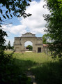
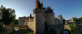
Set amongst market gardens and private castles, the Montfaucon route takes you to explore, in particular, the castle of the same name, a fine example of a small medieval keep. Built inthe 14th century, Montfaucon is the oldest civil building in the commune. It was remodelled inthe 15th century, at which point it lost some of its defensive character in favour of a more residential function.

Details

10023415
Creation:
Last update:
Last review:
  • Walking
    Activity: Walking
  • ↔
    Distance: 7.55 mi
  • ◔
    Average duration: 3h 45 
  • ▲
    Difficulty: Moderate

  • ⚐
    Back to start: Yes
  • ↗
    Ascent: + 289 ft
  • ↘
    Descent: - 289 ft

  • ▲
    Highest point: 456 ft
  • ▼
    Lowest point: 253 ft

Photos

Description of the walk

Start at the Town Hall Square in Marigny-Brizay. Follow signs for ‘Beaumont’, go round the church via Rue Jean Arnaud; at the junction, keep left onto the D82 and leave the town. About 200 metres after leaving the town, you’ll reach Chemin de Montfaucon.

(1) Turn left onto this track and pass the Château de Montfaucon, which is on your left.

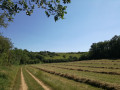
(2) After the château, turn right then left onto a track running alongside a vineyard. Continue straight on until you reach the high-speed rail line (LGV).

(3) Turn right, follow the LGV for about 500 m and take the underpass on the left. At the exit, turn left, then turn right again towards the village of Chenagon. Join the D82 and cross it (take care).

(4) Continue straight on for about 400 m and take the small road on the right for about 650 m. After a wide bend to the left followed by another to the right, with a walnut tree on the right, you’ll reach the start of a path (opposite a marker post at elevation 102).

(5) Turn right onto this path, which cuts across the fields. At the junction, turn left and pass under the high-speed rail line again. As you emerge from the underpass, you’ll see the sports complex on your right. Ignore the path on the right leading towards the stadium and turn left to follow the fitness trail. Follow this route, which comes out at the stadium.
Walk past the changing rooms and join the D20.

(6) Cross the road at the farm on the left and take the path towards Parc Roger. Walk past the market gardens; at the junction, turn left, leaving a pond on your left, and ignore the turnings to the right or left until you reach the crossroads with Chemin de Santilly.

(7) Turn right at the edge of a wood. At the next junction, turn right onto a path that climbs towards Brizay Castle, leaving a small wood on your right. Join the D21.

(8) Follow it to the right for about a hundred metres (this is a busy road, so take care), then take the small road on the left leading to the hamlet of Méoc.
Ignore the path straight ahead and turn right. Walk between the cave dwellings and the truffle fields and leave Méoc

(9) On leaving the hamlet, leave the Méoc path and turn left, along the edge of the woods, to reach the Château de la Mare. Walk past the foot of the castle and continue straight on until you reach Rue Auguste Poulin in Marigny.

(10) Turn right to reach the town hall square (S/E).

Waypoints

  1. S/E : mi 0 - alt. 348 ft - Car park at the Town Hall Square
  2. 1 : mi 0.55 - alt. 371 ft - Chemin de Montfaucon
  3. 2 : mi 0.99 - alt. 443 ft - Montfaucon Castle
  4. 3 : mi 1.37 - alt. 420 ft - High-Speed Line
  5. 4 : mi 2.2 - alt. 358 ft - Village of Chenagon – D82
  6. 5 : mi 2.8 - alt. 335 ft - Junction – Cote 102
  7. 6 : mi 4.19 - alt. 272 ft - D20 junction
  8. 7 : mi 4.84 - alt. 276 ft - Crossroads – The market gardeners
  9. 8 : mi 6.41 - alt. 387 ft - D21 junction
  10. 9 : mi 6.71 - alt. 430 ft - Exit at Méoc - Château de la Mare
  11. 10 : mi 7.35 - alt. 387 ft - Rue Auguste Poulin – Marigny
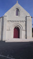
  12. S/E : mi 7.55 - alt. 348 ft - Car park at the Town Hall Square - Église Saint-Étienne (Jaunay-Marigny)

Notes

The ‘L’Igny-Marin’ grocery shop, situated opposite the Town Hall, is a good place to pick up a few items, particularly local produce.

You can enjoy a refreshing drink after your walk at the Café de la Poste on Rue Jean Arnaud, about thirty metres from the Town Hall Square.

Reviews and comments

3.8 / 5
Based on 3 reviews

Reliability of the description
4.3 / 5
Ease of following the route
3.7 / 5
Route interest
3.3 / 5
Couturiers 86
Couturiers 86

Overall rating : 4.3 / 5

Date of your route : Oct 01, 2023
Reliability of the description : ★★★★★ Very good
Ease of following the route : ★★★★☆ Good
Route interest : ★★★★☆ Good
Very busy route : Yes

The route follows the description and the route shown on the map.
The walk took place in sweltering autumn heat.
There is little shade along this route.

Machine-translated

AYRAULT DANIELLE
AYRAULT DANIELLE

Overall rating : 3.3 / 5

Date of your route : Sep 20, 2021
Reliability of the description : ★★★★☆ Good
Ease of following the route : ★★★★☆ Good
Route interest : ★★☆☆☆ Disappointing
Very busy route : No

At number 3 along the LGV – it’s not looked after at all. What a shame – nothing special about it at all!!!
Machine-translated

Chamdom
Chamdom
• Edited:

Overall rating : 3.7 / 5

Date of your route : Sep 02, 2021
Reliability of the description : ★★★★☆ Good
Ease of following the route : ★★★☆☆ Average
Route interest : ★★★★☆ Good
Very busy route : No

An interesting walk, but one best avoided in hot weather as there isn’t much shade along the way. The final stretch is the most interesting part.

Machine-translated

Other walks in the area

For more walks, use our search engine .

The GPS track and description are the property of this route's author. Please do not copy them without permission.