The Pendants route in Dissay

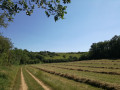
A walk through the fields, with panoramic views.
Route recommended by the Dissay local council and the Les Randonneurs Pédestrians association.

Details

1249241
Creation:
Last update:
Last review:
  • Walking
    Activity: Walking
  • ↔
    Distance: 4.41 mi
  • ◔
    Average duration: 2h 15 
  • ▲
    Difficulty: Easy

  • ⚐
    Back to start: Yes
  • ↗
    Ascent: + 240 ft
  • ↘
    Descent: - 236 ft

  • ▲
    Highest point: 361 ft
  • ▼
    Lowest point: 200 ft
  • ⚐ Country: France
  • ⚐ City: Dissay (86130)
  • ⚑
    Start/End: N 46.698788° / E 0.427848°
  • ❏
    IGN map(s): Ref. 1826SB
  • Hour-by-hour weather

Photos

Description of the walk

The walk starts at the small car park in front of the primary school, where you’ll find the information board for the walks.

(S/E) As you leave the car park, take Rue du Parc on the left, then turn right towards the municipal campsite.

(1) In front of the campsite, take the small path on the right that runs between the campsite and a series of gardens. Cross the small bridge over the canal, and turn left onto the small road. Follow this road, keeping the forest paths on your right. After the bend, at the T-junction, turn left.

(2) Take the main road (Rue des Lordières) on the left (do not turn into Rue du Parc). After a few metres, turn right into Rue du Puits, then right again into Chemin des Ribatons. Follow this path uphill; it curves to the left as the tarmac ends, then turns sharply to the right (do not continue straight on: private property). As you continue uphill, the track winds round a few bends, with no other junctions. After a sharp bend and a straight stretch, you’ll reach a T-junction and turn right.

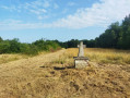
(3) At the next T-junction, facing the view over the Clain valley (you can see Futuroscope), turn right onto the descending path. At the bottom of the valley, at the junction, turn left.
N.B. At point (3), it is also possible to turn left to walk along the top of the hill and rejoin the route shortly afterwards (5).

(4) From this point, you can follow a short interpretive trail on the Coteau des Pendants, which veers slightly off the main route before rejoining it (white signs marked ‘Coteau des Pendants’).

(5) As you leave the valley, turn left at the T-junction. Continue straight on along theGR® de Pays des Trois Batailles de Poitiers (red and yellow markings). This follows the old route of a Roman road and a pilgrimage route to Santiago de Compostela. Cross two tarmac roads (take care when crossing, especially the first one, the D85).

(6) At the third tarmac road (Rue du Puits Pineau), turn left. Leave the road shortly afterwards, as it curves to the left, and continue straight on along the dirt track. At the junction, go straight on. You’ll come out onto the D15; follow it to the left.

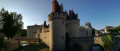
(7) Take the first left (towards the guesthouses), Rue de Bellevue. Pass two cul-de-sacs and then two streets on the right. When the road bends to the left, carry on straight ahead along the gravel track. The track descends to the main road. Then turn left, walk past the château, and turn right to reach the car park (S/E).

Waypoints

  1. S/E : mi 0 - alt. 210 ft - School car park
  2. 1 : mi 0.1 - alt. 207 ft - Campsite
  3. 2 : mi 0.6 - alt. 213 ft - Main street
  4. 3 : mi 1.37 - alt. 325 ft - Coteau des Pendants
  5. 4 : mi 1.93 - alt. 249 ft - Route information
  6. 5 : mi 2.25 - alt. 285 ft - Roman road
  7. 6 : mi 3.33 - alt. 292 ft - Departmental road
  8. 7 : mi 3.9 - alt. 282 ft - Residential area
  9. S/E : mi 4.41 - alt. 210 ft - School car park

Notes

Yellow markings throughout the route, very few in the opposite direction.

There is very little shade along the route, so bring sun protection in summer.

Worth a visit

- Dissay Castle.
- There are two other signposted walks in Dissay (the routes overlap).

Always be cautious and plan ahead when you're outdoors. Visorando and the author of this route cannot be held responsible for any accidents occurring on this route.

The GR® and PR® markings are the intellectual property of the Fédération Française de Randonnée Pédestre.

Reviews and comments

4.8 / 5
Based on 2 reviews

Reliability of the description
5 / 5
Ease of following the route
5 / 5
Route interest
4.5 / 5
damsi
damsi

Overall rating : 5 / 5

Date of your route : May 26, 2019
Reliability of the description : ★★★★★ Very good
Ease of following the route : ★★★★★ Very good
Route interest : ★★★★★ Very good

We really enjoyed this walk. The views were varied; we hadn’t been to Les Pendants before – these hills enjoy an exceptional microclimate. We were treated to lovely views of the fields of Poitou in the spring sunshine and enjoyed walking along a section of the GR trail that runs from Tours to St Jacques along an ancient Roman road.

Machine-translated

AYRAULT DANIELLE
AYRAULT DANIELLE

Overall rating : 4.7 / 5

Date of your route : Oct 20, 2018
Reliability of the description : ★★★★★ Very good
Ease of following the route : ★★★★★ Very good
Route interest : ★★★★☆ Good

From point 4 (the slopes of Les Pendants) onwards, the path is full of holes dug by badgers and rabbits; be careful not to trip...
This route is ideal for a breath of fresh air up in the hills.

Machine-translated

Other walks in the area

For more walks, use our search engine .

The GPS track and description are the property of this route's author. Please do not copy them without permission.