Country:
 City:
City:



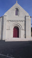
Park in the car park on Place du 8 Mai 1945, near the school.
(S/E) With your back to the castle, walk past the school on your left and turn into Rue du Parc. At the junction, turn right towards the campsite. In front of the campsite, take the path to the right of the entrance which runs alongside the campsite and the gardens. Cross the small stream and join a cycle path.
(1) Follow the cycle path to the left, which is also open to pedestrians. Turn left with the path, cross the stream again and arrive at a T-junction.
(2) Then turn left onto Chemin des Marais. At the junction, take thesecond left, Rue des Lordières. Then take thefirst right, Rue du Puits, which goes uphill, then thefirst right again, Chemin des Ribatons.
(3) At the end of the tarmac, continue along a track that veers to the right (south-west) and climbs. Further on, the track turns left (south-east) and becomes more or less level.
(4) At the T-junction, turn right. At the next T-junction, turn right again and head down a gentle slope. At the bottom, at another T-junction, turn left. Follow the path which winds at the foot of Les Pendants and leads to a T-junction.
(5) Follow theGRP® des Trois Batailles de Poitiers to the right, along the route of an ancient Roman road. At the junction (elevation 87), turn left. Continue straight on, ignoring the turn-offs to the left. You’ll come out onto the D85 and follow it as it continues.
(6) At the three-way junction, veer left. Shortly afterwards, when the road bends to the left, veer right onto a path leading towards a copse. Walk alongside it on your left-hand side and, when the path bends to the right, continue straight on, walking alongside another copse on your right-hand side. Continue through the fields along this path, which heads east-northeast.
(7) At the junction just before a wood, turn left towards the hamlet of Villevert. You’ll come out onto a road; follow it to the right to cross the hamlet.
(8) At the end of the road, first turn right then left to follow a path towards a wood. Stay on the edge of the wood, then enter it. You’ll come out onto a small road; follow it to the right towards La Cormaillère.
(9) Before the hamlet sign, leave the road and take the path on the left. Continue straight on, heading west-north-west. Pass under a high-voltage power line and rejoin the tarmac road. At the junction, turn left and you’ll soon reach a crossroads in the hamlet of Les Tiers.
(10) Cross the road and carry on straight ahead. A little further on, cross another road and continue straight ahead for about a hundred metres. When the road bends to the left, carry on straight ahead along a track. At the next junction (marker 98), go straight ahead, slightly downhill. You’ll come out onto the D15 near the cemetery and follow it to the left for about a hundred metres.
(11) At the junction, turn left into Rue de Bellevue, which climbs slightly. Ignore two turn-offs on the right. At the junction (with a cross), carry straight on, ignoring a further two turn-offs on the right and then one on the left, and follow Rue du Trait de la Charbonnerie (pedestrian street). Head steeply downhill to the castle.
(12) Turn left, then right, to reach the car park (S/E).


 Visorando Member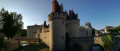
 Easy
Easy 

 Tourist office