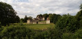
Walk from Clos Barault to Colombiers

A lovely family walk through the woods with beautiful views over the Envigne valley and Haut-Clairvaux.

Details

3148415
Creation:
Last update:
Last review:
  • Walking
    Activity: Walking
  • ↔
    Distance: 4.17 mi
  • ◔
    Average duration: 2h 05 
  • ▲
    Difficulty: Easy

  • ⚐
    Back to start: Yes
  • ↗
    Ascent: + 194 ft
  • ↘
    Descent: - 210 ft

  • ▲
    Highest point: 476 ft
  • ▼
    Lowest point: 305 ft

Description of the walk

Park in the car park at Place de Manderen, next to the Town Hall.
Please note: yellow signposting is currently being installed.

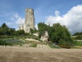
(S/E) Opposite the Town Hall, turn left into Rue de la Perroterie, then left again onto Route des Vignes. Admire the view of the Haut-Clairvaux tower in Scorbé-Clairvaux.

(1) Veer to the right, continue along the road for about 120 metres, then turn right into the woods, just after the sign marking the exit from Colombiers. Stay on a pleasant, straight, sandy and stony path for 200 metres.

(2) Turn left onto a cross-country path lined with heather and, at the end of this path, turn left again onto a semi-tarmacked track, following the fenced-off Bois du Clos Barault.

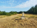
(3) Just past the fire warning sign, turn right following the sign for “path no. 8 Croix de Jude”, continuing to follow the fence and taking a stonier path. At the end of this path, turn right onto the widest path situated between the Château du Rouet estate and the Bois du Clos Barault. Ignore the descent to the left and continue along this path, which is lined with large stones, until you reach the Croix au Jude.

.(4) Turn right, towards L’Erpinerie, onto a small sandy track which widens before turning sharply right and then immediately left. Walk along a pleasant grassy path, partly lined with pine trees, until you reach a four-way junction.

(5) Turn right, follow the road for 50 m, then turn right onto a wide path flanked by a ditch lined with beautiful oak trees, broom and vines for about 1 km.

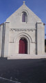
(6) Turn left onto a grassy path and head down to Rue la Perroterie. Turn left and follow this street, which first turns right then left. Once at the bottom, turn right onto Route des Lavoirs and turn right at the church to reach Place Manderen (S/E).

Waypoints

  1. S/E : mi 0 - alt. 338 ft - Car park on Place Manderen
  2. 1 : mi 0.28 - alt. 436 ft - View of the Haut-Clairvaux Tower
  3. 2 : mi 0.54 - alt. 469 ft - Heather path
  4. 3 : mi 1.33 - alt. 459 ft - Path on the right
  5. 4 : mi 2.28 - alt. 407 ft - Croix au Jude, on the right towards L’Érpinerie
  6. 5 : mi 3.01 - alt. 466 ft - Four-way junction
  7. 6 : mi 3.61 - alt. 476 ft - On the left, along a grassy path
  8. S/E : mi 4.17 - alt. 338 ft - Car park on Place Manderen

Worth a visit

Church dating from the 12th to the 15th centuries.

The Haut-Clairvaux keep in Scorbé-Clairvaux.

Reviews and comments

4.6 / 5
Based on 3 reviews

Reliability of the description
4.3 / 5
Ease of following the route
5 / 5
Route interest
4.3 / 5
User 26986997

Overall rating : 4.7 / 5

Date of your route : Jul 27, 2026
Reliability of the description : ★★★★☆ Good
Ease of following the route : ★★★★★ Very good
Route interest : ★★★★★ Very good
Very busy route : No

A very pleasant walk, with lovely shaded sections; I’d recommend it on very sunny days like we’ve had recently!

Machine-translated

FOURNYMICHELLE1
FOURNYMICHELLE1

Overall rating : 4.3 / 5

Date of your route : Mar 10, 2026
Reliability of the description : ★★★★☆ Good
Ease of following the route : ★★★★★ Very good
Route interest : ★★★★☆ Good
Very busy route : Yes

A lovely walk on a spring Sunday morning

Machine-translated

Grand Châtellerault
Grand Châtellerault

Thank you very much, Danièle Perdreau, for your feedback.

Machine-translated

daniele PERDEREAU
daniele PERDEREAU

Overall rating : 4.7 / 5

Date of your route : Mar 15, 2021
Reliability of the description : ★★★★★ Very good
Ease of following the route : ★★★★★ Very good
Route interest : ★★★★☆ Good
Very busy route : Yes

A very well-signposted and enjoyable walk

Machine-translated

Other walks in the area

For more walks, use our search engine .

The GPS track and description are the property of this route's author. Please do not copy them without permission.