


 Country:
 City:
City:


The route starts at Place de la Liberté in Thuré, at the walking sign.
(S/E) At right angles to the sign, cross the road and take the small Rue du Lycée. Walk past this agricultural college and its car parks. Continue to the top of the hill.
(1) Turn right at the buildings onto a grassy path. Then head downhill to the left and turn left again, following a ditch. Next, head uphill to the right between the fields towards the houses higher up at La Guillonnière, at the top of the hill.
(2) Turn right and walk alongside the houses. Take the road as you leave La Guillonière, then follow it downhill to a Fork in the road.
(3) Turn left and head up the sunken track towards La Fouctière. After the hamlet, you’ll reach the woods and come to a crossroads.
(4) Turn right along the stone wall. Walk past the pylon and the vineyards, with unobstructed views of the countryside. At the end of the path, head down to the right onto the very stony track. Enjoy the view and walk past an imposing building, continuing to the road (D43).
(5) Cross it carefully and continue straight ahead to a junction.
(6) Here, you have two options:
- For the shorter route (approx. 6.8 km), turn right and follow the main route from the next reference point (6) further on in the description.
- For the full walk, as shown on the map, turn left onto a path leading to the road at the foot of the gates of Plante Castle. Follow it to the right and, at the cross, take the small path on the right running parallel to the road until you reach the bend.
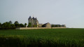
(7) Turn right towards an imposing slate-roofed building. Go straight on at the junction, then head back along a small road to Le Poudreau.
(8) Ignore the path on the right, then the one on the left. Head straight ahead between the newer houses. On leaving the village, go straight on and take a straight path to its end at the T-junction.
(9) Turn right towards the poplars. At the three-way junction, take the left-hand hairpin bend. Climb gently, then, at the hamlet, head down the stony path to the road.
(10) Turn left onto the road, keeping carefully to the left-hand side. On the left, you’ll catch a glimpse of the Château de la Genauraye, home to Maurice Bedel. On the right, you’ll see the Usseau quarries. This will take you to a road junction.
(11) Turn left onto the D43 and follow the hedgerows of the château grounds. Take thefirst left, going round the château grounds. Head downhill again, enjoying the beautiful panoramic views. Continue to the T-junction you passed earlier.
(9) Turn right and, following the route in reverse to the outward journey, return to the junction you also passed earlier.
(6) Head straight on along the hedgerows running perpendicular to the path until you reach the next Fork in the road (signpost).
(12) Turn sharply left at the junction. At the road, carefully head down to the right. Pass the dead-end road, then turn right for a few metres.
(13) Carefully turn left onto the narrow Rue de la Pinotière. Cross a small bridge. Join a road and turn right onto it until you reach the sign for Thuré.
(14) Pass this sign. After the bend, turn left onto the footpath running alongside the housing estate to avoid the road until you reach the first path on the right (Rue Bernard Buffet).
(15) Follow this road, then turn left twice until you reach a small path leading to the D43.
(16) Cross the road by first turning left then right and continue along Rue des Crapaudins. Walk behind the school, with the secondary school’s greenhouses visible in the distance to the right. At the end, turn right onto the D14 and return to Place de la Liberté (S/E).

 Visorando Member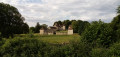

 Tourist office
 Easy
Easy 
