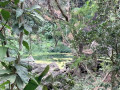
Rivière des Galets, Sans-Souci

A short walk with views of the river and the sea. Suitable for children aged 10 and 12.

Details

n°54180
Creation:
Last update:
Last review:
  • Walking
    Activity: Walking
  • ↔
    Distance: 4.13 mi
  • ◔
    Average duration: 2h 25 
  • ▲
    Difficulty: Moderate

  • ⚐
    Back to start: Yes
  • ↗
    Ascent: + 587 ft
  • ↘
    Descent: - 587 ft

  • ▲
    Highest point: 945 ft
  • ▼
    Lowest point: 331 ft

Description of the walk

Start from La Poste des Galets.

(S/E) Find the access point to the river near the Rivière des Galets post office. Cross the river with care once or several times, depending on the weather conditions over the previous few days.
Follow the yellow markings, which will lead you out of the river to the south, and continue following them until you pass a small cemetery and reach the small tarmac road.

(1) Turn left onto the road until you reach the first hairpin bend. Then take the small path that leads uphill through the grass to a wayside shrine.
Take the main path on the left until you reach the road leading up to Sans-Souci.

(2) Take the road on your left. Walk past a Hindu temple with blue façades. Further up, you’ll pass a small children’s playground.

(3) Take the path on your left. Take the first hairpin bend to the right, then the second to the left.

(4) At the third hairpin bend, go straight on down the path. Opposite you, there is a 90° right-hand bend; do not turn there, but head straight ahead into the vegetation.
A path will take you to the Rivière des Galets.

(5) Once you reach the riverbed, simply turn left one last time and find a way to cross the river to get back to your car in the village (S/E).

Waypoints

  1. S/E : mi 0 - alt. 358 ft - La Poste des Galets
  2. 1 : mi 0.95 - alt. 476 ft - Turn left onto the road
  3. 2 : mi 1.15 - alt. 646 ft - Turn left onto the road
  4. 3 : mi 1.54 - alt. 810 ft - Turn left onto the path
  5. 4 : mi 2.06 - alt. 912 ft - 3rd hairpin bend, straight ahead
  6. 5 : mi 2.61 - alt. 440 ft - Rivière des Galets (fleuve)
  7. S/E : mi 4.13 - alt. 358 ft - La Poste des Galets

Notes

Remember to take water and a snack, as well as a good pair of shoes.

Reviews and comments

3.7 / 5
Based on 2 reviews

Reliability of the description
3.5 / 5
Ease of following the route
3.5 / 5
Route interest
4 / 5
patldl
patldl

Overall rating : 3 / 5

Date of your route : May 04, 2023
Reliability of the description : ★★★☆☆ Average
Ease of following the route : ★★★☆☆ Average
Route interest : ★★★☆☆ Average
Very busy route : No

A nice little outing – nothing too fancy – if you’ve got two or three hours to spare whilst you’re in La Possession.
There’s a lovely view of the pebble-strewn river once you reach the village of Sans-Soucis.
Please note that, right from the start, flooding has altered the riverbank. To get out properly and return to point (1) on the map, you need to continue downstream for 200–300 metres, then climb up the bank to reach the tarmac road that takes you past the small cemetery.
Also be careful when crossing the river, as it is very slippery and you’ll need to take your shoes off (wear sandals if possible).

Machine-translated

alainbellot
alainbellot
• Edited:

Overall rating : 4.3 / 5

Date of your route : Dec 05, 2016
Reliability of the description : ★★★★☆ Good
Ease of following the route : ★★★★☆ Good
Route interest : ★★★★★ Very good

Stunning views throughout the hike in Mafate

Machine-translated

Other walks in the area

For more walks, use our search engine .

The GPS track and description are the property of this route's author. Please do not copy them without permission.