


Refine your search for walks in Lucey (Savoie)
Lucey (Savoie) walks


 Lucey and Jongieux circuit
 Visorando Member
 7.64 mi
 +1,129 ft
 -1,129 ft
 4h 30
4h 30
 Moderate
 Departure from Lucey (Savoie) (Savoie)
This circuit runs along a sunny hillside. It takes you to the heritage sites of the commune of Lucey and offers a beautiful view of the Jongieux vineyards dominated by the Saint-Romain Chapel.
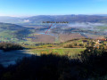
Loop around Jongieux
 6.60 mi
+1,106 ft
-1,119 ft
4h 00
Moderate
Departure from Jongieux (Savoie)
6.60 mi
+1,106 ft
-1,119 ft
4h 00
Moderate
Departure from Jongieux (Savoie)
Tour of the vineyards of the Savoyard hinterland.
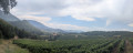
Circuit around Mont Landard from Jongieux
 10.63 mi
+1,804 ft
-1,821 ft
6h 30
10.63 mi
+1,804 ft
-1,821 ft
6h 30
 Difficult
Departure from Jongieux (Savoie)
Difficult
Departure from Jongieux (Savoie)
A pleasant route starting from Jongieux, alternating between sections through the vineyards of the Savoyan foothills and through woodland, culminating in a route around Mont Landard and its viewpoint overlooking Saint-Pierre-de-Curtille.
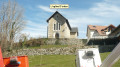
On the heights of Jongieux
 7.78 mi
+2,274 ft
-2,260 ft
5h 35
Moderate
Departure from Jongieux (Savoie)
7.78 mi
+2,274 ft
-2,260 ft
5h 35
Moderate
Departure from Jongieux (Savoie)
A pleasant, varied walk, with sections through vineyards, others through forest and some beautiful panoramic views.
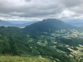
Mont de la Charvaz circular route from Ontex
 5.84 mi
+1,847 ft
-1,850 ft
4h 20
Moderate
Departure from Ontex (Savoie)
5.84 mi
+1,847 ft
-1,850 ft
4h 20
Moderate
Departure from Ontex (Savoie)
Mont de la Charvaz can be climbed from various sides. Here is a circular route offering a variety of routes from Ontex: ascent via La Cauche and the western slope, and a more direct descent via the mountain itself.
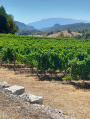
 Route of the wine-growing villages of Bugey, starting from Lac du Lit au Roi.
 26.06 mi
+1,745 ft
-1,762 ft
4 hrs
26.06 mi
+1,745 ft
-1,762 ft
4 hrs
 Easy
Departure from Cressin-Rochefort (Ain)
Easy
Departure from Cressin-Rochefort (Ain)
Starting from Lac du Lit au Roi, passing by Lac de Barterand and then through the wine-growing villages of Bugey, Flaxieu, Pollieu, Vongnes, Ceyzerieu and its hamlets, and Saint-Martin de Bavel.Views of the Grand Colombier and the Lavours marshes.Circular with return to Lac du Lit du Roi for a quick dip.
Mont Landard circuit
 3.97 mi
+719 ft
-725 ft
2h 25
Easy
Departure from Saint-Pierre-de-Curtille (Savoie)
3.97 mi
+719 ft
-725 ft
2h 25
Easy
Departure from Saint-Pierre-de-Curtille (Savoie)
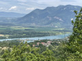
An easy walk in the Savoyard foothills starting from the curious Church of Saint-Pierre-de-Curtille.
The walk provides access to a pretty viewpoint over the Rhône river developments.
Lake Barterand
 5.10 mi
+1,145 ft
-1,119 ft
3h 20
Moderate
Departure from Cressin-Rochefort (Ain)
5.10 mi
+1,145 ft
-1,119 ft
3h 20
Moderate
Departure from Cressin-Rochefort (Ain)
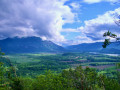
A peaceful hike on the border between Ain and Savoie. From the start, there is a beautiful view of the Rhône riverbed. Further on, you will see Lac de Barterand, bordered by unexpected sculptures in the rock. A short climb towards the flag reveals a beautiful view of the lake.
Circular at Hautecombe Abbey starting from the Ontex viewpoint
6.36 mi
+1,926 ft
-1,946 ft
4h 35
Moderate
Departure from Saint-Pierre-de-Curtille (Savoie)
This hike takes you to the remarkable site of Hautecombe Abbey, starting from the Belvédère d'Ontex, which offers a magnificent view of the site. The route is more difficult than it appears, with a somewhat uneven path above the lake and a fairly challenging final climb.
Mont de la Charvaz, loop from Billième
 5.21 mi
+2,103 ft
-2,103 ft
4h 15
Moderate
Departure from Billième (Savoie)
5.21 mi
+2,103 ft
-2,103 ft
4h 15
Moderate
Departure from Billième (Savoie)
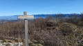
Among the many access routes to Mont de la Charvaz, this loop takes the most direct route to the summit, via its steep western face, and descends via gentler forest paths. The view from the summit over the Avant Pays Savoyard and the surrounding mountains is extensive.
The Mountain of Parves
 6.97 mi
+1,329 ft
-1,302 ft
4h 20
Moderate
Departure from Parves (Ain)
6.97 mi
+1,329 ft
-1,302 ft
4h 20
Moderate
Departure from Parves (Ain)
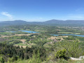
Parves and a few other villages are nestled between the old Rhône and the canal (actually the canalised Rhône): you could say that this area forms an island. The suggested walk takes place at low altitude through woods, forests, agricultural landscapes, villages and hamlets that have preserved or enhanced the typical buildings of the Bugey region. There is also a beautiful view of the Savoyard foothills.
La Charvaz - Ontex route
 10.70 mi
+3,035 ft
-3,015 ft
7h 35
Difficult
Departure from Billième (Savoie)
10.70 mi
+3,035 ft
-3,015 ft
7h 35
Difficult
Departure from Billième (Savoie)
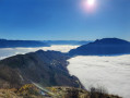
A medium-altitude hike in the Avant Pays Savoyard. Ideal for spring or autumn when there is still or already snow elsewhere.
The yellow markers and directional signs at the main intersections leave very little room for doubt.
Circular walk starting from Billième via Saint-Romain
 5.66 mi
+846 ft
-820 ft
3h 20
Easy
Departure from Billième (Savoie)
5.66 mi
+846 ft
-820 ft
3h 20
Easy
Departure from Billième (Savoie)
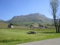
This circular walk starting from the village of Billième in the Savoyard foothills allows you to explore the region’s vineyards and take in some panoramic views.In autumn, along the path there’s a chestnut tree here, a walnut tree there – your pockets won’t be big enough for all the fruit you’ll gather. In the vineyards, the grape-pickers will surely have left a few grapes behind. If a hiker tries to slip off the path discreetly, follow them – it means they know a spot for mushrooms.
Circular route in the Montagne de Parves from the Pont de Nattages
 9.71 mi
+1,696 ft
-1,670 ft
5h 55
Moderate
Departure from Yenne (Savoie)
9.71 mi
+1,696 ft
-1,670 ft
5h 55
Moderate
Departure from Yenne (Savoie)
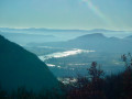
The Montagne de Parves is a promontory of the Bugey region, wedged between the Rhône diversion feeding the Belley waterfall and the route of the bypassed section of the Rhône passing through the Pierre-Châtel gorge. Its modest altitude makes it accessible all year round; the suggested route starting from Yenne offers a wide variety of landscapes and views, ranging from the banks of the Rhône, the site of Fort les Bans, the limestone plateau of Mont Chevreaux and the rural landscape of the commune of Parves-et-Nattages.
Circuit of viewpoints and balconies in Yenne
 5.26 mi
+1,040 ft
-1,040 ft
3h 20
Moderate
Departure from Yenne (Savoie)
5.26 mi
+1,040 ft
-1,040 ft
3h 20
Moderate
Departure from Yenne (Savoie)
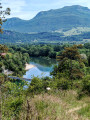
This is a half-day outing and the route is dotted with points of interest with information panels.
Until the Pré Cevin intersection, shortly after the Croix de Chevru, the route follows theGR® trail, which is part of the Way of St. James. Then follow the yellow markings until you reach your destination.