


Refine your search for walks in Livet-sur-Authou
Livet-sur-Authou walks


 Route de la Vallée du Livet
 Visorando Member
 4.59 mi
 +728 ft
 -614 ft
 2h 45
2h 45
 Easy
Easy
 Departure from Livet-sur-Authou (Eure)
A lovely walk through the listed Livet Valley with its springs and wash houses; a very shaded route with its narrow paths and remarkable trees. Throughout the walk, the tranquillity of this hike invites you to switch off.
Hike around Bec-Hellouin
 8.04 mi
+285 ft
-315 ft
3h 55
8.04 mi
+285 ft
-315 ft
3h 55
 Moderate
Departure from Le Bec-Hellouin (Eure)
Moderate
Departure from Le Bec-Hellouin (Eure)
An easy hike around Bec-Hellouin, through forest and old monuments:
old houses, an abbey and a monastery.
Saint-Vincent Forest Walk
 6.08 mi
+187 ft
-217 ft
3h 00
Easy
Departure from Glos-sur-Risle (Eure)
6.08 mi
+187 ft
-217 ft
3h 00
Easy
Departure from Glos-sur-Risle (Eure)
In the Montfort National Forest, an extended version of the Yellow-marked trail starting from the Saint-Vincent visitor centre, with a higher proportion of unpaved paths. Combining a wide variety of woodland settings, alternating between narrow paths and wide lanes, this route also offers an escape into a typical Normandy bocage landscape.
Path along the old railway line in Thierville
 4.63 mi
+427 ft
-446 ft
2h 30
Easy
Departure from Thierville (Eure)
4.63 mi
+427 ft
-446 ft
2h 30
Easy
Departure from Thierville (Eure)
Disused since the 1970s, the old railway line offers a superb elevated view of the Risle Valley. It makes for a lovely walk starting from a quiet, charming village and passing through the Montfort State Forest. Along the way, you’ll come across some remarkable trees, a small valley with a dry riverbed, a lovely patch of wooded countryside and, occasionally, a few cows, goats, hares or roe deer.
The little secret valley in Thierville
 5.38 mi
+328 ft
-358 ft
2h 45
Easy
Departure from Thierville (Eure)
5.38 mi
+328 ft
-358 ft
2h 45
Easy
Departure from Thierville (Eure)
Away from the marked trails lies a small valley with no waterways but full of charm. It is so hidden that the nightjar, a rare bird in Normandy, has been spotted there during its migration. Starting from the pretty village of Thierville, itself set apart from the Risle valley, this route takes you through varied forest environments and offers beautiful encounters such as the remarkable "Four Brothers" tree.
Mont Rôti in Saint-Georges-de-Vièvre
6.00 mi
+440 ft
-430 ft
3h 10
Easy
Departure from Saint-Georges-du-Vièvre (Eure)
On the hills near Pont-Audemer and Bec-Hélloin Abbey in the Risle Valley,on a clear day you can see the Seine estuary in the distance.
The Beuvron Loop to Montfort-sur-Risle
 7.45 mi
+545 ft
-535 ft
3h 55
Moderate
Departure from Montfort-sur-Risle (Eure)
7.45 mi
+545 ft
-535 ft
3h 55
Moderate
Departure from Montfort-sur-Risle (Eure)
A walk that allows you to explore the Risle Valley and follow some magnificent forest trails.
Medieval Heritage Route in the Val de Risle
 Tourist office
 7.72 mi
+354 ft
-348 ft
3h 50
Moderate
Departure from Montfort-sur-Risle (Eure)
7.72 mi
+354 ft
-348 ft
3h 50
Moderate
Departure from Montfort-sur-Risle (Eure)
This hiking route (unmarked) allows you to discover the history and architecture of four sites from the medieval period: Montfort Castle, the Priory and a seigneurial residence in Glos-sur-Risle. Along the way, you can discover various hydraulic structures on the Risle River. The hike ends with a long walk through the Montfort State Forest, which has been awarded the "Remarkable Tree" label for 11 of its trees.
The Forest of Montfort-sur-Risle, starting from the Lodge de la Motte
8.91 mi
+551 ft
-525 ft
4h 35
Moderate
Departure from Montfort-sur-Risle (Eure)
A very convenient walk if you are staying at the Lodge du Château de la Motte in Montfort-sur-Risle. The forest is home to a wide variety of tree species and overlooks the Risle Valley, offering a beautiful view.
Claireau forest and medieval walk
 6.19 mi
+394 ft
-371 ft
3h 10
Moderate
Departure from Montfort-sur-Risle (Eure)
6.19 mi
+394 ft
-371 ft
3h 10
Moderate
Departure from Montfort-sur-Risle (Eure)
Unmarked route, rich and varied, almost exclusively on paths.
The ruins of the medieval castle and the banks of the Risle at Château la Motte provide a beautiful end to this hike, which offers a wide variety of landscapes, between the national forest and the Claireau valley, as well as elements of natural heritage (remarkable trees) and historical heritage (Château la Motte, 18th-century wash house, etc.).
The Véronne Trail
5.55 mi
+453 ft
-469 ft
3h 20
Easy
Departure from Saint-Étienne-l'Allier (Eure)
You’ll be charmed by this refreshing walk, which offers numerous panoramic views of the Véronne valley, which has retained its traditional landscape of meadows enclosed by hedgerows and embankments, with its sunken paths lined with trees that are sometimes spectacular. The route crosses the Véronne (a tributary of the Risle) and follows the river several times; we are truly on the ‘waterways’.
Circular of the Risle lakes at Ponts Gras
 6.72 mi
+525 ft
-495 ft
3h 35
Moderate
Departure from Condé-sur-Risle (Eure)
6.72 mi
+525 ft
-495 ft
3h 35
Moderate
Departure from Condé-sur-Risle (Eure)
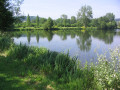
A flat, marshy valley, especially in winter, the Risle valley is bordered by forests on both sides. The ponds dug inthe 20th century alternate with the wet meadows of the ancestral Norman bocage. Encompassing all these landscapes, this route offers one of the few possible crossings of the Risle valley on footpaths.
Sarrasins footpath in Condé-sur-Risle
 7.07 mi
+640 ft
-610 ft
3h 50
Moderate
Departure from Condé-sur-Risle (Eure)
7.07 mi
+640 ft
-610 ft
3h 50
Moderate
Departure from Condé-sur-Risle (Eure)
In the Risle Valley in Normandy, a hike alternating between forest, sunken lanes and open plains. Stroll through the Sarrasins valley to discover a fountain lost in the heart of nature. The forest is the dominant feature, with numerous panoramic views. The bocage is very common, with many trees of remarkable size, especially the Chêne à Leude, which has been there since the Middle Ages.
Tour des Étangs, the roller coaster of Condé-sur-Risle
1.83 mi
+30 ft
-30 ft
0h 50
Easy
Departure from Condé-sur-Risle (Eure)
The Grand Huit goes around the ponds of Condé-sur-Risle and Appeville-Annebault. This route crosses the Risle on a bridge and offers a panoramic view and a discovery of the fauna and flora of the wetlands at the bottom of the valley. Three quarters of the route is located along the water's edge. Some poplar trees are remarkably tall.
Walk in the Véronne valley
 4.97 mi
+495 ft
-502 ft
2h 45
Easy
Departure from Campigny (Eure) (Eure)
4.97 mi
+495 ft
-502 ft
2h 45
Easy
Departure from Campigny (Eure) (Eure)
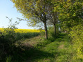
In Normandy, in the countryside near Pont-Audemer, there is a valley that has been preserved from urbanisation. The Véronne valley is ideal for walking along its sunken paths, which offer beautiful rural landscapes, natural sites of great beauty and interesting examples of built heritage.
This unmarked route crosses three official marked routes: one light blue route starting from Campigny (CY), one yellow route and one dark blue route starting from Saint Martin Saint Firmin (SM).