The Beuvron Loop to Montfort-sur-Risle

A walk that allows you to explore the Risle Valley and follow some magnificent forest trails.

Details

1040359
Creation:
Last update:
Last review:
  • Walking
    Activity: Walking
  • ↔
    Distance: 7.45 mi
  • ◔
    Average duration: 3h 55 
  • ▲
    Difficulty: Moderate

  • ⚐
    Back to start: Yes
  • ↗
    Ascent: + 545 ft
  • ↘
    Descent: - 535 ft

  • ▲
    Highest point: 354 ft
  • ▼
    Lowest point: 95 ft

Photos

Description of the walk

Start at Place des Annonciades.

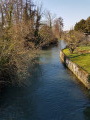
(S/E) From the market hall, turn left and walk up Rue Saint-Pierre to the square on the banks of the Risle.

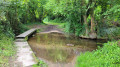
(1) Take the footbridge on the left over the river, then cross the car park and go over another footbridge. Walk up the street opposite. At Rue Saint-Pierre, turn left then right onto Rue de l’Écu.

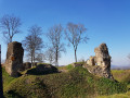
(2) Turn right onto the Sente Saint-Nicolas and follow it to the feudal castle.

(3) At the crossroads, turn left along the castle moat and then through the farmyard.

(4) Turn right onto the small road that crosses the farm, then follow a path that takes you
into the forest, where you’ll turn left twice to reach a road.

(5) At the water reservoir, turn right. Back in the forest, turn right at the gate, then
left to head down into the valley.

(6) At the bottom of the Grand Val, turn left. At the road, head up to the right as far as the Rond de Beuvron, then carry straight on.

(7) At the junction, leave the nature trail and head down to the right. At the bottom, turn right.

(8) Turn left to go under the railway tunnel and head back up the other side of the Grand Val, then turn right.

(9) At the top, take theGR®224to the right.

(10) Leave theGR®224, veer left and follow the path for about 900 metres.

(11) You can descend via the 220 steps. (Take care – they are very slippery.) Alternatively, continue straight on to reach the path in front of the castle and the descent towards Montfort via the Saint-Nicolas path to reach the car park (S/E).

Waypoints

  1. S/E : mi 0 - alt. 105 ft - Car park in front of the post office
  2. 1 : mi 0.2 - alt. 108 ft - Footbridge on the left - Risle (rivière)
  3. 2 : mi 0.57 - alt. 131 ft - Turn right onto the Saint-Nicolas path
  4. 3 : mi 0.74 - alt. 243 ft - Turn left along the moat of the > - Château Médiéval de Montfort sur Risle XIe - XIIe
  5. 4 : mi 0.89 - alt. 243 ft - Turn right to cross the farm
  6. 5 : mi 2.09 - alt. 295 ft - Turn right at the reservoir
  7. 6 : mi 2.91 - alt. 157 ft - Turn left at the bottom of the valley
  8. 7 : mi 4.06 - alt. 325 ft - Turn right at the junction
  9. 8 : mi 5.43 - alt. 180 ft - Turn left into the tunnel
  10. 9 : mi 6.03 - alt. 348 ft - Turn right onto the GR224
  11. 10 : mi 6.62 - alt. 325 ft - Turn left as you leave the GR
  12. 11 : mi 7.31 - alt. 285 ft - Steps on the left
  13. S/E : mi 7.45 - alt. 108 ft - Car park in front of the post office

Notes

Walking poles recommended on certain sections (crossing the farm track).
Signposting:GR®224; Blue and Yellow.

Worth a visit

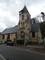
Sundial on the church façade, the medieval castle of Monfort, and numerous information boards about the area surrounding the town. Opportunities to sit down along the way (plenty of benches and a shelter at the Beuvron roundabout).

Always be cautious and plan ahead when you're outdoors. Visorando and the author of this route cannot be held responsible for any accidents occurring on this route.

The GR® and PR® markings are the intellectual property of the Fédération Française de Randonnée Pédestre.

Reviews and comments

4 / 5
Based on 3 reviews

Reliability of the description
3.7 / 5
Ease of following the route
4 / 5
Route interest
4.3 / 5
Geraldine76
Geraldine76

Overall rating : 4.3 / 5

Date of your route : May 18, 2023
Reliability of the description : ★★★★☆ Good
Ease of following the route : ★★★★☆ Good
Route interest : ★★★★★ Very good
Very busy route : No

The description between S/E and point 1 is rather unclear and the route is difficult to follow: we therefore shortened this section.
At point 3, forget about the moat: there’s grass, brambles and stinging nettles as tall as a person, and no path, so it’s virtually impassable. It’s better to go round the site by following the blue markers to the left and passing in front of the picnic tables. You’ll come back onto the small road a little further up.
At point 10, there’s no path, so carry on for about 50 m and follow the GR to the left to rejoin the route.
Apart from that, the walk is very pleasant with very little tarmac and shaded paths and tracks, mainly through woodland.

Machine-translated

noelja
noelja

Overall rating : 3.3 / 5

Date of your route : Jul 10, 2022
Reliability of the description : ★★★☆☆ Average
Ease of following the route : ★★★☆☆ Average
Route interest : ★★★★☆ Good
Very busy route : No

I fully agree with the comments from 8 March...
Did we lose the path after the moat...? We managed to find it again further on at Rond de Beuvron....
Otherwise, lovely, pleasant paths with no difficulties.

Machine-translated

GOGO
GOGO
• Edited:

Overall rating : 4.3 / 5

Date of your route : Mar 07, 2021
Reliability of the description : ★★★★☆ Good
Ease of following the route : ★★★★★ Very good
Route interest : ★★★★☆ Good
Very busy route : Yes

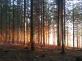
A pleasant little walk that isn’t too challenging. The woodland, which makes up almost the entire route, is lovely and is certainly even more beautiful in autumn.
A few comments on the route:
1. The (too) many waypoints at the start obscure the route on the printed map, which makes it difficult to follow.
2- At the starting point, when you turn left, the street sign is misleading as it says ‘rue du Franc Manoir’. It might be better to specify: ‘Turn left and walk past the church. Continue to the square…’.
3-At the end of the circular route on the island (1), there are two footbridges. If you take the first one, you’ll end up directly opposite Rue de l’Ecu. If you take the second one, the description is accurate.
4-From point 3, I suggest staying on the path along the top of the moat until you reach a flat section where you can rejoin the road on the left. This alternative avoids a section of tarmac road and allows you to make the most of the castle ruins.

Machine-translated

Other walks in the area

For more walks, use our search engine .

The GPS track and description are the property of this route's author. Please do not copy them without permission.