Country:
 City:
City:


Park in the car park next to Livet-sur-Authou Town Hall.
Blue-marked route.
(S/E) As you leave the car park, turn left straight away onto Rue du Village and take thefirst street on the left (Rue de la Vallée). Cross the Ruisseau de la White Cross, pass a mill and continue to the end of this street.
(1) Take the dead-end road, ‘Pied de la Côte’, on the right and follow it to the end.
(2) Take the country lane on the right to cross a small bridge over the Ruisseau de la White Cross, reach Rue du Vieux Moulin and head up to the D38.
(3) At the junction, cross carefully to take the path opposite and follow it up through the Bois de la Houssaye for about 2 km (if in doubt at any junctions, always keep to the right).
(4) Turn right, go up the small hill and you’ll reach a plateau facing a field. Continue along the path, veering slightly to the left, which runs alongside the field (Les Vas).
(5) Take thefirst path on the right, which continues to run alongside the field, and, at the end of the path, you’ll come to a road (Rue de la Davoudière) where there is a farm.
(6) Follow it to the right, skirting the farm, until you reach a Fork in the road; go down the slope taking the path on the left and, at the bottom of the slope, take the path on the right.
(7) Turn right into Rue André Join Lambert, walk down it towards the church whilst passing Livet-sur-Authou Castle on your left.
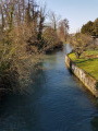
(8) Cross the junction carefully (take a moment to admire the old cedar tree) and continue straight on along Rue du Moulin Sainte-Marie, passing the church on your right and the river known as ‘le Torrent’ with its wash house on your left. Continue straight on until the next junction, passing an old mill.
(1) Turn right onto Rue de Vallée and cross the river again, then turn right onto Rue du Village to return to the car park at Livet-sur-Authou Town Hall (S/E).
 Visorando Member
 Moderate

 Tourist office