Country:

 City:
City:


The walk starts at the Pré de la Charité car park on Rue de la Rouche.
(S/E) Walk round the house at the end of the car park, cross the River Aulne and take the Sentier du Creux Chemin, which leads to the Place du Château.
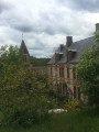
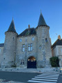
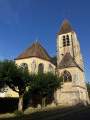
(1) You can admire the château and the church, though you’ll see them again later on the walk; for now, turn left as you come out of the path to join the Sentier de l’Aulne du Creux a little further on.
(2) Follow the path on the left downwards, which crosses over the river and climbs back up into Rue de la Rouche, where you turn left and walk down the street. You’re almost back at your starting point, but just before you reach it, take the third path on the right along this walk.
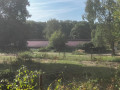
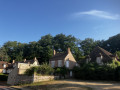
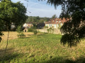
(3) The path climbs slightly alongside a field, and at the top offers a breathtaking view of La Celle. It’s a great spot for photos, particularly in the afternoon (with the sun behind you) and/or in winter (when there are fewer leaves on the trees to obscure the buildings). You’ll reach the Chemin de la Villeneuve, which you follow to the left to head back down to La Celle.
(4) At the sign for La Celle-les-Bordes, you can either turn right across the fields to join the Sente des Plesses or carry on straight ahead along Rue de la Masette. Either way, you’ll come out in front of the Café-restaurant des Cinq Anneaux (https://www.cinqanneaux.fr/), where you can stop for a break if you wish. Continue along Rue de l’Église, which offers a lovely view of the church and the castle, but don’t forget to turn right into Rue du Salfessier.
(5) This street has a strange name, the origin of which remains a matter of debate: did it once house workers who salted pigs, tanners, or simply sharecroppers working at the castle or on the surrounding farms until the mid-20th century? In any case, it’s a very pleasant street today and offers a lovely view of the large estate it runs alongside (pond, geese) and of Rue de l’Église. Turn back at the end of Rue du Salfessier
(5) Continue along Rue de l’Église and walk past the château.
(1) Turn left onto the Sente de Creux Chemin to return to the car park on the right (S/E).
 Visorando Member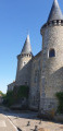
 Moderate