Circular loop around the Ruisseau des Enclaves and the Bois de Besnières

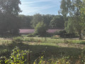
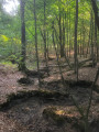
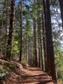
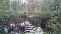
A short walk starting from La Celle-les-Bordes. The first part of the route follows a small stream that winds through the forest. The second part is more traditional and follows wide paths through the forest.

Details

n°109318616
Creation:
Last update:
Last review:
–
  • Walking
    Activity: Walking
  • ↔
    Distance: 3.32 mi
  • ◔
    Average duration: 1h 40 
  • ▲
    Difficulty: Easy

  • ⚐
    Back to start: Yes
  • ↗
    Ascent: + 154 ft
  • ↘
    Descent: - 154 ft

  • ▲
    Highest point: 564 ft
  • ▼
    Lowest point: 407 ft

Description of the walk

Start from the car park at La Celle-les-Bordes cemetery, along the D61.

(S/E) Cross the D61 carefully and first turn right then left onto a path heading west.

(1) After about 150 m, take a path on the right, pass through a clump of bamboo and follow the River Aulne on your left.

(2) At the junction, turn left, continuing to follow the stream.

(3) At the T-junction, first turn right then left to cross the stream and follow it on your right. Cross the stream again and follow it on your left.

(4) Turn slightly right and cross the Aulne one last time. Follow a blue and white signposted path until you reach the junction at Poteau des Enclaves.

(5) Turn right onto a wide lane, the Route du Fossé Broux. Pass the first junction and carry on straight ahead until you reach the Carrefour des Bas Besnières.

(6) Turn right onto a narrower forest track, the Route de la Noue. Pass the Carrefour Millaud and continue until you reach a path starting on the right, just before the edge of the forest and the D61.

(7) Follow this path to the right and stay on the edge of the woodland. You’ll soon come to a junction you passed at the start of the walk.

(2) Turn left and, following the route in reverse to the one taken on the way there, head back to the car park at La Celle-les-Bordes cemetery (S/E).

Waypoints

  1. S/E : mi 0 - alt. 410 ft - Car park – La Celle-les-Bordes cemetery
  2. 1 : mi 0.13 - alt. 413 ft - Start of the trail - Aulne (cours d'eau) - Affluent de la Gloriette
  3. 2 : mi 0.34 - alt. 436 ft - Junction of the circular loop
  4. 3 : mi 0.92 - alt. 459 ft - T-junction
  5. 4 : mi 1.15 - alt. 479 ft - Crossroads – Footbridge over the - Aulne (cours d'eau) - Affluent de la Gloriette
  6. 5 : mi 1.41 - alt. 548 ft - Route du Fossé Broux - Poteau des Enclaves
  7. 6 : mi 1.91 - alt. 564 ft - Route de la Noue - Carrefour des Bas Besnières
  8. 7 : mi 2.82 - alt. 492 ft - Junction at the edge of the woods
  9. S/E : mi 3.32 - alt. 410 ft - Car park – La Celle-les-Bordes cemetery

Notes

Easy parking at the cemetery.

The route is accessible to all.

Worth a visit

La Celle-les-Bordes Church (open to visitors).

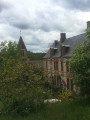
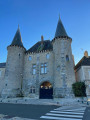
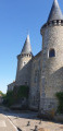
La Celle Castle is privately owned.

Other walks in the area

For more walks, use our search engine .

The GPS track and description are the property of this route's author. Please do not copy them without permission.