


Refine your search for walks in Château de La Celle
Château de La Celle walks


 The Grand Circular Route of La Noue
 Visorando Member
 4.07 mi
 +390 ft
 -404 ft
 2h 15
2h 15
 Easy
Easy
 Departure from La Celle-les-Bordes (Yvelines)
A circular route of around 2 hours around the hamlet of La Noue in La Celle-les-Bordes, mainly through woodland, allowing you to discover some lovely scenery, ending at the castle and the church.
The Bois des Gaules circular walk
 2.38 mi
+171 ft
-171 ft
1h 15
Easy
Departure from La Celle-les-Bordes (Yvelines)
2.38 mi
+171 ft
-171 ft
1h 15
Easy
Departure from La Celle-les-Bordes (Yvelines)
The Bois Départemental des Gaules is the wooded area situated on the north-eastern slope of the Aulne Valley in La Celle-les-Bordes. It stretches out lengthways and forms a link between the plateau and the valley, with quite a bit of elevation gain!
The footpaths of La Celle
 1.89 mi
+154 ft
-148 ft
1h 00
Easy
Departure from La Celle-les-Bordes (Yvelines)
1.89 mi
+154 ft
-148 ft
1h 00
Easy
Departure from La Celle-les-Bordes (Yvelines)
As you wander along the paths of La Celle, you’ll discover this pretty village in the Chevreuse Valley. It’s a short walk, but dotted with viewpoints where you’re sure to stop and admire the scenery.
Walks near Château de La Celle
From Rambouillet to Saint-Léger-en-Yvelines, follow the GR®1 trail.
 15.84 mi
+597 ft
-669 ft
7h 50
15.84 mi
+597 ft
-669 ft
7h 50
 Difficult
Departure from Rambouillet (Yvelines)
Difficult
Departure from Rambouillet (Yvelines)
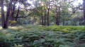
The Rambouillet Forest is one of the largest forests in the Paris region. This section ofthe GR®®1 trailallows you to explore the western part of the forest. It is full of charm and features remarkable sites such as the Chêne de la Pocqueterie oak tree, the Rochers d'Angennes rocks and the Pierre Ardoue stone. The route starts in a town with great cultural potential, including the Château de Rambouillet, the Hermitage, the Laiterie de la Reine and the Chaumière aux Coquillages.
From Rambouillet to Orgerus through the Rambouillet and Quatre Piliers forests
 18.03 mi
+492 ft
-591 ft
7 hrs
18.03 mi
+492 ft
-591 ft
7 hrs
 Very difficult
Departure from Rambouillet (Yvelines)
Very difficult
Departure from Rambouillet (Yvelines)
A south-north crossing of the Rambouillet and Quatre Piliers forests, from station to station! The route, mainly through forest, is long and requires a good sense of direction for the first half. Several ponds and remarkable trees line the route.
From Le Perray to Rambouillet via ponds, ditches and the Drouette river
 8.79 mi
+23 ft
-69 ft
4h 05
8.79 mi
+23 ft
-69 ft
4h 05
 Moderate
Departure from Le Perray-en-Yvelines (Yvelines)
Moderate
Departure from Le Perray-en-Yvelines (Yvelines)
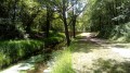
A hike from station to station with a water theme! In the Haute Vallée de Chevreuse Natural Park and then in the Rambouillet Forest, this is a pleasant route, mostly shaded, along ponds, small canals and a charming river, the Drouette.
From Le Perray-en-Yvelines to Rambouillet through the forest
17.02 mi
+515 ft
-591 ft
8h 15
Very difficult
Departure from Le Perray-en-Yvelines (Yvelines)
Hike in the Rambouillet forest, but in the lesser-known and less frequented part. The Rochers d'Angennes are impressive; you don't expect to find yourself in a blue-collar atmosphere in this place. Hike from station to station with a fast TER at the end, if returning to Paris.
From Le Perray to Montfort via the Saint-Hubert and Hollande ponds
 11.64 mi
+197 ft
-453 ft
5h 30
Moderate
Departure from Le Perray-en-Yvelines (Yvelines)
11.64 mi
+197 ft
-453 ft
5h 30
Moderate
Departure from Le Perray-en-Yvelines (Yvelines)
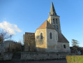
A hike from station to station that will take you through the forest of the Haute Vallée de Chevreuse Regional Nature Park. Ponds, castle, forest, ramparts and museum: everything you need for a wonderful day out with family or friends.
Chemin Charles Péguy: Saint-Cyr-sous-Dourdan - Ablis
 Association / Club / Walk leader
 16.19 mi
+482 ft
-236 ft
7h 50
Difficult
Departure from Saint-Cyr-sous-Dourdan (Essonne)
16.19 mi
+482 ft
-236 ft
7h 50
Difficult
Departure from Saint-Cyr-sous-Dourdan (Essonne)
This route is the second of four sections of the Charles Péguy Trail: Lozère (Palaiseau) - Chartres via Dourdan. It follows in the footsteps of the poet Charles Péguy, who celebrated his two pilgrimages (made in 1912 and 1913, each lasting four days there and back) in a poem that remains famous to this day. This is the transition stage: from the valleys and rolling hills of Hurepoix to the Beauce plateau.
Follow the Yvette from Essarts-le-Roi to Saint-Rémy-lès-Chevreuse
 12.16 mi
+564 ft
-879 ft
6h 05
Difficult
Departure from Les Essarts-le-Roi (Yvelines)
12.16 mi
+564 ft
-879 ft
6h 05
Difficult
Departure from Les Essarts-le-Roi (Yvelines)
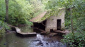
A hike from station to station that takes us to the source of the River Yvette and then up and down through the woods that frame its valley. The route crosses the Maincourt Marsh and then an area of rocky chaos. The forest trails are interspersed with villages and hamlets rich in heritage.
Chemin Charles Péguy: Alternative route via Forges-les-Bains
 4.03 mi
+210 ft
-302 ft
2h 00
4.03 mi
+210 ft
-302 ft
2h 00
 Not specified
Departure from Limours (Essonne)
Not specified
Departure from Limours (Essonne)
An alternative route to the first section of the Chemin Charles Péguy. It bypasses Limours and instead showcases the Hurepoix region. Discover the beautiful village of Forges-les-Bains and a route through stunning countryside.
Following the Yvette from Saint-Rémy-lès-Chevreuse to Lozère
 8.24 mi
+167 ft
-164 ft
3h 55
Moderate
Departure from Saint-Rémy-lès-Chevreuse (Yvelines)
8.24 mi
+167 ft
-164 ft
3h 55
Moderate
Departure from Saint-Rémy-lès-Chevreuse (Yvelines)
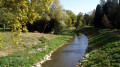
A hike from station to station where you play leapfrog with the Yvette River! The route is mostly close to the river and crosses a few woods and pretty parks, including the one in the western part of the Paris-Sud University campus.
From Saint-Rémy-lès-Chevreuse to Coignières in the Upper Chevreuse Valley
 14.57 mi
+1,112 ft
-846 ft
7h 40
Difficult
Departure from Saint-Rémy-lès-Chevreuse (Yvelines)
14.57 mi
+1,112 ft
-846 ft
7h 40
Difficult
Departure from Saint-Rémy-lès-Chevreuse (Yvelines)
Thirty-third and penultimate stage of the Grand Tour of Île-de-France via the GR®11, almost entirely in the Yvelines department.It starts in Saint-Rémy-lès-Chevreuse and reaches Coignières after climbing up the Yvette valley and crossing the Haute Vallée de Chevreuse Regional Nature Park with its rich natural and architectural heritage, just a stone's throw from Paris and its inner suburbs.