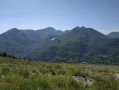
Granges de Cuous via the Cime de Codolis

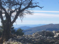
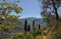
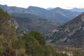
A route with numerous viewpoints, leading to Les Granges de Cuous. Admire the gorge at Pont de la Founta.

Details

35670294
Creation:
Last update:
Last review:
  • Walking
    Activity: Walking
  • ↔
    Distance: 6.53 mi
  • ◔
    Average duration: 5h 45 
  • ▲
    Difficulty: Moderate

  • ⚐
    Back to start: Yes
  • ↗
    Ascent: + 3,114 ft
  • ↘
    Descent: - 3,104 ft

  • ▲
    Highest point: 3,389 ft
  • ▼
    Lowest point: 1,299 ft

Photos

Description of the walk

Car park at the turning point on the bend in the D2566 near Saint-Vincent.

(S/E) From the car park, follow the D2566 road uphill to marker 55. Head towards Saint-Vincent. At the last house in the hamlet, cross the track and continue along the path opposite to the Cime de Penas (marker 19).

(1) Head towards the Cime de Codolis and continue to marker 18.

(2) Leave theGR® 52A and turn right onto the cairn-marked path to marker 17.

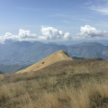
(3) Follow the Crête de Mandine to the left as far as the Cime de Codolis, and continue to the Pas de la Capelette (marker 15).

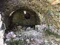
(4) Take the path on the left which descends to Les Granges de Cuous and head towards them.

(5) At marker 50, turn right towards the Pont de Founta. Continue to the junction at marker 51.

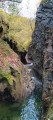
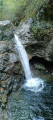
(6) Carry on, still heading towards Pont de Founta. Cross the bridge and take the opportunity to admire the gorge of the Ruisseau de Cuous. Continue to marker 52.

(7) Take the path on the left to join the D2566. This path crosses numerous dry streams. Just before reaching the D2566, the path crosses the stream and climbs back up onto the bridge. Turn left onto the road to reach the car park (S/E).


Waypoints

  1. S/E : mi 0 - alt. 1,339 ft - Bend in the D2566 before marker 55. Near the - Bévéra (rivière)
  2. 1 : mi 1.41 - alt. 2,805 ft - Marker 19 - cime de Penas (1018m)
  3. 2 : mi 1.96 - alt. 2,503 ft - Marker 18
  4. 3 : mi 2.31 - alt. 3,150 ft - Marker 17. Towards the - Cime de Codolis (1022m)
  5. 4 : mi 2.57 - alt. 3,389 ft - Marker 15
  6. 5 : mi 3.5 - alt. 2,894 ft - Marker 50
  7. 6 : mi 3.88 - alt. 2,625 ft - Marker 51
  8. 7 : mi 4.26 - alt. 2,329 ft - Marker 52
  9. S/E : mi 6.53 - alt. 1,339 ft - Bend in the D2566 before marker 55

Notes

Please note: make sure you take plenty of water in hot weather.

Always be cautious and plan ahead when you're outdoors. Visorando and the author of this route cannot be held responsible for any accidents occurring on this route.

The GR® and PR® markings are the intellectual property of the Fédération Française de Randonnée Pédestre.

Reviews and comments

4.4 / 5
Based on 3 reviews

Reliability of the description
4 / 5
Ease of following the route
4.7 / 5
Route interest
4.7 / 5
L'Antoine
L'Antoine

Overall rating : 3.7 / 5

Date of your route : Jan 12, 2024
Reliability of the description : ★★☆☆☆ Disappointing
Ease of following the route : ★★★★☆ Good
Route interest : ★★★★★ Very good
Very busy route : No

Hello, a lovely walk with a spectacular return route through unspoilt countryside starting from the Founta bridge. It deserves to be classified as a challenging walk as it is 13.7 km long with an elevation gain of almost 1,000 metres, due to the alternating descents and ascents (and not 10.5 km and 871 metres as stated). The start point at marker 55 was completely blocked by branches cut by tree surgeons who hadn’t cleared away their waste! Once past this obstacle, the path is in poor condition for a few hundred metres. Between markers 19 and 18, the GR is very poorly signposted, with just a few cairns to guide the way. At the Founta bridge, you must head back up the P.R. path and DO NOT immediately turn left onto the path running alongside the river. At marker 52, it’s a shame that the wooden marker doesn’t indicate the return route to the D 2566 towards Sospel. Towards the end, just before the bridge and marker 54 (which has disappeared), the path is blocked by a landslide for 50 metres, but you can get past by following the river. In total, a 4-hour 45-minute walk for two
hikers aged 65 and 72. It’s well worth doing, but the description is far too brief. Also, be careful of the wet and slippery rocks from marker 52 onwards. Enjoy the hike. L’ANTOINE

Machine-translated

STEPHANE TOG
STEPHANE TOG
• Edited:

Overall rating : 4.7 / 5

Date of your route : Nov 15, 2023
Reliability of the description : ★★★★★ Very good
Ease of following the route : ★★★★★ Very good
Route interest : ★★★★☆ Good
Very busy route : No

Thank you for this superb circular route! It ended up being 12 km long with 957 m of elevation gain.
I’d rate this hike as moderate to difficult, given the elevation gain over such a short distance.
It took 5 hours 30 minutes, including a break, with a few detours to get as close as possible to the gorge.

Machine-translated

Remi_22
Remi_22

Overall rating : 5 / 5

Date of your route : Jul 29, 2023
Reliability of the description : ★★★★★ Very good
Ease of following the route : ★★★★★ Very good
Route interest : ★★★★★ Very good
Very busy route : No

A brilliant hike! The views are absolutely stunning! There’s even a spot for a swim at the end of the route. It gets very hot in summer, but swimming in the river with its natural pools is truly magical! There are lovely views of the surrounding valleys and a beautiful forest. Definitely one to do again!

Machine-translated

Other walks in the area

For more walks, use our search engine .

The GPS track and description are the property of this route's author. Please do not copy them without permission.